|
|
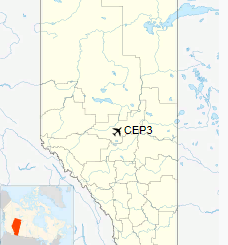
Barrhead Airport, (TC LID: CEP3) is located 1.7 nautical miles (3.1 km; 2.0 mi) southwest of Barrhead, Alberta, Canada.
| Barrhead Airport |
- IATA: none
- ICAO: none
- TC LID: CEP3
|
| Summary |
| Airport type |
Public |
| Operator |
County of Barrhead |
| Location |
County of Barrhead No. 11, near Barrhead, Alberta |
| Time zone |
MST (UTC-07:00) |
| Summer (DST) |
MDT (UTC-06:00) |
| Elevation AMSL |
2,121 ft / 646 m |
| Coordinates |
54°05'49" N
114°26'20" W |
| Map |
|
|
| Runways |
| Direction |
Length |
Surface |
| ft |
m |
07/25 |
3,506 |
1,069 |
Asphalt |
|
The above content comes from Wikipedia and is published under free licenses – click here to read more.
| General Info
|
| Country |
Canada
|
| Latitude |
54.100000
54° 06' 00.00" N
|
| Longitude |
-114.433333
114° 26' 00.00" W
|
| Elevation |
2121 feet
646 meters
|
| Magnetic Variation |
017° E (01/06)
|
| Beacon |
Yes
|
| Operating Agency |
MUNICIPAL
|
| Daylight Saving Time |
Second Sunday in March at 0200 to first Sunday in November at 0200 local time (Exception Arizona and that portion of Indiana in the Eastern Time Zone)
|
| Communications
|
| CTAF |
123.2
|
| Runways
|
| ID |
Dimensions |
Surface |
PCN |
ILS
|
| 07/25 |
3500 x 100 feet
1067 x 30 meters |
ASPHALT |
- |
NO
|
| Supplies/Equipment
|
| Fuel |
Jet B, Wide cut turbine fuel, Without icing inhibitor.
|
The content above was published at Airports-Worldwide.com in 2018.
We don't guarantee the information is fresh and accurate. The data may
be wrong or outdated.
For more up-to-date information please refer to other sources.
|
|