|
|
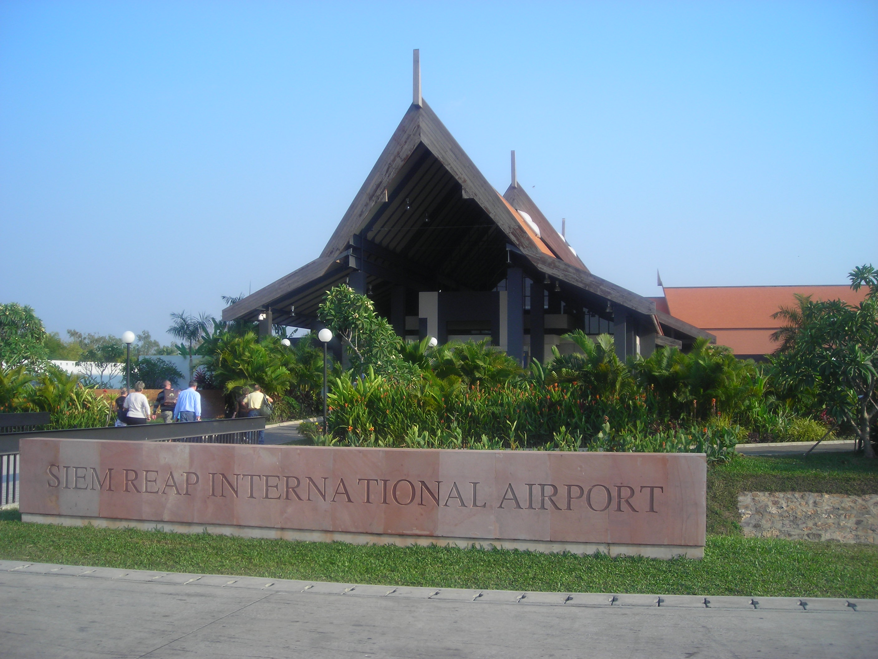
| Siem Reap International Airport |
 |
| IATA: REP – ICAO: VDSR |
| Summary |
| Airport type |
Public |
| Serves |
Siem Reap, Cambodia |
| Elevation AMSL |
60 ft / 18 m |
| Coordinates |
13°24′38″N 103°48′46″E / 13.41056°N 103.81278°E / 13.41056; 103.81278 |
| Website |
cambodia-airports.com/... |
| Runways |
| Direction |
Length |
Surface |
| m |
ft |
| 05/23 |
2,550 |
8,366 |
Concrete |
| Source: DAFIF |
Siem Reap International Airport (IATA: REP, ICAO: VDSR) (Khmer: អាកាសយានដ្ឋានអន្តរជាតិសៀមរាបអង្គរ French: Aéroport International de Siem Reap) is the airport in Cambodia handling the greatest number of passengers. It is located in Siem Reap, home of Angkor Wat, and is also known as Angkor International Airport.
The full architecture design of the airport was developed by Archetype Group. Official inauguration of Siem Reap-Angkor International Airport's new terminal was in August 28, 2006.
The Cambodian government has plans to replace the airport with a new one, 60km from Siem Reap. Facilities
The airport resides at an elevation of 60 feet (18 m) above mean sea level. It has one runway designated 05/23 with a concrete surface measuring 2,550 by 45 metres (8,366 × 148 ft).
As of 2008, extensions to the airport's apron and parking areas are taking place. Air Traffic Control is provided by CATS (Cambodia Air Traffic Services), with full approach and aerodrome VHF facilities being housed in the control tower, between the fire station and the domestic terminal. Area control is still provided from CATS Centre in Phnom Penh (Pochentong) VHF frequencies used at Siem Reap are: Tower: 118.000 MHz (AM) Approach: 124.300 MHz (AM) ACC (FIR): 127.500 MHz (AM) Ground (apron): 121.750 MHz (AM) ATIS (WX): 129.950 MHz (AM) Tower – fire 3A: 143.750 MHz (FM) CATS are also responsible for clearing takeoffs and landings of tourist helicopters from the "Big Balloon" site, 3km away, near Angkor Wat. Both Helicopters Cambodia and Sokha Helicopters operate from the airport, with Sokha mainly operating from the Big Yellow Balloon site. The airport itself is located some 6km outside Siem Reap, just off National Route 6 north. Runway alignments are 23 & 05, with only 23 being used for takeoff, due to flight restrictions over Angkor temple.
Airfield
- Length: 2,550 m
- Width: 45 m, with shoulders 2.5 m. wide each
- Perpendicular taxiway: 1 (length: 240 meters, width: 20 meters and 10 meters of shoulders). Under construction: 1 (length: 600 meters, width: 23 meters and 15 meters of shoulders)
- Number of stands: 8
- Navigation aids and visual aids:
Airlines and destinations
| Airlines |
Destinations |
| AirAsia |
Kuala Lumpur |
| Asiana Airlines |
Seoul-Incheon |
| Bangkok Airways |
Bangkok-Suvarnabhumi |
| Cambodia Angkor Air |
Ho Chi Minh City, Phnom Penh |
| China Southern Airlines |
Guangzhou |
| Jetstar Asia |
Singapore |
| Lao Airlines |
Luang Prabang |
| Malaysia Airlines |
Kuala Lumpur |
| Monarch Airlines |
Cairns, Manchester (Both Charter) |
| SilkAir |
Da Nang, Singapore |
| Vietnam Airlines |
Hanoi, Ho Chi Minh City, Luang Prabang |
Statistics
Passengers and aircraft movements as of 2010:
| Year |
Passengers |
Aircraft movements |
| 2001 |
449,690 |
12,407 |
| 2002 |
572,664 |
13,605 |
| 2003 |
551,344 |
11,965 |
| 2004 |
799,743 |
15,476 |
| 2005 |
1,038,118 |
16,923 |
| 2006 |
1,360,390 |
18,857 |
| 2007 |
1,732,428 |
22,012 |
| 2008 |
1,531,820 |
19,982 |
| 2009 |
1,255,166 |
18,247 |
The above content comes from Wikipedia and is published under free licenses – click here to read more.
| General Info
|
| Country |
Cambodia(Formerly Kampuchea)
|
| ICAO ID |
VDSR
|
| Time |
UTC+7
|
| Latitude |
13.410666
13° 24' 38.40" N
|
| Longitude |
103.812840
103° 48' 46.22" E
|
| Elevation |
60 feet
18 meters
|
| Magnetic Variation |
000° W (01/06)
|
| Operating Agency |
CIVIL GOVERNMENT, (LANDING FEES AND DIPLOMATIC CLEARANCE MAY BE REQUIRED)
|
| Operating Hours |
SEE REMARKS FOR OPERATING HOURS OR COMMUNICATIONS FOR POSSIBLE HOURS
|
| International Clearance Status |
Airport of Entry
|
| Communications
|
| TWR |
118.5
|
ATIS
Opr 2300-1400Z dly.
|
129.95
|
| APP |
124.3
|
| Runways
|
| ID |
Dimensions |
Surface |
PCN |
ILS
|
| 05/23 |
8366 x 148 feet
2550 x 45 meters |
CONCRETE. |
040RBXT |
NO
|
| Navaids
|
| Type |
ID |
Name |
Channel |
Freq |
Distance From Field |
Bearing From Navaid
|
| VOR-DME |
SRE |
SIEM REAP |
085X |
113.8 |
At Field |
-
|
| NDB |
SIR |
SIEM REAP |
- |
441 |
At Field |
-
|
| Supplies/Equipment
|
| Fuel |
Unknown fuel type or whether there is any fuel.
|
| Remarks
|
| CAUTION |
WIP on APN extension and new TWY.
|
| MISC |
Ldg fees.
|
| OPR HOURS |
Opr 2300-1400Z.
|
| RSTD |
Rwy 05 for ldg; Rwy 23 for tkof.
|
The content above was published at Airports-Worldwide.com in 2010.
We don't guarantee the information is fresh and accurate. The data may be wrong or outdated.
For more up-to-date information please refer to other sources.
|
|