Lieutenant Colonel Rafael Pabón Airport |
Lieutenant Colonel Rafael Pabón Airport (Spanish: Aeropuerto Teniente Coronel Rafael Pabón) (IATA: VLM, ICAO: SLVM) is an airport serving the city of Villamontes in the Gran Chaco Province of the Tarija Department of Bolivia.
The airport is 4 kilometres (2.5 mi) east of the city and 4 kilometres (2.5 mi) north of the Pilcomayo River.
The Villamontes non-directional beacon (Ident: VTS) is located on the field.
|
Lt. Col. Rafael Pabón Airport
Aeropuerto TCNL Rafael Pabón
|
|
|
| Summary |
| Airport type |
Public |
| Operator |
Government |
| Serves |
Villamontes, Bolivia |
| Elevation AMSL |
1,306 ft / 398 m |
| Coordinates |
21°15′18″S
63°24′20″W |
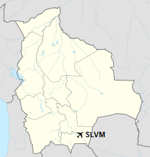
| Map |
Location of TNCL Rafael Pabón Airport in Bolivia
|
| Runways |
| Direction |
Length |
Surface |
| m |
ft |
| 18/36 |
1,500 |
4,921 |
Asphalt |
|
The above content comes from Wikipedia and is published under free licenses – click here to read more.
| General Info
|
| Country |
Bolivia
|
| ICAO ID |
SLVM
|
| Time |
UTC-4
|
| Latitude |
-21.255231
21° 15' 18.83" S
|
| Longitude |
-63.405611
063° 24' 20.20" W
|
| Elevation |
1306 feet
398 meters
|
| Magnetic Variation |
008° W (05/06)
|
| Operating Agency |
CIVIL GOVERNMENT, (LANDING FEES AND DIPLOMATIC CLEARANCE MAY BE REQUIRED)
|
| Near City |
Villamontes
|
| Communications
|
| VILLAMONTES TWR |
118.7
|
| VILLAMONTES RDO |
6622
|
| Runways
|
| ID |
Dimensions |
Surface |
PCN |
ILS
|
| 18/36 |
4918 x 115 feet
1499 x 35 meters |
ASPHALT |
023FBXT |
NO
|
| Navaids
|
| Type |
ID |
Name |
Channel |
Freq |
Distance From Field |
Bearing From Navaid
|
| NDB |
VTS |
VILLAMONTES |
- |
219 |
At Field |
-
|
| Remarks
|
| OPR HOURS |
Opr 1000-2100Z Mon-Sat; 1000-1700Z Sun.
|
The content above was published at Airports-Worldwide.com in 2019.
We don't guarantee the information is fresh and accurate. The data may be wrong or outdated.
For more up-to-date information please refer to other sources.
|