|
 |
|
||||
|
El Alto International Airport (Spanish: Aeropuerto Internacional El Alto) (IATA: LPB, ICAO: SLLP) is an international airport serving La Paz, Bolivia. It is located in the city of El Alto, 8 mi (13 km) west of La Paz. At an altitude of 4,061.5 m (13,325 ft), it is the highest international airport and the fifth highest commercial airport in the world. The airport has been in service since the first half of the 20th century, but was modernized in the late 1960s, when its runway was lengthened and a new passenger terminal with modern facilities was built. The new airport was inaugurated in 1965. El Alto airport was a primary hub for the former Lloyd Aéreo Boliviano, Bolivia’s flag carrier which ceased operations in 2007 and is a hub for Línea Aérea Amaszonas. It serves also as a focus city for Boliviana de Aviación which is a state-owned airline.
History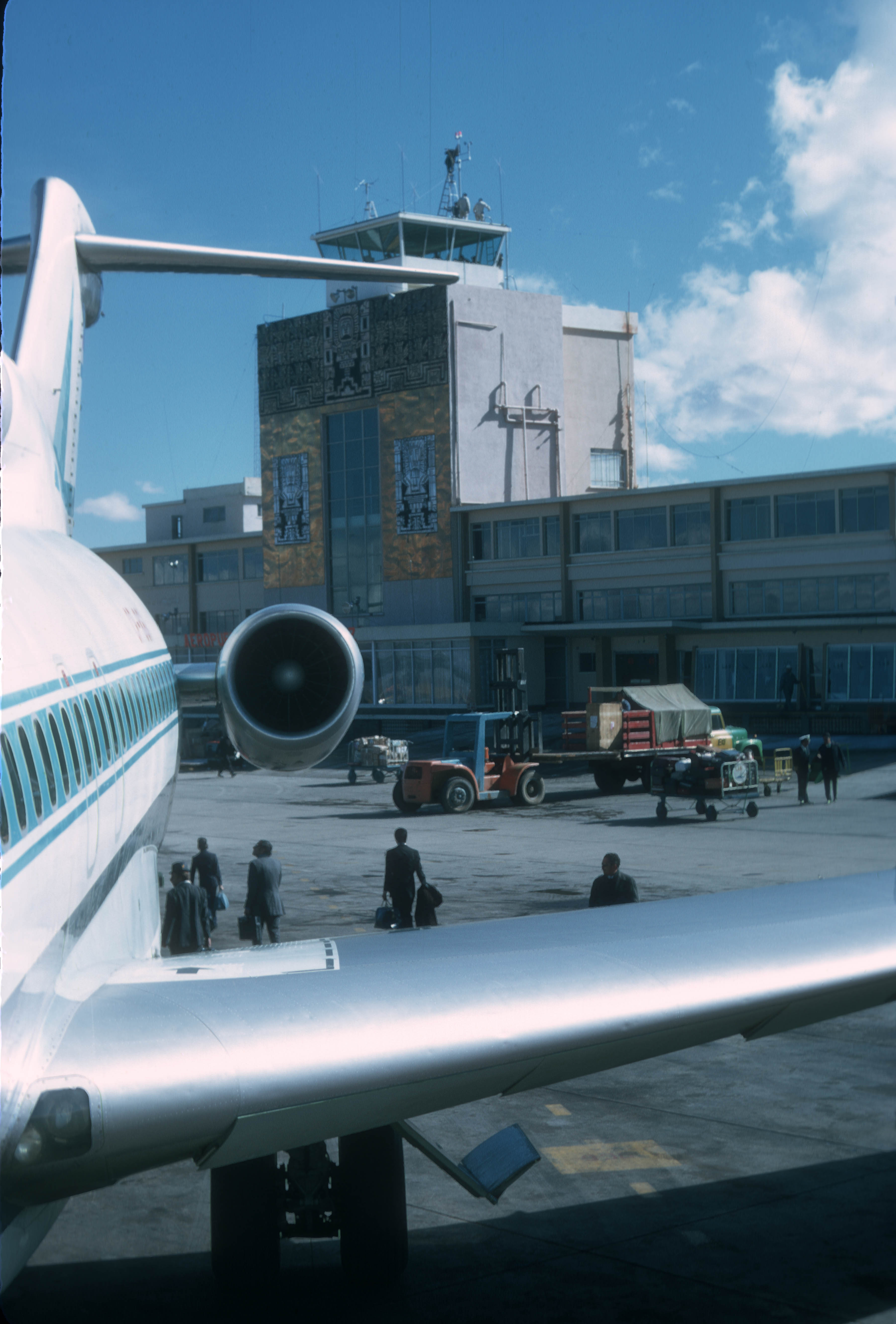
The airport during the 1960s. A LAB Boeing 727-100 is seen in the foreground with the old terminal and its iconic Inca façade in the background. 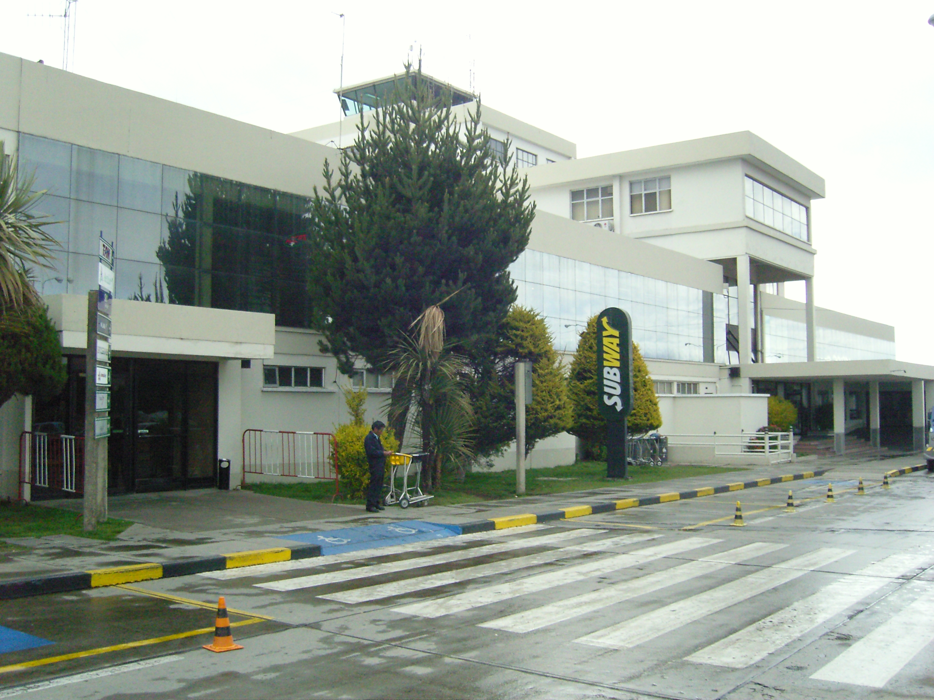
Old terminal. Bolivia is characterized by an extremely varied terrain including rugged mountains, high plateaus, low valleys and tropical forests; this topography has had a negative effect on national transportation, making communication difficult between elevated and low cities along with isolated tropical towns. Aviation is an important solution for isolated communities in this environment. Bolivian air transport started in 1916, when the Military school of Aviation (Spanish: Escuela Militar de Aviación) was formed in La Paz. In 1929 the local La Paz Government first planned the construction of an airport. However it was not officially inaugurated until the 1960s. In 1974 the airport was reconstructed, a new terminal was built and its facilities were enlarged and modernized. Until 1999 the airport had John F. Kennedy (JFK) as its official name although in practice this name was never publicly used. In that year, before the pressure of different sectors, by means of the Law 1944 during the government of Hugo Banzer Suárez the airport changed its name officially to El Alto International Airport. ModernizationIn 2006, SABSA (Spanish: Servicios Aeroportuarios Bolivianos S.A.) invested nearly 2.3 million dollars in the reconstruction of the main terminal. The new terminal consists of the enlargement, reshaping and construction of the baggage claim room, the check-in area and the corridor to the air bridges. The administrative offices of AASANA as well as the main hall and the international area were completely modernized. Characteristics
At more than 13,000 ft above sea level, El Alto is one of the highest international airports in the world The new terminal includes various shops offering Bolivian handicrafts as well as bookstores, and duty-free shops. There are also restaurants and cafes in the main lobby and in both domestic and international departure areas. The airport has two runways: The main one «10R/28L» has a concrete surface and is 4,000 metres (13,123 ft) long, allowing large aircraft operations at higher altitudes. A second runway, «10L/28R» is located parallel to the main runway and has a grass surface. The airport is equipped with VOR/DME, DVOR/DME navigation systems, as well as ILS CAT I approach systems. El Alto is the world’s highest international airport, located at 4,062 metres (13,327 ft) above sea level. The average temperature at the airport is 6 °C (43 °F). Because of the thin high altitude air, most commercial wide-body aircraft such as the Boeing 747 and Airbus A330 cannot operate at full load out of El Alto International Airport. As a result, much of the international traffic to and from Bolivia operates out of Viru Viru International Airport in Santa Cruz de la Sierra which is located at a much lower altitude, allowing heavy aircraft operations. Flight testingAs one of the world’s highest-altitude airports, El Alto offers features taken advantage of by aircraft manufacturers such as Airbus and Boeing to test high-altitude takeoff and landing. Modern aircraft such as the Airbus A350 XWB and Boeing 787 have used El Alto to perform flight tests for their certification processes. OperatorsFrom 1997, the airport was managed by TBI plc which owned concessions of the three biggest airports in the country: El Alto International Airport, Jorge Wilstermann International Airport and Viru Viru International Airport through its subsidiary Servicio de Aeropuertos Bolivianos S.A. (SABSA). In 1999 Airport Group International was purchased by TBI plc. In 2004, the company was acquired by the Spanish conglomerate Abertis, hence taking ownership of SABSA. In February 2013, the Government of Bolivia announced the nationalization of SABSA, taking full ownership and operations of Bolivia’s main international gateways. Airlines and destinations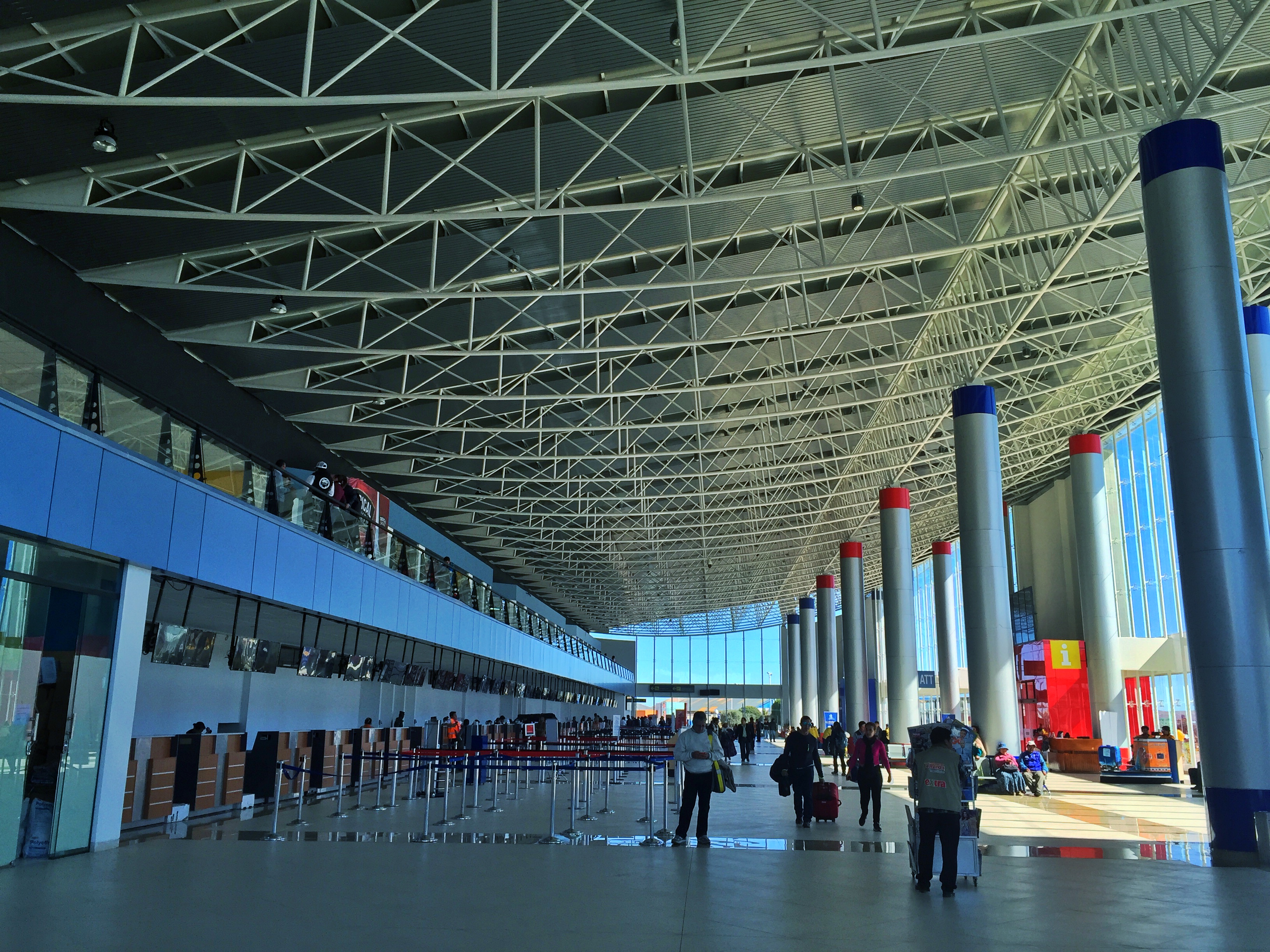
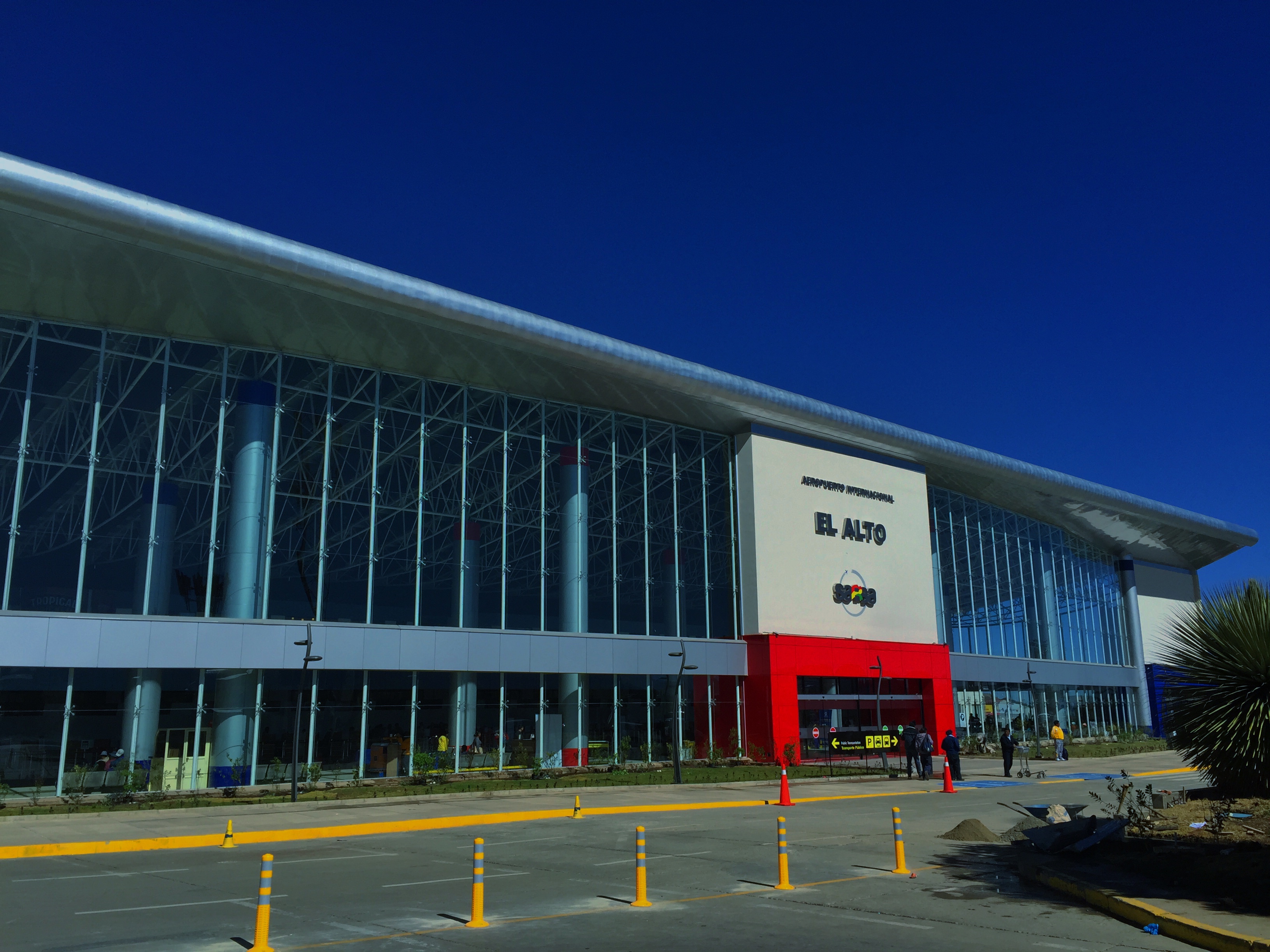
The new terminal is used for both domestic and international flights. 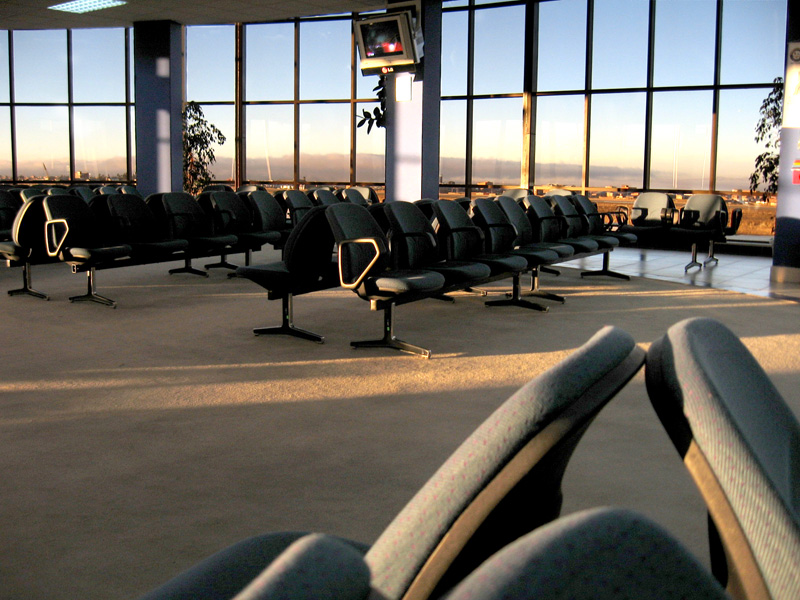
Domestic departures and waiting area in the old terminal.
Notes:
Accidents and incidents
The content above was published at Airports-Worldwide.com in 2019. |
||||||||||||||||||||||||||||||||||||||||||||||||||||||||||||||||||||||||||||||||||||||||||||||||||||||||||||||||||||||||||||||||||||||||||||||||||||||||||||||||||||||||||||||||||||||||||||||||||||||||||||||||

 |
|
Copyright 2004-2026 © by Airports-Worldwide.com, Vyshenskoho st. 36, Lviv 79010, Ukraine Legal Disclaimer |