 |
|
Copacabana Airport (Spanish: Aeropuerto Copacabana, (ICAO: SLCC)) is an extremely high elevation airport serving Copacabana, a town on Lake Titicaca in the La Paz Department of Bolivia.
Town and airport are on a peninsula connected to Peru, with no land connection with Bolivia. The runway is 2 kilometres (1.2 mi) south of the town, in a dead-end valley that opens onto the lake. There is rising terrain in all quadrants except west-southwest, over the lake.
|
Copacabana Airport |
|
|
| Summary |
| Airport type |
Public |
| Serves |
Copacabana, Bolivia |
| Elevation AMSL |
12,591 ft / 3,838 m |
| Coordinates |
16°11′25″S
69°05′40″W |
| Map |
|
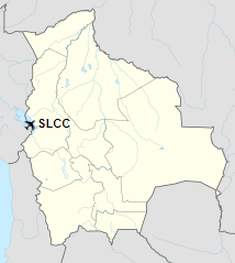
Location of Copacabana Airport in Bolivia
|
| Runways |
| Direction |
Length |
Surface |
| m |
ft |
06/24 |
2,000 |
6,562 |
Gravel |
|
|
Source: Landings.com Google Maps GCM |
The above content comes from Wikipedia and is published under free licenses – click here to read more.
The content above was published at Airports-Worldwide.com in 2019.
We don't guarantee the information is fresh and accurate. The data may be wrong or outdated.
For more up-to-date information please refer to other sources.
|
|


