 |
|
Concepción Airport (Spanish: Aeropuerto de Concepción) (IATA: CEP, ICAO: SLCP) is an airport serving Concepción, a town in the Santa Cruz Department of Bolivia. The runway is in the southern section of the town, which is in Bolivia's Gran Chaco region.
|
Concepción Airport |
|
|
| Summary |
| Airport type |
Public |
| Serves |
Concepción, Bolivia |
| Elevation AMSL |
1,631 ft / 497 m |
| Coordinates |
16°08′35″S
62°01′35″W |
| Map |
|
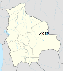
Location of Concepción Airport in Bolivia
|
| Runways |
| Direction |
Length |
Surface |
| m |
ft |
17/35 |
1,795 |
5,889 |
Grass |
|
|
Source: Landings.com Google Maps GCM |
The above content comes from Wikipedia and is published under free licenses – click here to read more.
The content above was published at Airports-Worldwide.com in 2019.
We don't guarantee the information is fresh and accurate. The data may be wrong or outdated.
For more up-to-date information please refer to other sources.
|
|


