|
Charaña Airport Spanish: Aeropuerto Charaña, (ICAO: SLCN) is an extremely
high elevation airstrip serving Charaña, a town in the altiplano of the La Paz Department of Bolivia.
The airport is east of the town and 3 kilometres (1.9 mi) east of the border with Chile.
The Charana non-directional beacon (Ident: CHA) is located on the field.
|
Charaña Airport |
|
|
| Summary |
| Airport type |
Public |
| Serves |
Charaña |
| Elevation AMSL |
13,310 ft / 4,057 m |
| Coordinates |
17°35′40″S
69°26′00″W |
| Map |
|
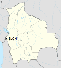
Location of Charaña Airport in Bolivia
|
| Runways |
| Direction |
Length |
Surface |
| m |
ft |
10/28 |
2,040 |
6,693 |
Dirt |
|
|
Source: Landings.com GCM Google Maps |
The above content comes from Wikipedia and is published under free licenses – click here to read more.
The content above was published at Airports-Worldwide.com in 2019.
We don't guarantee the information is fresh and accurate. The data may be wrong or outdated.
For more up-to-date information please refer to other sources.
|


