 |
|
Independence Airport (Belize) |
Independence Airport (IATA: INB, ICAO: MZSV), also known as Savannah Airport
or Mango Creek Airport, is an airport serving Independence and Mango Creek, a coastal community
straddling the border between Toledo and Stann Creek Districts in Belize. The airport runs along the Independence Highway, 4 kilometres (2 mi) inland from the coast.
The Puerto Barrios VOR-DME (Ident: IOS) and non-directional beacon (Ident: BAR) are located 48.6 nautical miles (90 km)
south of the airport.
|
Independence Airport |
|
|
| Summary |
| Airport type |
Private |
| Serves |
Independence, Belize |
| Elevation AMSL |
18 ft / 5 m |
| Coordinates |
16°32′04″N
88°26′30″W |
| Map |
|
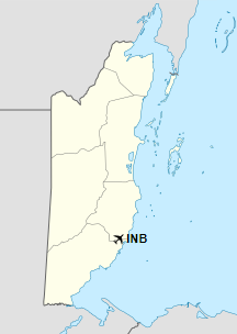
Location of Independence Airport in Belize
|
| Runways |
| Direction |
Length |
Surface |
| m |
ft |
07/25 |
970 |
3,182 |
Asphalt |
|
|
Source: GCM Google Maps |
Airlines and destinations
| Airlines |
Destinations |
| Maya Island Air |
Belize International, Belize Municipal, Caye Caulker, Caye Chapel, Corozal, Dangriga, Placencia, Punta Gorda, San Pedro Ambergris Caye |
| Tropic Air |
San Pedro |
The above content comes from Wikipedia and is published under free licenses – click here to read more.
The content above was published at Airports-Worldwide.com in 2019.
We don't guarantee the information is fresh and accurate. The data may be wrong or outdated.
For more up-to-date information please refer to other sources.
|
|


