|
Caye Chapel Airport (IATA: CYC, ICAO: MZCP) is an airport serving Caye Chapel, an island 20 kilometres (12 mi)
off the coast of Belize. The runway is at the southern tip of the narrow cay.
Runway length does not include an additional 35 metres (115 ft) paved overrun on the south end.
Portions of the runway have minimal separation from the sea on the west side. Airport approach and departure are over the water.
The Belize VOR-DME (Ident: BZE) is located 18.2 nautical miles (34 km) west-southwest of the airport.
|
Caye Chapel Airport |
|
|
| Summary |
| Airport type |
Private |
| Serves |
Caye Chapel |
| Elevation AMSL |
3 ft / 1 m |
| Coordinates |
17°41′00″N
88°02′40″W |
| Map |
|
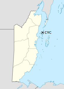
Location in Belize
|
| Runways |
| Direction |
Length |
Surface |
| m |
ft |
18/36 |
992 |
3,255 |
Asphalt |
|
|
Source: GCM Google Maps |
Scheduled Service
| Airlines |
Destinations |
| Maya Island Air |
Belize City-International, Caye Caulker |
The above content comes from Wikipedia and is published under free licenses – click here to read more.
The content above was published at Airports-Worldwide.com in 2019.
We don't guarantee the information is fresh and accurate. The data may be wrong or outdated.
For more up-to-date information please refer to other sources.
|


