 |
|
Saint-Hubert Airport (ICAO: EBSH) is a public use airport located near Saint-Hubert, Belgium, Luxembourg, Wallonia, Belgium.
It is the second highest airport in Belgium at 1,847 ft (563 m) above sea level.
It has four grass runways, almost perpendicular; five aircraft hangars are rented on the site.
It is located in the heart of the Ardennes, in uncontrolled airspace, accessible through the E411 road.
|
Saint-Hubert Airport |
|
|
| Summary |
| Airport type |
Public |
| Serves |
Saint-Hubert |
| Location |
Wallonia, Belgium |
| Elevation AMSL |
1,847 ft / 563 m |
| Coordinates |
50°02′09″N
005°24′15″E |
| Map |
|
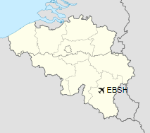
Location of Saint-Hubert Airport
|
| Runways |
| Direction |
Length |
Surface |
| m |
ft |
05L/23R |
600 |
1,969 |
Grass |
05R/23L |
600 |
1,969 |
Grass |
14L/32R |
799 |
2,621 |
Grass |
14R/32L |
799 |
2,621 |
Grass |
|
|
Sources: Belgian AIP |
History
Initially created as an aviation school in 1930, it was used as a US Army center in 1945, and then sold to the
Belgian state in 1946 and served as a backup airport for the city of Ostend, in case Melsbroek or Brussels Airport were to be unusable.
The above content comes from Wikipedia and is published under free licenses – click here to read more.
The content above was published at Airports-Worldwide.com in 2019.
We don't guarantee the information is fresh and accurate. The data may be wrong or outdated.
For more up-to-date information please refer to other sources.
|
|


