|
|
Flanders International Airport |
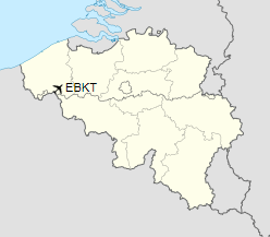
Flanders International Airport or Flanders Airport (IATA: KJK, ICAO: EBKT) is an airport located in Belgium, in the town of Wevelgem and partly also in the Bissegem section of the city of Kortrijk (2 nautical miles (3.7 km; 2.3 mi) west.
|
Flanders International Airport
Advanced Landing Ground (ALG) B-55
Kortrijk/Wevelgem Airport
|
|
|
|
| Summary |
| Airport type |
Public |
| Operator |
International Airport Kortrijk-Wevelgem |
| Serves |
Kortrijk / Wevelgem, Belgium |
| Elevation AMSL |
64 ft / 20 m |
| Coordinates |
50°49′07″N
003°12′23″E |
| Website |
www.KortrijkAirport.be |
| Map |
|
|
| Runways |
| Direction |
Length |
Surface |
| m |
ft |
| 06/24 |
1,900 |
6,234 |
Asphalt |
|
Origins
The airport was created in 1916 by the Germans during the First World War.
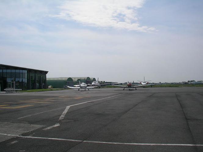
Features
The airport runway is 1,900 m × 45 m (6,234 ft × 148 ft). Alongside a section of the airport is a business park, some of which is restricted to enterprises undertaking airport related activities: several of the business park tenants have paid for direct private access to the runway. The aerodrome used to offer IFR («instrument» or «blind flying») procedures, but as of June 2017 these had been withdrawn from the AIP. In 2019, an RNAV approach, GNSS based, is given in the AIP.
Uses
It is mainly used as a business airport. One of the main users of this airport is Abelag Aviation, though it is also used by flying clubs and schools. According to its official website around 100,000 passengers use the airport every year.
Airlines and destinations
There are no scheduled services offered from Wevelgem International Airport.
Charter
| Destinations |
| Abelag Aviation |
|
| ASL |
|
The above content comes from Wikipedia and is published under free licenses – click here to read more.
| General Info
|
| Country |
Belgium
|
| ICAO ID |
EBKT
|
| Time |
UTC+1(+2DT)
|
| Latitude |
50.817222
50° 49' 02.00" N
|
| Longitude |
3.204722
003° 12' 17.00" E
|
| Elevation |
64 feet
20 meters
|
| Magnetic Variation |
001° W (05/06)
|
| Operating Agency |
CIVIL GOVERNMENT, (LANDING FEES AND DIPLOMATIC CLEARANCE MAY BE REQUIRED)
|
| Near City |
Kortrijk
|
| Operating Hours |
SEE REMARKS FOR OPERATING HOURS OR COMMUNICATIONS FOR POSSIBLE HOURS
|
| Daylight Saving Time |
Last Sunday in March to last Sunday in October
|
| Communications
|
AFIS
CALL RADIO
|
120.25
|
| Runways
|
| ID |
Dimensions |
Surface |
PCN |
ILS
|
| 06/24 |
6030 x 148 feet
1838 x 45 meters |
ASPHALT |
052FBXT |
YES
|
| Navaids
|
| Type |
ID |
Name |
Channel |
Freq |
Distance From Field |
Bearing From Navaid
|
| NDB |
OKT |
KORTRIJK |
- |
371 |
At Field |
-
|
| Supplies/Equipment
|
| Fuel |
Jet A1, without icing nhibitor.
100/130 MIL Spec, low lead, aviation gasoline (BLUE)
|
| Remarks
|
| CSTMS/IMG |
CSTMS avbl HS.
|
| FUEL |
(NC-100LL, A1)
|
| OPR HOURS |
Opr 0700Z++-SS Mon-Fri; 0800Z++-SS Sat, Sun, hol. PPR-Nr to opr other than thesehr must be obtained 24H prior. Fax C+32-56-354-059, attn EBKTZPZX
|
| RSTD |
The arpt is for IFR tfc; arpt is rstd to acft able to opr with a tkof dist of less than 3937' at MTOW. Rwy 24 LDA 5741' (day), 5184' (ngt) .
|
The content above was published at Airports-Worldwide.com in 2019.
We don't guarantee the information is fresh and accurate. The data may be wrong or outdated.
For more up-to-date information please refer to other sources.
|
|