| Tejgaon Airport |
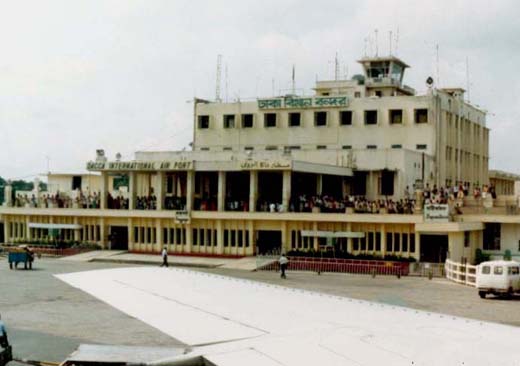 |
| Airside view of terminal building |
| IATA: none – ICAO: VGTJ |
| Summary |
| Airport type |
Military |
| Owner |
Bangladesh Air Force |
| Operator |
Bangladesh Air Force |
| Serves |
Dhaka |
| Elevation AMSL |
24 ft / 7 m |
| Coordinates |
23°46′43″N 090°22′57″E / 23.77861°N 90.3825°E / 23.77861; 90.3825 |
| Runways |
| Direction |
Length |
Surface |
| ft |
m |
| 17/35 |
9,315 |
2,839 |
Asphalt |
Tejgaon Airport (ICAO: VGTJ) in Dhaka, Bangladesh served as the country's sole international airport prior to the construction of Shahjalal International Airport.
Following the transfer of civilian flights to the newly built Shahjalal International Airport in 1981, Tejgaon was taken under the control of the Bangladesh Air Force.
History
The British had built military airstrips at Tejgaon, Dhaka during the Second World War for operating warplanes towards the war fields of Kohima and other Burmese war threats. Tejgaon Airport became the first airport to operate civil aviation in the then East Pakistan and it was also a station of the Pakistan Air Force. A number of other British built military airstrips in Bangladesh territory were also converted into civil airports – some during Pakistan period and some after Liberation. A few others were converted to STOL (Short Take-off and Landing) ports some years ago. And some are still left alone. The airstrips not yet converted to any civil airport of any kind are at Feni, Rajendrapur, Pahar Kanchanpur, Chakaria and Rasulpur.
Soon after the Second World War broke out, the British authority felt the need of constructing the Royal Indian Air Force (RIAF) stations in Dhaka and other vulnerable places in Bangladesh territory. The construction of Tejgaon Airport at a place named Dainodda started in 1941; and the building of a landing strip at Kurmitola (Balurghat) started at about the same time. The airstrips at Tejgaon and Kurmitola had military fighter plane landing facilities and the British Royal Air Force used the airstrips for safe up‑keeping their aircraft. There was also an American air force detachment here during the war period. The first RIAF light fighter landed on the under‑construction runway of Tejgaon at the beginning of 1943 and after development of the airport facilities, it became the first civil airport of Bangladesh. Today it is a part of BAF (Bangladesh Air Force) Base Bashar.
The above content comes from Wikipedia and is published under free licenses – click here to read more.
| General Info
|
| Country |
Bangladesh
|
| ICAO ID |
VGTJ
|
| Time |
UTC+6
|
| Latitude |
23.778783
23° 46' 43.62" N
|
| Longitude |
90.382689
090° 22' 57.68" E
|
| Elevation |
24 feet
7 meters
|
| Type |
Military
|
| Magnetic Variation |
000° W (05/06)
|
| Operating Agency |
MILITARY
|
| Communications
|
TWR
Opr 0130Z++ to SS.
|
123.0
122.9
|
| Runways
|
| ID |
Dimensions |
Surface |
PCN |
ILS
|
| 17/35 |
9315 x 98 feet
2839 x 30 meters |
ASPHALT |
012FCYT |
NO
|
| Supplies/Equipment
|
| Fuel |
Jet A1, without icing nhibitor.
|
The content above was published at Airports-Worldwide.com in 2010.
We don't guarantee the information is fresh and accurate. The data may be wrong or outdated.
For more up-to-date information please refer to other sources.
|


