|
|
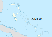
San Salvador Airport (IATA: ZSA, ICAO: MYSM), also known as Cockburn Town Airport, is an airport in San Salvador, Bahamas.
San Salvador International Airport is one of the few airports in the Bahamas that has Instrument rating landing for aeroplanes, and as a result aircraft can now land at ZSA after official sunset (with local civil aviation permission).
Bahamas Customs and Immigration is present at ZSA between normal working hours of 9am-5pm. The main carrier at ZSA is the national flag carrier Bahamasair, which has daily flights to and from Nassau. Club Med, a major hotel on the island, also has charter jet service flights direct from Paris, Montreal and New York.
As of May 18, 2015 FBO and handling services is provided by Odyssey Aviation (San Salvador). The development include a 1,200 sq feet FBO and a 25,000 gallon Jet A-1 fuel storage facility.
|
San Salvador Airport
Cockburn Town Airport
|
|
|
| Summary |
| Airport type |
Public |
| Location |
San Salvador Island |
| Elevation AMSL |
24 ft / 7 m |
| Coordinates |
24°03′48″N
074°31′26″W |
| Map |
|
|
| Runways |
| Direction |
Length |
Surface |
| m |
ft |
| 10/28 |
2,438 |
7,999 |
Asphalt |
|
Airlines and destinations
| Destinations |
| Air Canada Rouge |
Montréal–Trudeau |
| Air Caraibes |
Seasonal: Paris–Orly, Punta Cana |
| Bahamasair |
Deadman’s Cay, Miami, Nassau |
Accidents and incidents
- On 2 March 1973, Douglas C-47 N6574 of Arute International Air overran the runway on landing and was damaged beyond economic repair. The cause was pilot error in that a downwind landing was made. The aircraft was operating an international non-scheduled passenger flight from Miami International Airport, United States.
The above content comes from Wikipedia and is published under free licenses – click here to read more.
| General Info
|
| Country |
Bahamas, The
|
| ICAO ID |
MYSM
|
| Time |
UTC-5 (-4DT)
|
| Latitude |
24.063275
24° 03' 47.79" N
|
| Longitude |
-74.523967
074° 31' 26.28" W
|
| Elevation |
24 feet
7 meters
|
| Magnetic Variation |
009° W (05/06)
|
| Beacon |
Yes
|
| Operating Agency |
CIVIL GOVERNMENT, (LANDING FEES AND DIPLOMATIC CLEARANCE MAY BE REQUIRED)
|
| Island Group |
San Salvador I
|
| Operating Hours |
SUNRISE TO SUNSET (SR-SS)
|
| International Clearance Status |
Airport of Entry
|
| Daylight Saving Time |
Second Sunday in March at 0200 to first Sunday in November at 0200 local time (Exception Arizona and that portion of Indiana in the Eastern Time Zone)
|
| Communications
|
| UNICOM |
122.8
|
| NASSAU RDO |
124.6
|
| Communications Remarks |
|
| RDO |
(RCO)
|
| Runways
|
| ID |
Dimensions |
Surface |
PCN |
ILS
|
| 10/28 |
8000 x 150 feet
2438 x 46 meters |
ASPHALT |
052FAXT |
NO
|
| Navaids
|
| Type |
ID |
Name |
Channel |
Freq |
Distance From Field |
Bearing From Navaid
|
| NDB |
ZSJ |
SAN SALVADOR |
- |
281 |
At Field |
-
|
| Supplies/Equipment
|
| Fuel |
Jet A1, without icing nhibitor.
|
| Remarks
|
| CAUTION |
Numerous obst up to 90' within .25 NM of rwy.
|
| FUEL |
Chevron Texaco Global Avn Texaco/Esso C506-339-9160/9008 A1 via TRUCK (NC-100LL)
|
| OPR HOURS |
Opr SR-SS.
|
The content above was published at Airports-Worldwide.com in 2020.
We don't guarantee the information is fresh and accurate. The data may be wrong or outdated.
For more up-to-date information please refer to other sources.
|
|