|
|
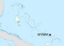
Mayaguana Airport (IATA: MYG, ICAO: MYMM) is an airport in Mayaguana in the Bahamas.
|
Mayaguana Airport
|
|
|
| Summary |
| Location |
Mayaguana |
| Elevation AMSL |
11 ft / 3 m |
| Coordinates |
22°22′46″N
073°00′49″W |
| Map |
|
|
| Runways |
| Direction |
Length |
Surface |
| m |
ft |
| 06/24 |
2,224 |
7,297 |
Asphalt |
|
Airlines and destinations
| Destinations |
| Bahamasair |
Nassau |
The above content comes from Wikipedia and is published under free licenses – click here to read more.
| General Info
|
| Country |
Bahamas, The
|
| ICAO ID |
MYMM
|
| Time |
UTC-5 (-4DT)
|
| Latitude |
22.379528
22° 22' 46.30" N
|
| Longitude |
-73.013500
073° 00' 48.60" W
|
| Elevation |
11 feet
3 meters
|
| Magnetic Variation |
009° W (05/06)
|
| Operating Agency |
CIVIL GOVERNMENT, (LANDING FEES AND DIPLOMATIC CLEARANCE MAY BE REQUIRED)
|
| Operating Hours |
SUNRISE TO SUNSET (SR-SS)
|
| International Clearance Status |
Airport of Entry
|
| Runways
|
| ID |
Dimensions |
Surface |
PCN |
ILS
|
| 06/24 |
7297 x 150 feet
2224 x 46 meters |
ASPHALT |
- |
NO
|
| Remarks
|
| OPR HOURS |
Opr SR-SS.
|
The content above was published at Airports-Worldwide.com in 2020.
We don't guarantee the information is fresh and accurate. The data may be wrong or outdated.
For more up-to-date information please refer to other sources.
|
|