|
|
Andros Town International Airport |
Andros Town Airport or Andros Town International Airport (IATA: ASD, ICAO: MYAF) is an airport serving Andros Town on Andros Island in the Bahamas. It is also known as Fresh Creek Airport.
It is one of three commercial airports on Andros Island. The airport is served by two airlines, but few tourists actually fly there. The airport is like any small Bahamian airport, with check-in, customs, gift shops and restaurants.
|
Andros Town Airport
Fresh Creek Airport
|
|
|
| Summary |
| Airport type |
Public |
| Operator |
Government |
| Serves |
Andros Town, Andros Island, Bahamas |
| Elevation AMSL |
11 ft / 3.5 m |
| Coordinates |
24°41′54″N
077°47′44″W |
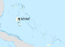
| Map |
|
|
| Runways |
| Direction |
Length |
Surface |
| m |
ft |
| 09/27 |
1,237 |
4,058 |
Asphalt |
|
Facilities
The airport is at an elevation of 5 ft (1.5 m) above mean sea level. It has one runway designated 09/27 with an asphalt surface measuring 1,237 m × 30 m (4,058 ft × 98 ft).
Airlines serving the airport
| Destinations |
| Flamingo Air |
Nassau |
| LEAIR |
Nassau |
The above content comes from Wikipedia and is published under free licenses – click here to read more.
| General Info
|
| Country |
Bahamas, The
|
| ICAO ID |
MYAF
|
| Time |
UTC-5 (-4DT)
|
| Latitude |
24.698283
24° 41' 53.82" N
|
| Longitude |
-77.795611
077° 47' 44.20" W
|
| Elevation |
5 feet
2 meters
|
| Magnetic Variation |
007° W (07/06)
|
| Operating Agency |
CIVIL GOVERNMENT, (LANDING FEES AND DIPLOMATIC CLEARANCE MAY BE REQUIRED)
|
| Alternate Name |
ANDROS TOWN
|
| Island Group |
Andros I
|
| Operating Hours |
SUNRISE TO SUNSET (SR-SS)
|
| International Clearance Status |
Airport of Entry
|
| Daylight Saving Time |
Second Sunday in March at 0200 to first Sunday in November at 0200 local time (Exception Arizona and that portion of Indiana in the Eastern Time Zone)
|
| Communications
|
| UNICOM |
122.8
|
AUTEC OPS
(US Navy, AUTEC Range)
|
126.3
277.8
355.0
|
| Runways
|
| ID |
Dimensions |
Surface |
PCN |
ILS
|
| 09/27 |
4060 x 100 feet
1237 x 30 meters |
BITUMINOUS, TAR OR ASPHALT MIXED IN PLACE, OILED. |
- |
NO
|
| Supplies/Equipment
|
| Fuel |
Jet fuel avaiable but type is unknown.
|
| JASU |
NC-8A/A1
DC: 500 amp constant, 750 amp intermittent, 28v, AC: 60kva@0.8pf, 115/200v, 3 phase, 400hz
|
| Remarks
|
| CAUTION |
Extv copter opr 500' and blw over water and 70 NM S. Copter carrying hvy external loads, ltd ability to maneuver. Ltd prk ramp hvy used by C-130, FH-227, DC-3 and lgt civ acft. C-130 ramp/taxi opr should be ltd to min pwr and one acft to preclude damage/blocking lcl tfc. Parallel twy is 15 ft fr Rwy 09/27, do not use dur other acft tkof and ldg. Acft are advs to circle afld to ensure compliance.
|
| FUEL |
Fuel req for over 1000 gal rqr prior arng. A1 (Mil)
|
| JASU |
1(NC-8A/A1) 1(NC-10A)
|
| LGT |
Rwy lgt avbl 15 min ntc to AUTEC OPS.
|
| MISC |
US Navy AUTEC Heliport lctd 2 NM E. Heliport opr day/ngt. VFR mrk by rot bcn (white/orange/green).
|
| OPR HOURS |
Opr SR-SS.
|
| RSTD |
PPR for all US mil acft and all acft arr to support AUTEC. Ctc AUTEC OPS DSN 483-7390 or C407-655-5155, extn 4366. Diplomatic clnc not rqr (US mil in support ofAUTEC only).
|
| TRAN ALERT |
No priority basis, ltd tran svc and maint avbl. Tran crews must be able to provide technical direction and assistance in svc/maint. All PPR acft inbd ctc AUTEC OPS 30 min prior to obtain crash/rescue svc.
|
The content above was published at Airports-Worldwide.com in 2020.
We don't guarantee the information is fresh and accurate. The data may be wrong or outdated.
For more up-to-date information please refer to other sources.
|
|