|
|
Ganja International Airport |
Ganja International Airport (Azerbaijani: Gəncə Beynəlxalq Hava Limanı) (IATA: KVD, ICAO: UBBG) is an airport serving Ganja (also known as Gyandzha), the second-largest city in Azerbaijan.
It is also used by the Azerbaijani Air and Air Defence Force and was previously used by the Soviet Air Force.
|
Ganja International Airport
Gəncə Beynəlxalq Hava Limanı
|
|
|
| Summary |
| Airport type |
Public / Military |
| Owner |
Government of Azerbaijan |
| Operator |
Government |
| Serves |
Ganja |
| Location |
Ganja, Azerbaijan |
| Elevation AMSL |
1,083 ft / 330 m |
| Coordinates |
40°44′16″N
046°19′03″E |
| Website |
ganjaairport.com |
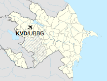
| Map |
Location of airport in Ganja, Azerbaijan
|
| Runways |
| Direction |
Length |
Surface |
| m |
ft |
| 12/30 |
3,300 |
10,827 |
Asphalt/Concrete |
|
| Statistics (2014) |
| Passengers |
329,156 |
| Passenger change 13–14 |
-4.6% |
| Aircraft movements |
3,060 |
| Movements change 13–14 |
+0.3% |
|
Facilities
The airport resides at an elevation of 1,083 feet (330 m) above mean sea level. It has one runway designated 12/30 with an asphalt/concrete surface measuring 3,300 by 44 metres (10,827 ft × 144 ft).
Airlines and destinations
| Destinations |
| Azerbaijan Airlines |
Baku, Moscow–Vnukovo, St. Petersburg |
| Buta Airways |
Moscow–Vnukovo |
| Turkish Airlines |
Istanbul |
| Ural Airlines |
Moscow–Domodedovo |
Statistics
Traffic by calendar year. Official ACI Statistics
| |
Passengers |
Change from previous year |
Aircraft operations |
Change from previous year |
Cargo
(metric tons) |
Change from previous year |
| 2012 |
259,451 |
N.D. |
2,814 |
N.D. |
917 |
N.D. |
| 2013 |
345,055 |
+32.99% |
3,052 |
+ 8.46% |
883 |
- 3.71% |
| 2014 |
329,156 |
- 4.61% |
3,060 |
+ 0.26% |
721 |
-18.35% |
Source: Airports Council International. World Airport Traffic Reports
(Years 2012, 2013, and 2014) |
The above content comes from Wikipedia and is published under free licenses – click here to read more.
| General Info
|
| Country |
Azerbaijan
|
| ICAO ID |
UBBG
|
| Time |
UTC+4(+5DT)
|
| Latitude |
40.737678
40° 44' 15.64" N
|
| Longitude |
46.317581
046° 19' 03.29" E
|
| Elevation |
1083 feet
330 meters
|
| Type |
Civil
|
| Magnetic Variation |
005° E (05/06)
|
| Operating Agency |
CIVIL GOVERNMENT, (LANDING FEES AND DIPLOMATIC CLEARANCE MAY BE REQUIRED)
|
| Operating Hours |
24 HOUR OPERATIONS
|
| Daylight Saving Time |
Last Sunday in March to last Sunday in October
|
| Communications
|
| TWR |
124.0
|
| ATIS |
119.25
|
| APP |
124.0
|
| Communications Remarks |
|
| ATIS |
(Russian - English)
|
| Runways
|
| ID |
Dimensions |
Surface |
PCN |
ILS
|
| 12/30 |
8217 x 144 feet
2505 x 44 meters |
CONCRETE. |
070RBXT |
NO
|
| Navaids
|
| Type |
ID |
Name |
Channel |
Freq |
Distance From Field |
Bearing From Navaid
|
| NDB |
ZW |
GANJA |
- |
486 |
2.8 NM |
122.6
|
| Supplies/Equipment
|
| Fuel |
Unknown fuel type or whether there is any fuel.
|
| Other Fluids |
OX, Indicates oxygen servicing when type of servicing is unknown
|
| Remarks
|
| FLUID |
OX
|
| FUEL |
(NC-TS1)
|
| OIL |
O-MK8
|
The content above was published at Airports-Worldwide.com in 2020.
We don't guarantee the information is fresh and accurate. The data may be wrong or outdated.
For more up-to-date information please refer to other sources.
|
|