Vienna International
Airport |
 Southeast
of Vienna is Vienna International Airport. In 2005, there
were over 230,900 separate flights departing or arriving, and the airport
was used by 15.86 million passengers. After a several year long negotiation
with surrounding communities it was decided to increase the capacity of
airport flights with the addition of a third runway. Currently the airport
is undergoing a major enlargement (construction of several new buildings)
to prepare for an expected increase in passengers. Southeast
of Vienna is Vienna International Airport. In 2005, there
were over 230,900 separate flights departing or arriving, and the airport
was used by 15.86 million passengers. After a several year long negotiation
with surrounding communities it was decided to increase the capacity of
airport flights with the addition of a third runway. Currently the airport
is undergoing a major enlargement (construction of several new buildings)
to prepare for an expected increase in passengers.
Vienna International Airport is the leader in the number
of flight destinations in Eastern Europe: 42 destinations provide optimal
service for passengers (source: OAG, Official Airline Guides Inc., Nov.
2006). This OAG survey showed Vienna in first place followed by Frankfurt
(39 destinations), Prague (30 destinations), Munich (29 destinations),
Budapest (21 destinations), Milan MXP (21 destinations) and Zurich (16
destinations).
|
 |
(Click on the photo to enlarge) |
History
Originally built as a military airport in 1938, it was taken over by
the British in 1945. In 1954, the Betriebsgesellschaft was founded, and
the airport replaced Aspern as Vienna's (and Austria's) principal aerodrome.
There was just one runway, which in 1959 was expanded to measure 3,000
metres. The erection of the new airport building starting in 1960. In
1972 another runway was built.
The airport received Olympic teams as Austria has twice hosted the Winter
Olympics. Pope John Paul II also used the airport during his visits to
Austria. On December 27, 1985, the El Al ticket counter was attacked by
Palestinian terrorists.
The airport formerly featured a Harrods, but it closed in 2003.
|
 |
(Click on the photo to enlarge) |
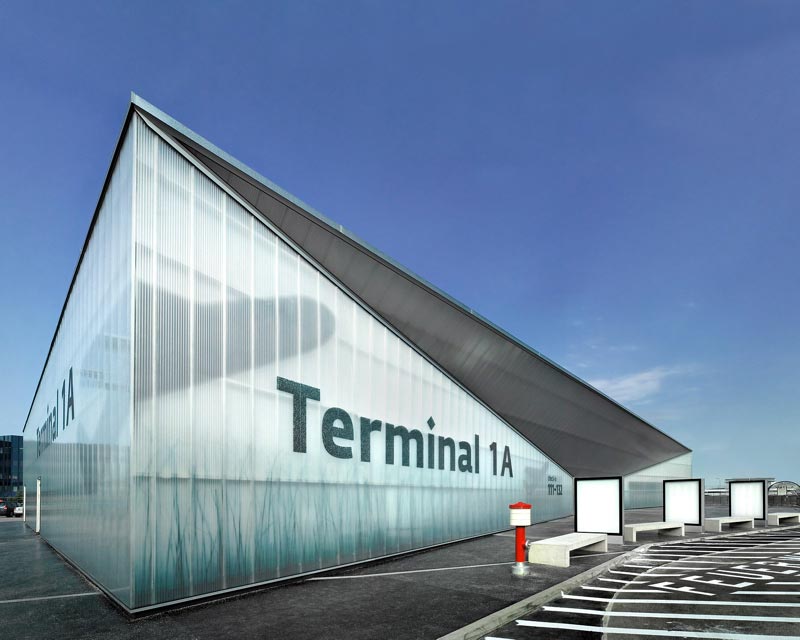
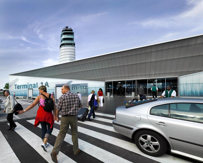
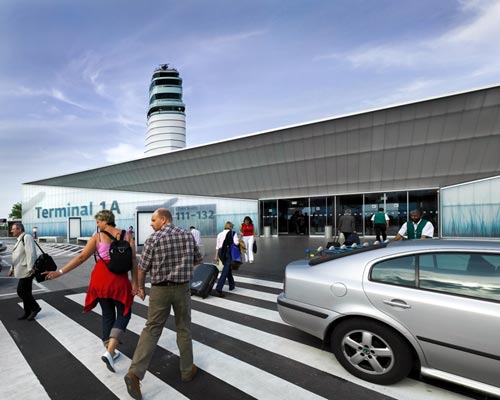
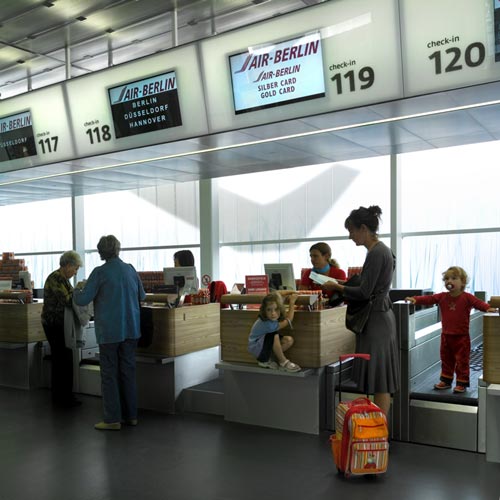
Terminals
Presently, Vienna International Airport has three terminals. A provisory
Terminal (1A) was built to offer more place for low cost carriers. In
2006, the airport started building a new terminal, SKYLINK, which will
make the airport more capable of dealing with higher passenger volumes
(2006: 17.3 million). This new terminal will also make the airport capable
of handling bigger aircraft, such as the Airbus A380.
|
 |
(Click on the photo to enlarge) |
Masterplan 2015
Because of its constant growth in passenger numbers and freight, Vienna
International Airport has decided to enlarge Austria's biggest airport
with several new and respectively adapted buildings.
- New Tower: A new Tower was built, directly besides
the World Trade Center. With its 109 meters of height, it allows a free
overlook of the entire airport area and it offers another spectacular
sight: a night laser show, which should welcome the passengers even from
the airplane.
- New Terminal: Due to constant passenger and freight
growth, Vienna International Airport has planned to build another Terminal,
SKYLINK, which should be able to compensate higher passenger rates. Construction
started in 2006 and will last until late 2008. If there is still an enormous
amount of passenger growth, the Masterplan 2015 sees an enlargement of
SKYLINK.
- Third Runway: Due to higher aviation rates, a third
runway will be necessary for the airport. A mediation process was held,
and the start of the construction of the third runway will be in 2009.
- Railway station: The underground railway station will
be enlarged and a connection to Bratislava will be constructed. Additionally
the CAT, City Airport Train, which connects the center of Vienna with
the airport in just 16 minutes, will receive a new underground railway
station.
Flughafen Wien AG
Vienna International Airport
P.O. Box 1
A-1300 Vienna Airport, Austria
Phone: +43-1/7007-0
E-mail: v at viennaairport com
http://www.viennaairport.com/
Images and information placed above are from
http://www.viennaairport.com/
http://en.wikipedia.org/wiki/Vienna_International_Airport
We thank them for the data!
| General Info
|
| Country |
Austria
|
| ICAO ID |
LOWW
|
| Time |
UTC+1(+2DT)
|
| Latitude |
48.110278
48° 06' 37.00" N
|
| Longitude |
16.569722
016° 34' 11.00" E
|
| Elevation |
600 feet
183 meters
|
| Type |
Civil
|
| Magnetic Variation |
003° E (05/06)
|
| Operating Agency |
CIVIL GOVERNMENT, (LANDING FEES AND DIPLOMATIC CLEARANCE MAY BE REQUIRED)
|
| Alternate Name |
VIENNA
|
| Near City |
Wien
|
| Operating Hours |
SEE REMARKS FOR OPERATING HOURS OR COMMUNICATIONS FOR POSSIBLE HOURS
|
| International Clearance Status |
Airport of Entry
|
| Daylight Savings Time |
Last Sunday in March to last Sunday in October
|
| Communications
|
| WIEN TWR |
119.4
121.2
123.8
|
| VIENNA ICE |
131.625
|
INFO
Opr 0800-evening civ twilight (no later than 2000Z++).
|
118.525
|
WIEN GND
Opr 0600-2100Z++
|
121.6
121.77
|
| DIRECTOR |
119.8
126.55
|
| WIEN CLNC DEL |
122.125
|
| ATIS |
121.725
122.95
(121.725 Dep) (122.95 Arr)
|
| WIEN RADAR |
128.2
124.55
129.05
132.475
(FL245 and blw)
|
| Runways
|
| ID |
Dimensions |
Surface |
PCN |
ILS
|
| 11/29 |
11483 x 148 feet
3500 x 45 meters |
ASPHALT |
055FBWT |
YES
|
| 16/34 |
11811 x 148 feet
3600 x 45 meters |
ASPHALT |
070FAWT |
YES
|
| Navaids
|
| Type |
ID |
Name |
Channel |
Freq |
Distance From Field |
Bearing From Navaid
|
| VOR-DME |
WGM |
WAGRAM |
059X |
112.2 |
13.2 NM |
165.1
|
| NDB |
WO |
SCHWECHAT |
- |
303 |
5.0 NM |
113.9
|
| Supplies/Equipment
|
| Fuel |
Jet A1, without icing nhibitor.
100/130 MIL Spec, low lead, aviation gasoline (BLUE)
|
| Other Fluids |
DE-ICE, Anti-icing/De-icing/Defrosting Fluid (MIL A 8243)
|
| Remarks
|
| CAUTION |
Rescue copter ops at low alt to/fr ASPERN (6.5 NM N thld Rwy 16 on extn RCL Rwy 34 and 1 NM W of extn RCL Rwy 34.
|
| FLUID |
Ctc Vienna Ice for de-ice svc.
|
| FUEL |
A1 (TFE Austria, fone C43-22-36-53-233) (NC-100LL)
|
| LGT |
PAPI Rwy 11 GS 3.1 MEHT 54'. PAPI Rwy 29 MEHT 53'. PAPI Rwy 16 MEHT 50'. PAPI Rwy 34 MEHT 50'.
|
| NS ABTMT |
Rwy 29 dep climb tr 294 max grad and turn immed at 1300' MSL wi 4 NM.
|
11483 x 148 feet
3500 x 45 meters
| Runway 11
|
| Surface |
ASPHALT
|
| True Heading |
116.0
|
| Latitude |
48.122814
48° 07' 22.13" N
|
| Longitude |
16.533358
016° 32' 00.09" E
|
| Elevation |
575.0 feet
175 meters
|
| Slope |
0.2°
|
| Landing Distance |
11483 feet
3500 meters
|
| Takeoff Distance |
11483 feet
3500 meters
|
| Lighting System |
SF
CL
HIRL
REIL
A1
PAPI |
| Runway 29
|
| Surface |
ASPHALT
|
| True Heading |
296.0
|
| Latitude |
48.109047
48° 06' 32.57" N
|
| Longitude |
16.575631
016° 34' 32.27" E
|
| Elevation |
600.0 feet
183 meters
|
| Slope |
-0.2°
|
| Landing Distance |
11483 feet
3500 meters
|
| Takeoff Distance |
11483 feet
3500 meters
|
| Lighting System |
SF
TDZL
CL
HIRL
REIL
A1
PAPI |
Runway 16/34
11811 x 148 feet
3600 x 45 meters
| Runway 16
|
| Surface |
ASPHALT
|
| True Heading |
164.0
|
| Latitude |
48.119783
48° 07' 11.22" N
|
| Longitude |
16.578167
016° 34' 41.40" E
|
| Elevation |
600.0 feet
183 meters
|
| Slope |
-0.1°
|
| Landing Distance |
8858 feet
2700 meters
|
| Takeoff Distance |
11811 feet
3600 meters
|
| Displaced Threshold Length |
2953 feet
900 meters
|
| Lighting System |
SF
TDZL
CL
HIRL
REIL
A1
PAPI |
| Runway 34
|
| Surface |
ASPHALT
|
| True Heading |
344.0
|
| Latitude |
48.088631
48° 05' 19.07" N
|
| Longitude |
16.591339
016° 35' 28.82" E
|
| Elevation |
586.0 feet
179 meters
|
| Slope |
0.1°
|
| Landing Distance |
11811 feet
3600 meters
|
| Takeoff Distance |
11811 feet
3600 meters
|
| Lighting System |
SF
CL
HIRL
REIL
A1
PAPI |
Navaids
| WAGRAM
|
| Type |
ID |
Channel |
Freq |
Country |
State
|
| VOR-DME |
WGM |
059X |
112.2 |
Austria |
-
|
| Latitude |
Longitude |
Airport
|
48.323856
48° 19' 25.88" N |
16.490953
016° 29' 27.43" E |
LOWW |
Navaids
| SCHWECHAT
|
| Type |
ID |
Channel |
Freq |
Country |
State
|
| NDB |
WO |
- |
303 |
Austria |
-
|
| Latitude |
Longitude |
Airport
|
48.147425
48° 08' 50.73" N |
16.457592
016° 27' 27.33" E |
LOWW |
The content above was published at Airports-Worldwide.com in 2006.
We don't guarantee the information is fresh and accurate. The data may be wrong or outdated.
For more up-to-date information please refer to other sources.
|