|
Vision
 Blue
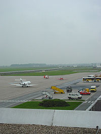
Danube Airport Linz is one of Austria´s leading regional airports.
As a modern aviation logistics centre, within the framework of an increasingly
networked business world it helps to secure Upper Austria´s position
as an economic location and provides holiday travel in the short- and
medium-haul sectors. We wish to be a model enterprise, not only for its
customers, but also the entire population in its catchment area. The people
of Upper Austria should be able to identify with their regional airport
and in order to achieve this goal, we have established the following focal
points for ongoing improvements in the environmental, quality and safety
areas: Blue
Danube Airport Linz is one of Austria´s leading regional airports.
As a modern aviation logistics centre, within the framework of an increasingly
networked business world it helps to secure Upper Austria´s position
as an economic location and provides holiday travel in the short- and
medium-haul sectors. We wish to be a model enterprise, not only for its
customers, but also the entire population in its catchment area. The people
of Upper Austria should be able to identify with their regional airport
and in order to achieve this goal, we have established the following focal
points for ongoing improvements in the environmental, quality and safety
areas:
Customers
As a regional airport, Linz Airport is an ideal starting point for business
and holiday travel and offers high sympathy levels. We aim to remain competitive
by means of ongoing infrastructure and service upgrades, and organisational
optimisation. Our objective is to further encourage the loyalty of existing
customers and attract new passengers.
Employees
In a services company, the work force is of special importance. Therefore,
we seek to transfer a large degree of responsibility to well-trained employees
and thus both challenge and further our personnel. The aim is to ensure
customer satisfaction through motivated employees.
 Partners Partners
Our goals can only be achieved in teamwork with partners. In this connection,
we regard constructive co-operation, a shared customer-orientation and
a uniform understanding of the law as being especially important.
Safety
Safety is one of the most important aspects of aviation. We wish to safeguard
our partners, customers and employees to the highest degree possible by
means to technical safety systems and ongoing training.
Environment
At Linz Airport, we allocate special significance to environmental compatibility.
Consequently, we assess the environmental impact of all our activities,
wether pending or current, and have undertaken to emplement adequate and
continuous improvements in operational environmental protection. Our objective
is to reduce environmental impact to the maximum degree permitted by the
economically acceptable use of the best technology available.
Our focus in this regard is on the areas of noise, waste, energy and emergency
precautions.
For us, adherence to all environmental statutes is a minimum prerequisite
and we seek open dialogue with the general public in our region.
 Owners Owners
As a successfully managed company, we wish to ensure that our owners receive
appropriate returns. Economic strength also serves to secure our independence.
Linz Airport as an economic factor
Aviation in general continues to enjoy steady growth. Our activities are
not only aimed at securing employment, but also the creation of new jobs.
In addition, through its efficiency, Blue Danube Airport Linz should contribute
to the securing of the Upper Austrian economic region.
Business Hours:
Mondays to Fridays: 5.30 am-11.00 pm
Saturdays and Sundays: 6.00 am-11.00 pm
The Departure Hall and the car park are open approx. 2 1/2 hours prior
to the first departure.
Shareholders:
50% Province of Upper Austria (OÖ. Verkehrsholding GmbH)
50% City of Linz
Staff:
160 people (year 2005)
Including the employees of partner companies 850 people work at Linz Airport.
Flughafen Linz GesmbH
Flughafenstr. 1
A-4063 Hörsching
Phone: +43/7221/600-0
Fax: +43/7221/600-100
E-mail: info at linz-airport com
http://www.linz-airport at /
Images and information placed above are from
http://www.linz-airport at /
We thank them for the data!
| General Info
|
| Country |
Austria
|
| ICAO ID |
LOWL, LOXL
|
| Time |
UTC+1(+2DT)
|
| Latitude |
48.233219
48° 13' 59.59" N
|
| Longitude |
14.187511
014° 11' 15.04" E
|
| Elevation |
978 feet
298 meters
|
| Type |
Joint (Civil and Military)
|
| Magnetic Variation |
002° E (05/06)
|
| Beacon |
Yes
|
| Operating Agency |
CIVIL GOVERNMENT, (LANDING FEES AND DIPLOMATIC CLEARANCE MAY BE REQUIRED)
|
| Alternate Name |
HORSCHING
|
| Operating Hours |
SEE REMARKS FOR OPERATING HOURS OR COMMUNICATIONS FOR POSSIBLE HOURS
|
| International Clearance Status |
Airport of Entry
|
| Daylight Savings Time |
Last Sunday in March to last Sunday in October
|
| Communications
|
| TWR |
118.8
|
| ATIS |
128.125
|
| RADAR |
129.625
119.75
|
| Runways
|
| ID |
Dimensions |
Surface |
PCN |
ILS
|
| 09/27 |
9843 x 197 feet
3000 x 60 meters |
ASPHALT |
060FBWT |
YES
|
| 09L/27R |
2165 x 148 feet
660 x 45 meters |
GRASS OR EARTH NOT GRADED OR ROLLED. |
- |
NO
|
| Navaids
|
| Type |
ID |
Name |
Channel |
Freq |
Distance From Field |
Bearing From Navaid
|
| VOR-DME |
LNZ |
LINZ |
113X |
116.6 |
3.4 NM |
086.4
|
| NDB |
LNZ |
LINZ |
- |
327 |
5.4 NM |
265.7
|
| Supplies/Equipment
|
| Fuel |
Jet A1, without icing nhibitor.
100/130 MIL Spec, low lead, aviation gasoline (BLUE)
|
| Other Fluids |
DE-ICE, Anti-icing/De-icing/Defrosting Fluid (MIL A 8243)
|
| Remarks
|
| FLUID |
Acft de-icing vehicles.
|
| FUEL |
Avbl 0400-1900Z (0300-2000Z sum) (NC-100LL, A1) OT PN.
|
| LGT |
ABn
|
| NS ABTMT |
2100-0400Z++ ldg Rwy 09 (ASP) (exc IMC) and tkof Rwy 27 (ASP) if possible.
|
| OPR HOURS |
Opr 0430-2200Z++ Mon-Fri; 0500-2200Z++ Sat, Sun.
|
Runway 09/27
9843 x 197 feet
3000 x 60 meters
| Runway 09
|
| Surface |
ASPHALT
|
| True Heading |
087.0
|
| Latitude |
48.232522
48° 13' 57.08" N
|
| Longitude |
14.167378
014° 10' 02.56" E
|
| Elevation |
978.0 feet
298 meters
|
| Slope |
-0.2°
|
| Landing Distance |
9022 feet
2750 meters
|
| Takeoff Distance |
9843 feet
3000 meters
|
| Displaced Threshold Length |
821 feet
250 meters
|
| Lighting System |
SF
CL
HIRL
A1
PAPI |
| Runway 27
|
| Surface |
ASPHALT
|
| True Heading |
267.0
|
| Latitude |
48.233917
48° 14' 02.10" N
|
| Longitude |
14.207650
014° 12' 27.54" E
|
| Elevation |
963.0 feet
294 meters
|
| Slope |
0.2°
|
| Landing Distance |
9350 feet
2850 meters
|
| Takeoff Distance |
9843 feet
3000 meters
|
| Displaced Threshold Length |
493 feet
150 meters
|
| Lighting System |
SF
TDZL
CL
HIRL
REIL
BS
PAPI |
Runway 09L/27R
2165 x 148 feet
660 x 45 meters
| Runway 09L
|
| Surface |
GRASS OR EARTH NOT GRADED OR ROLLED.
|
| True Heading |
087.0
|
| Latitude |
48.235311
48° 14' 07.12" N
|
| Longitude |
14.183800
014° 11' 01.68" E
|
| Elevation |
971.0 feet
296 meters
|
| Slope |
-0.1°
|
| Landing Distance |
2165 feet
660 meters
|
| Takeoff Distance |
2165 feet
660 meters
|
| Runway 27R
|
| Surface |
GRASS OR EARTH NOT GRADED OR ROLLED.
|
| True Heading |
267.0
|
| Latitude |
48.235581
48° 14' 08.09" N
|
| Longitude |
14.192647
014° 11' 33.53" E
|
| Elevation |
968.0 feet
295 meters
|
| Slope |
0.1°
|
| Landing Distance |
2165 feet
660 meters
|
| Takeoff Distance |
2165 feet
660 meters
|
Navaids
| LINZ
|
| Type |
ID |
Channel |
Freq |
Country |
State
|
| VOR-DME |
LNZ |
113X |
116.6 |
Austria |
-
|
| Latitude |
Longitude |
Airport
|
48.229711
48° 13' 46.96" N |
14.103156
014° 06' 11.36" E |
LOXL |
Navaids
| LINZ
|
| Type |
ID |
Channel |
Freq |
Country |
State
|
| NDB |
LNZ |
- |
327 |
Austria |
-
|
| Latitude |
Longitude |
Airport
|
48.237100
48° 14' 13.56" N |
14.321783
014° 19' 18.42" E |
LOXL |
The content above was published at Airports-Worldwide.com in 2006.
We don't guarantee the information is fresh and accurate. The data may be wrong or outdated.
For more up-to-date information please refer to other sources.
|


