 |
 |
|
||||
|
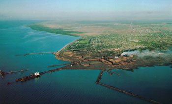
Images and information placed above are from www.airportsaustralia.com We thank them for the data!
Runway 05/23 4619 x 98 feet
|
|||||||||||||||||||||||||||||||||||||||||||||||||||||||||||||||||||||||||||||||||||||||||||||||||||||||||||||||||||||||||||||||||||||||||||||||||||||||||||||||||||||||||||||||||||||||||||||||||||||||||||||||||||||||||||||||
| Runway 05 | |
|---|---|
| Surface | GRAVEL. |
| True Heading | 054.0 |
| Latitude | -33.058697 33° 03' 31.31" S |
| Longitude | 137.507142 137° 30' 25.71" E |
| Elevation | 39.0 feet 12 meters |
| Slope | -0.1° |
| Landing Distance | 4619 feet 1408 meters |
| Takeoff Distance | 4619 feet 1408 meters |
| Lighting System | PORTABLE |
| Runway 23 | |
|---|---|
| Surface | GRAVEL. |
| True Heading | 234.0 |
| Latitude | -33.051333 33° 03' 04.80" S |
| Longitude | 137.519317 137° 31' 09.54" E |
| Elevation | 34.0 feet 10 meters |
| Slope | 0.1° |
| Landing Distance | 4619 feet 1408 meters |
| Takeoff Distance | 4619 feet 1408 meters |
| Lighting System | PORTABLE |
| Runway 17 | |
|---|---|
| Surface | ASPHALT |
| True Heading | 175.0 |
| Latitude | -33.052775 33° 03' 09.99" S |
| Longitude | 137.519439 137° 31' 09.98" E |
| Elevation | 35.0 feet 11 meters |
| Slope | -0.2° |
| Landing Distance | 5531 feet 1686 meters |
| Takeoff Distance | 5531 feet 1686 meters |
| Lighting System | PCL
LIRL PORTABLE |
| Runway 35 | |
|---|---|
| Surface | ASPHALT |
| True Heading | 355.0 |
| Latitude | -33.067781 33° 04' 04.01" S |
| Longitude | 137.521119 137° 31' 16.03" E |
| Elevation | 26.0 feet 8 meters |
| Slope | 0.2° |
| Landing Distance | 5531 feet 1686 meters |
| Takeoff Distance | 5531 feet 1686 meters |
| Lighting System | PCL
LIRL PORTABLE |
| WHYALLA | |||||
|---|---|---|---|---|---|
| Type | ID | Channel | Freq | Country | State |
| NDB | WHA | - | 371 | Australia | - |
| Latitude | Longitude | Airport |
| -33.058056 33° 03' 29.00" S |
137.524167 137° 31' 27.00" E |
YWHA |
The content above was published at Airports-Worldwide.com in 2004-2006.
We don't guarantee the information is fresh and accurate. The data may be wrong or outdated.
For more up-to-date information please refer to other sources.

 |
|
Copyright 2004-2026 © by Airports-Worldwide.com, Vyshenskoho st. 36, Lviv 79010, Ukraine Legal Disclaimer |
 Operator: Corporation of the City of Whyalla