 |
 |
|
||||
|
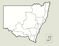
Walgett Shire is located on the productive black soil plains of northern New South Wales and covers an area of 22,000 square kilometres. It is home to eight magnificent rivers, perfect for fishing and other recreational activities. The main industries include sheep and cattle farming, wheat, cotton and various other crops, as well as, mining the black opal, Australia? s national gemstone. The shire comprises a number of towns and villages including Walgett, Lightning Ridge, Collarenebri, Burren Junction, Carinda, Grawin, Cumborah, Cryon, Come-by- Chance and Glengarry.
The geographical and administrative centre of Walgett Shire is the town of Walgett. Walgett means 'the meeting of two waters' and is where the Namoi River meets the Barwon River
Images and information placed above are from www.airportsaustralia.com We thank them for the data!
Runway 05/23 5335 x 98 feet
|
|||||||||||||||||||||||||||||||||||||||||||||||||||||||||||||||||||||||||||||||||||||||||||||||||||||||||||||||||||||||||||||||||||||||||||||||||||||||||||||||||||||||||||||||||||||||||||||||||||||||||||||||||||||||||||||||||||||||||||||||||||||||||||||
| Runway 05 | |
|---|---|
| Surface | ASPHALT |
| True Heading | 058.0 |
| Latitude | -30.037347 30° 02' 14.45" S |
| Longitude | 148.118319 148° 07' 05.95" E |
| Elevation | 439.0 feet 134 meters |
| Slope | 0.0° |
| Landing Distance | 5335 feet 1626 meters |
| Takeoff Distance | 5335 feet 1626 meters |
| Lighting System | PCL
LIRL PORTABLE |
| Runway 23 | |
|---|---|
| Surface | ASPHALT |
| True Heading | 238.0 |
| Latitude | -30.029608 30° 01' 46.59" S |
| Longitude | 148.132625 148° 07' 57.45" E |
| Elevation | 439.0 feet 134 meters |
| Slope | 0.0° |
| Landing Distance | 5335 feet 1626 meters |
| Takeoff Distance | 5335 feet 1626 meters |
| Lighting System | PCL
LIRL PORTABLE |
| Runway 18 | |
|---|---|
| Surface | GRASS OR EARTH NOT GRADED OR ROLLED. |
| True Heading | 191.0 |
| Latitude | -30.026636 30° 01' 35.89" S |
| Longitude | 148.126411 148° 07' 35.08" E |
| Elevation | 438.0 feet 134 meters |
| Slope | 0.0° |
| Landing Distance | 3783 feet 1153 meters |
| Takeoff Distance | 3783 feet 1153 meters |
| Lighting System | PORTABLE |
| Runway 36 | |
|---|---|
| Surface | GRASS OR EARTH NOT GRADED OR ROLLED. |
| True Heading | 011.0 |
| Latitude | -30.036869 30° 02' 12.73" S |
| Longitude | 148.124214 148° 07' 27.17" E |
| Elevation | 438.0 feet 134 meters |
| Slope | 0.0° |
| Landing Distance | 3783 feet 1153 meters |
| Takeoff Distance | 3783 feet 1153 meters |
| Lighting System | PORTABLE |
| WALGETT | |||||
|---|---|---|---|---|---|
| Type | ID | Channel | Freq | Country | State |
| NDB | WLG | - | 374 | Australia | - |
| Latitude | Longitude | Airport |
| -30.027272 30° 01' 38.18" S |
148.123786 148° 07' 25.63" E |
YWLG |
| WALGETT | |||||
|---|---|---|---|---|---|
| Type | ID | Channel | Freq | Country | State |
| VOR | WLG | - | 117.6 | Australia | - |
| Latitude | Longitude | Airport |
| -30.028650 30° 01' 43.14" S |
148.128411 148° 07' 42.28" E |
YWLG |
The content above was published at Airports-Worldwide.com in 2004-2006.
We don't guarantee the information is fresh and accurate. The data may be wrong or outdated.
For more up-to-date information please refer to other sources.

 |
|
Copyright 2004-2026 © by Airports-Worldwide.com, Vyshenskoho st. 36, Lviv 79010, Ukraine Legal Disclaimer |
 Operator: Walgett Shire Council