 |
 |
|
||||
|
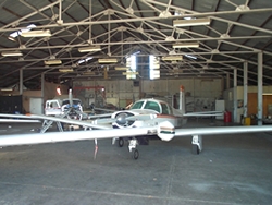
Images and information placed above are from Tamworth Airport We thank them for the data!
Runway 06/242762 x 98 feet
|
|||||||||||||||||||||||||||||||||||||||||||||||||||||||||||||||||||||||||||||||||||||||||||||||||||||||||||||||||||||||||||||||||||||||||||||||||||||||||||||||||||||||||||||||||||||||||||||||||||||||||||||||||||||||||||||||||||||||||||||||||||||||||||||||||||||||||||||||||||||||||||||||||||||||||||||||||||||||||||||||||||||||||||||||||||||
| Runway 06 | |
|---|---|
| Surface | GRASS OR EARTH NOT GRADED OR ROLLED. |
| True Heading | 073.0 |
| Latitude | -31.083181 31° 04' 59.45" S |
| Longitude | 150.842903 150° 50' 34.45" E |
| Elevation | 1313.0 feet 400 meters |
| Slope | -0.1° |
| Landing Distance | 2762 feet 842 meters |
| Takeoff Distance | 2762 feet 842 meters |
| Runway 24 | |
|---|---|
| Surface | GRASS OR EARTH NOT GRADED OR ROLLED. |
| True Heading | 253.0 |
| Latitude | -31.080981 31° 04' 51.53" S |
| Longitude | 150.851328 150° 51' 04.78" E |
| Elevation | 1310.0 feet 399 meters |
| Slope | 0.1° |
| Landing Distance | 2762 feet 842 meters |
| Takeoff Distance | 2762 feet 842 meters |
| Runway 12R | |
|---|---|
| Surface | ASPHALT |
| True Heading | 133.0 |
| Latitude | -31.081322 31° 04' 52.76" S |
| Longitude | 150.832867 150° 49' 58.32" E |
| Landing Distance | 3642 feet 1110 meters |
| Takeoff Distance | 3642 feet 1110 meters |
| Runway 30L | |
|---|---|
| Surface | ASPHALT |
| True Heading | 313.0 |
| Latitude | -31.088131 31° 05' 17.27" S |
| Longitude | 150.841392 150° 50' 29.01" E |
| Landing Distance | 3642 feet 1110 meters |
| Takeoff Distance | 3642 feet 1110 meters |
| Runway 12L | |
|---|---|
| Surface | ASPHALT |
| True Heading | 133.0 |
| Latitude | -31.071067 31° 04' 15.84" S |
| Longitude | 150.836972 150° 50' 13.10" E |
| Elevation | 1281.0 feet 390 meters |
| Slope | 0.5° |
| Landing Distance | 7218 feet 2200 meters |
| Takeoff Distance | 7218 feet 2200 meters |
| Lighting System | MIRL
VA |
| Runway 30R | |
|---|---|
| Surface | ASPHALT |
| True Heading | 313.0 |
| Latitude | -31.084564 31° 05' 04.43" S |
| Longitude | 150.853867 150° 51' 13.92" E |
| Elevation | 1320.0 feet 402 meters |
| Slope | -0.5° |
| Landing Distance | 7218 feet 2200 meters |
| Takeoff Distance | 7218 feet 2200 meters |
| Lighting System | MIRL
VA |
| Runway 18 | |
|---|---|
| Surface | GRASS OR EARTH NOT GRADED OR ROLLED. |
| True Heading | 188.0 |
| Latitude | -31.077119 31° 04' 37.63" S |
| Longitude | 150.846603 150° 50' 47.77" E |
| Elevation | 1292.0 feet 394 meters |
| Slope | 1.3° |
| Landing Distance | 3225 feet 983 meters |
| Takeoff Distance | 3346 feet 1020 meters |
| Displaced Threshold Length | 121 feet 37 meters |
| Runway 36 | |
|---|---|
| Surface | GRASS OR EARTH NOT GRADED OR ROLLED. |
| True Heading | 008.0 |
| Latitude | -31.086231 31° 05' 10.43" S |
| Longitude | 150.845067 150° 50' 42.24" E |
| Elevation | 1334.0 feet 407 meters |
| Slope | -1.3° |
| Landing Distance | 3346 feet 1020 meters |
| Takeoff Distance | 3346 feet 1020 meters |
| TAMWORTH | |||||
|---|---|---|---|---|---|
| Type | ID | Channel | Freq | Country | State |
| NDB | TW | - | 341 | Australia | - |
| Latitude | Longitude | Airport |
| -31.071156 31° 04' 16.16" S |
150.831156 150° 49' 52.16" E |
YSTW |
| TAMWORTH | |||||
|---|---|---|---|---|---|
| Type | ID | Channel | Freq | Country | State |
| VOR-DME | TW | 107X | 116 | Australia | - |
| Latitude | Longitude | Airport |
| -31.066203 31° 03' 58.33" S |
150.830022 150° 49' 48.08" E |
YSTW |
The content above was published at Airports-Worldwide.com in 2004-2006.
We don't guarantee the information is fresh and accurate. The data may be wrong or outdated.
For more up-to-date information please refer to other sources.

 |
|
Copyright 2004-2026 © by Airports-Worldwide.com, Vyshenskoho st. 36, Lviv 79010, Ukraine Legal Disclaimer |
 Operator: Tamworth City Council