|
|
|
|
|
|
 Perth Airport is the international and regional gateway
to Western Australia. Strategically located as one of Australia's closest
airports to South East Asia, Europe and Africa, Perth Airport is Australia's
fourth largest airport in terms of passenger traffic.
Perth Airport is the international and regional gateway
to Western Australia. Strategically located as one of Australia's closest
airports to South East Asia, Europe and Africa, Perth Airport is Australia's
fourth largest airport in terms of passenger traffic.
Located only 12 km from the heart of Perth, the airport is part of a 2,105
hectare site, which has the capacity to expand to meet projected commercial
aviation demand well into the 21st century.
As the international, and regional gateway to Western Australia for commercial
aircraft, freight and passengers, Perth Airport is a key contributor to
the State's economy.
A 1999 economic impact study showed that the airport contributes $900
million each year in salaries and wages, and provides direct and indirect
employment of almost 17,500 jobs. (Economic impacts associated with Perth
Airport - October 1999.)
History
 In
early 1942, the area on which Perth Airport is now located was converted
from the Dunreath golf course to an RAAF base, which operated until the
end of World War II in 1945. In
early 1942, the area on which Perth Airport is now located was converted
from the Dunreath golf course to an RAAF base, which operated until the
end of World War II in 1945.
The first runway was built by Western Australias Main Roads Department
for RAAF fighters in 1943, with a second strip being laid down a year
later. In 1944, the Government agreed to allow Australian National Airways
(ANA) and Qantas to operate from this site in Guildford, as Maylands had
become inadequate for their larger commercial aircraft.
Guildford Aerodrome officially changed its status and name to Perth Airport
in September 1952. In March 1953, the then new international terminal
was completed at a cost of $180,000, being built from second-hand wartime
materials. The main domestic airlines moved out of their separate hangars
in 1962 and into the first combined domestic and international terminal.
In November 1980, the Federal Transport Minister, Ralph Hunt, announced
a new international terminal would be built in Perth and on October 25,
1986, Prime Minister Bob Hawke unveiled the $60 million international
terminal complex on the eastern side of the airport, complete with a new
control tower.
The Federal Airports Corporation (FAC) was formed in 1988
to manage the larger Australian airports as self-funding commercial entities.
FAC implemented a major enhancement of retail outlets at the international
terminal and oversaw the redevelopment of the domestic terminal facilities
by Ansett and Australian Airlines.
In July 1997, Westralia Airports Corporation (WAC) took up a 99-year
leasehold interest over Perth Airport as part of the first phase in the
privatisation of airports in Australia, and has since operated the airport
and its 2,105 hectare estate.
 Perth Airport
ACN 077 153 130
ABN 24 077 153 130
PO Box 6, Cloverdale
Perth WA 6985
Australia
Contact Numbers
Telephone: +61 8 9478 8888
Fax: +61 8 9277 7537
Email: perthairport at wac com au
URL: www.perthairport.com
|
 |
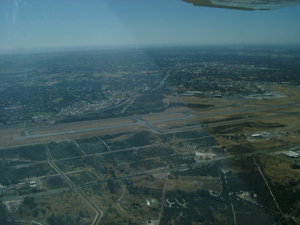
Photo credit: Dane Stead - Finals
Runway 24
|
|
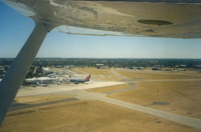 |
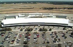
Photo credit: Dane Stead - Domestic
Apron
|
Images and information placed above are from
http://www.flightclub com au/wa-airstrips/perth/
www.perthairport.com
We thank them for the data!
| General Info
|
| Country |
Australia
|
| ICAO ID |
YPPH
|
| Time |
UTC+8
|
| Latitude |
-31.940278
31° 56' 25.00" S
|
| Longitude |
115.966944
115° 58' 01.00" E
|
| Elevation |
67 feet
20 meters
|
| Type |
Civil
|
| Magnetic Variation |
001° W (01/04)
|
| Beacon |
Yes
|
| Operating Agency |
CIVIL GOVERNMENT, (LANDING FEES AND DIPLOMATIC CLEARANCE MAY BE REQUIRED)
|
| International Clearance Status |
Airport of Entry
|
| Communications
|
| TWR |
120.5
|
| RAAF AIR OPS |
8974
11235
13206
3032
5687
|
| GND |
121.7
|
| DEP |
118.7
|
| CLNC DEL |
118.55
132.95
|
| ATIS |
113.7
272.0
123.8
|
| APP |
123.7
|
| Communications Remarks |
|
| OPS |
(8974 11235 13206 Opr 2100-0900Z) (3032 5687 8974 Opr 0900-2100Z)
|
| CLD |
(118.55 Perth Dep)(132.95 Other)
|
| Runways
|
| ID |
Dimensions |
Surface |
PCN |
ILS
|
| 03/21 |
11299 x 148 feet
3444 x 45 meters |
ASPHALT |
055FAYT |
YES
|
| 06/24 |
7096 x 148 feet
2163 x 45 meters |
ASPHALT |
050FAYU |
YES
|
| Navaids
|
| Type |
ID |
Name |
Channel |
Freq |
Distance From Field |
Bearing From Navaid
|
| VOR-DME |
PH |
PERTH |
084X |
113.7 |
At Field |
-
|
| NDB |
PRL |
PARKERVILLE |
- |
352 |
9.1 NM |
239.4
|
| Supplies/Equipment
|
| Oil |
O-117, 1100, Reciprocating Engine Oil (MIL L 6082)
|
| Remarks
|
| CAUTION |
To prevent erosion and eng damage acft eng overhanging twy edges to be opr at lopwr. Exp severe turbulence blw 3000' dur sum when E winds prevail.
|
| FUEL |
Avbl. Fone C08 9478 9898.(NC-100LL, A1,A1+).
|
| MISC |
Ldg fees. Arpt opr fone C08 9478 8888. Rwy 03-21 grooved. Rwy 06-24 porous.
|
| NS ABTMT |
See FLIP PLANNING AP/3.
|
| OIL |
O-117
|
Runway 03/21
11299 x 148 feet
3444 x 45 meters
| Runway 03
|
| Surface |
ASPHALT
|
| True Heading |
014.0
|
| Latitude |
-31.958739
31° 57' 31.46" S
|
| Longitude |
115.959683
115° 57' 34.86" E
|
| Elevation |
67.0 feet
20 meters
|
| Slope |
-0.2°
|
| Landing Distance |
11299 feet
3444 meters
|
| Takeoff Distance |
11299 feet
3444 meters
|
| Lighting System |
MIRL
PAPI
PORTABLE |
| Runway 21
|
| Surface |
ASPHALT
|
| True Heading |
194.0
|
| Latitude |
-31.928594
31° 55' 42.94" S
|
| Longitude |
115.968464
115° 58' 06.47" E
|
| Elevation |
43.0 feet
13 meters
|
| Slope |
0.2°
|
| Landing Distance |
11299 feet
3444 meters
|
| Takeoff Distance |
11299 feet
3444 meters
|
| Lighting System |
HIRL
J
PAPI
PORTABLE |
Runway 06/24
7096 x 148 feet
2163 x 45 meters
| Runway 06
|
| Surface |
ASPHALT
|
| True Heading |
059.0
|
| Latitude |
-31.940989
31° 56' 27.56" S
|
| Longitude |
115.959203
115° 57' 33.13" E
|
| Elevation |
58.0 feet
18 meters
|
| Slope |
0.0°
|
| Landing Distance |
7096 feet
2163 meters
|
| Takeoff Distance |
7096 feet
2163 meters
|
| Lighting System |
MIRL
PAPI
PORTABLE |
| Runway 24
|
| Surface |
ASPHALT
|
| True Heading |
239.0
|
| Latitude |
-31.930908
31° 55' 51.27" S
|
| Longitude |
115.978792
115° 58' 43.65" E
|
| Elevation |
57.0 feet
17 meters
|
| Slope |
0.0°
|
| Landing Distance |
7096 feet
2163 meters
|
| Takeoff Distance |
7096 feet
2163 meters
|
| Lighting System |
HIRL
J
PAPI
PORTABLE |
Navaids
| PERTH
|
| Type |
ID |
Channel |
Freq |
Country |
State
|
| VOR |
PTH |
- |
110.4 |
United Kingdom |
-
|
| Latitude |
Longitude |
Airport
|
56.442500
56° 26' 33.00" N |
-3.368611
003° 22' 07.00" W |
|
| PERTH
|
| Type |
ID |
Channel |
Freq |
Country |
State
|
| NDB |
PH |
- |
272 |
Australia |
-
|
| Latitude |
Longitude |
Airport
|
-31.937500
31° 56' 15.00" S |
115.950278
115° 57' 01.00" E |
YPPH
|
| PERTH
|
| Type |
ID |
Channel |
Freq |
Country |
State
|
| VOR-DME |
PH |
084X |
113.7 |
Australia |
-
|
| Latitude |
Longitude |
Airport
|
-31.945000
31° 56' 42.00" S |
115.959167
115° 57' 33.00" E |
YPPH
|
Navaids
| PARKERVILLE
|
| Type |
ID |
Channel |
Freq |
Country |
State
|
| NDB |
PRL |
- |
352 |
Australia |
-
|
| Latitude |
Longitude |
Airport
|
-31.859444
31° 51' 34.00" S |
116.117500
116° 07' 03.00" E |
YPPH
|
The content above was published at Airports-Worldwide.com in 2004-2006.
We don't guarantee the information is fresh and accurate. The data may be wrong or outdated.
For more up-to-date information please refer to other sources.
|
 |