 |
|
|
|
|
|
Operator: Mackay Port Authority
Address:
PO Box 3340
Mackay QLD 4740
Australia
Phone: +61 7 49570222
Fax: +61 7 4953 1929
Email: mpa at mackayports com
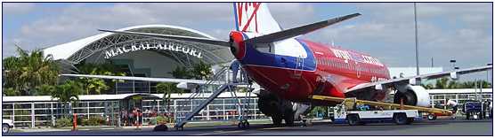
Mackay's spectacular airport terminal offers a memorable first impression of Mackay for tourists and creates a distinctive feeling of having arrived in North Queensland. The airport terminal won a most prestigious design award from the Royal Australia Institute of Architects.
Airport Profile
Licensed by the Australian Civil Aviation Safety Authority.
Mackay Port Authority owns and operates Mackay Airport.
The Mackay Airport:
- operates 16 hours per day (0500-2100), 7 days per week
- currently handles over 10,000 RPT movements per annum, dependent upon aircraft size mix
- currently handles over 30,000 Charter and GA movements per annum, dependent upon aircraft size mix
- has experienced rapid growth despite the September 2001 collapse of Ansett and Flight West operations due to the November 2001 expansion of QantasLink services and commencement of Virgin Blue, now handling over 320,000 passengers per annum through the terminal
In 2001/02 generated airport operating revenue of over $4.3 million
URL: Mackay Airport
Images and information placed above are from
Mackay
Airport
We thank them for the data!
| General Info
|
| Country |
Australia
|
| ICAO ID |
YBMK
|
| Time |
UTC+10
|
| Latitude |
-21.171667
21° 10' 18.00" S
|
| Longitude |
149.179722
149° 10' 47.00" E
|
| Elevation |
19 feet
6 meters
|
| Type |
Civil
|
| Magnetic Variation |
008° E (01/04)
|
| Beacon |
Yes
|
| Operating Agency |
CIVIL GOVERNMENT, (LANDING FEES AND DIPLOMATIC CLEARANCE MAY BE REQUIRED)
|
| Communications
|
TWR
2130-1050Z Mon-Sat, 2230-1050Z Sun.
|
124.5
|
MTAF
Outside twr hrs.
|
124.5
|
BRISBANE CNTR
Outside twr hrs
|
135.5
|
| ATIS |
112.7
128.0
|
| Communications Remarks |
|
| FSS |
(on gnd)
|
| MISC |
Nstd wi CTLZ to 4500'.
|
| Runways
|
| ID |
Dimensions |
Surface |
PCN |
ILS
|
| 05/23 |
4409 x 98 feet
1344 x 30 meters |
ASPHALT |
008FAYT |
NO
|
| 14/32 |
6499 x 148 feet
1981 x 45 meters |
ASPHALT |
055FAXT |
NO
|
| Navaids
|
| Type |
ID |
Name |
Channel |
Freq |
Distance From Field |
Bearing From Navaid
|
| VOR-DME |
MK |
MACKAY |
074X |
112.7 |
At Field |
-
|
| NDB |
MK |
MACKAY |
- |
308 |
At Field |
-
|
| Supplies/Equipment
|
| Fuel |
Jet A1, without icing nhibitor.
100/130 MIL Spec, low lead, aviation gasoline (BLUE)
|
| Remarks
|
| CAUTION |
High intensity floodlighting adjacent to short final on apch Rwy 14 may cause distraction in conditions of light mist or fog. Bird haz. Twin unlgtd twr 350' 0183.5 NM fr fld. PJE on arpt SR-SS to 10,000'.
|
| FUEL |
Avbl 2100-0730 dly,OT PN fone C07-4957-3226. (NC-100LL, A1)
|
| LGT |
ACTIVATE-Rwy lgt-119.6.
|
| MISC |
Ldg fees.
|
| NS ABTMT |
See FLIP PLANNING AP/3.
|
| RSTD |
Ltd park for acft abv GWT 50,600 lb. All acft abv GWT 12,500 lb RON rqr PN to arpt drct.
|
| TFC PAT |
RWY 5 and 14 Rgt hand circuit after hrs.
|
Runway 05/23
4409 x 98 feet
1344 x 30 meters
| Runway 05
|
| Surface |
ASPHALT
|
| True Heading |
058.0
|
| Latitude |
-21.175689
21° 10' 32.48" S
|
| Longitude |
149.174203
149° 10' 27.13" E
|
| Elevation |
19.0 feet
6 meters
|
| Slope |
-0.1°
|
| Landing Distance |
4222 feet
1287 meters
|
| Takeoff Distance |
4409 feet
1344 meters
|
| Displaced Threshold Length |
187 feet
57 meters
|
| Lighting System |
PCL
LIRL
PORTABLE |
| Runway 23
|
| Surface |
ASPHALT
|
| True Heading |
238.0
|
| Latitude |
-21.169244
21° 10' 09.28" S
|
| Longitude |
149.185172
149° 11' 06.62" E
|
| Elevation |
13.0 feet
4 meters
|
| Slope |
0.1°
|
| Landing Distance |
4409 feet
1344 meters
|
| Takeoff Distance |
4409 feet
1344 meters
|
| Lighting System |
PCL
LIRL
PORTABLE |
Runway 14/32
6499 x 148 feet
1981 x 45 meters
| Runway 14
|
| Surface |
ASPHALT
|
| True Heading |
148.0
|
| Latitude |
-21.163192
21° 09' 47.49" S
|
| Longitude |
149.177464
149° 10' 38.87" E
|
| Elevation |
17.0 feet
5 meters
|
| Landing Distance |
6499 feet
1981 meters
|
| Takeoff Distance |
6499 feet
1981 meters
|
| Lighting System |
PCL
LIRL
REIL
VA
PORTABLE |
| Runway 32
|
| Surface |
ASPHALT
|
| True Heading |
328.0
|
| Latitude |
-21.178325
21° 10' 41.97" S
|
| Longitude |
149.187667
149° 11' 15.60" E
|
| Elevation |
14.0 feet
4 meters
|
| Landing Distance |
6499 feet
1981 meters
|
| Takeoff Distance |
6499 feet
1981 meters
|
| Lighting System |
PCL
LIRL
VA
PORTABLE |
Navaids
| MACKAY
|
| Type |
ID |
Channel |
Freq |
Country |
State
|
| NDB |
MK |
- |
308 |
Australia |
-
|
| Latitude |
Longitude |
Airport
|
-21.162222
21° 09' 44.00" S |
149.186389
149° 11' 11.00" E |
YBMK
|
| MACKAY
|
| Type |
ID |
Channel |
Freq |
Country |
State
|
| VOR-DME |
MK |
074X |
112.7 |
Australia |
-
|
| Latitude |
Longitude |
Airport
|
-21.172778
21° 10' 22.00" S |
149.187222
149° 11' 14.00" E |
YBMK
|
The content above was published at Airports-Worldwide.com in 2004-2006.
We don't guarantee the information is fresh and accurate. The data may be wrong or outdated.
For more up-to-date information please refer to other sources.
|
 |


