|
|
Leonora, Western Australia
Leonora is a town and shire in the Goldfields-Esperance
region of Western Australia. The town of Leonora is located at 28°53'S
121°20'E, 833 kilometres north east of Perth and 237 kilometres north
of Kalgoorlie. The Shire of Leonora has an area of 31,743 square kilometres,
and a population of about 4,200 people. About 1,500 people live in the
town of Leonora, and another 1,400 live in Leinster, the only other town
in the shire. About a third of the population are of Aboriginal descent.
The area is extremely arid, with a mean annual rainfall of just 230 millimetres
(9 inches). It is also quite warm, with mean daily maximum temperatures
ranging from 18°C (64°F) in July to 37°C (99°F) in January.
Leonora is primarily a mining town. There
are a number of major gold mines in the Shire, and the Murrin Murrin laterite
nickel project is located in the shire. The area is too arid to support
agriculture, but there is a substantial pastoral industry.
The Leonora area was first explored by
John Forrest, who visited the area in 1869. Forrest's party made camp
near a hill, which Forrest named Mount Leonora, after a lady friend of
his, Miss Phylis Leonora Hardey. In 1894, gold was discovered in the area
by a prospector named Morrisey, and in the following two years a number
of rich finds resulted in rapid development of the area. The Gwalia and
Sons of Gwalia gold mines brought Leonora to the attention of the world.
By 1897 a residential and business area had been established, and the
town was gazetted as Leonora in 1898.
|
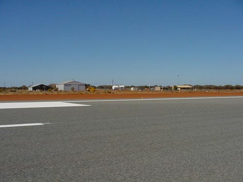 |
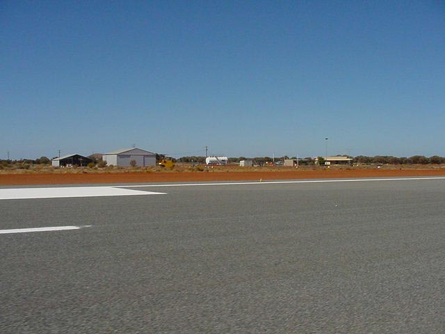
Photo credit: Transport (WA Govt)
(Click on the photo to enlarge) |
|
 |
Photo credit: Transport (WA Govt)
(Click on the photo to enlarge) |
Images and information placed above are from
http://www.flightclub.com.au/wa-airstrips/leonora/
http://en.wikipedia.org/wiki/Leonora,_Western_Australia
We thank them for the data!
| General Info
|
| Country |
Australia
|
| ICAO ID |
YLEO
|
| Time |
UTC+8
|
| Latitude |
-28.878056
28° 52' 41.00" S
|
| Longitude |
121.314722
121° 18' 53.00" E
|
| Elevation |
1217 feet
371 meters
|
| Magnetic Variation |
001° E (01/06)
|
| Operating Agency |
CIVIL GOVERNMENT, (LANDING FEES AND DIPLOMATIC CLEARANCE MAY BE REQUIRED)
|
| Communications
|
| MELBOURNE CNTR |
118.4
|
| CTAF |
126.8
|
| Communications Remarks |
|
| FSS |
(On gnd.)
|
| CTAF |
(required)
|
| Runways
|
| ID |
Dimensions |
Surface |
PCN |
ILS
|
| 04/22 |
6621 x 98 feet
2018 x 30 meters |
ASPHALT |
024FAYT |
NO
|
| 12/30 |
3740 x 98 feet
1140 x 30 meters |
GRAVEL. |
- |
NO
|
| Navaids
|
| Type |
ID |
Name |
Channel |
Freq |
Distance From Field |
Bearing From Navaid
|
| NDB |
LEO |
LEONORA |
- |
377 |
At Field |
-
|
| Supplies/Equipment
|
| Fuel |
Jet A1+, Jet A1 with icing inhibitor.
100/130 MIL Spec, low lead, aviation gasoline (BLUE)
|
| Remarks
|
| FUEL |
(NC-100LL) C089-037-6044.
|
| LGT |
ACTIVATE-Rwy 04-22 and PAPI 119.6. PAPI; Rwy 04 MEHT 45.4', Rwy 22 MEHT 45.7'. Rwy 12-30 portable lgt, emerg only.
|
| MISC |
Ldg fees.
|
| RSTD |
All rwy turns min speed max rad. All acft over 12500 lb use full length and turning nodes.
|
Runway 04/22
6621 x 98 feet
2018 x 30 meters
| Runway 04
|
| Surface |
ASPHALT
|
| True Heading |
037.0
|
| Latitude |
-28.889119
28° 53' 20.83" S
|
| Longitude |
121.306094
121° 18' 21.94" E
|
| Elevation |
1205.0 feet
367 meters
|
| Slope |
0.2°
|
| Landing Distance |
6621 feet
2018 meters
|
| Takeoff Distance |
6621 feet
2018 meters
|
| Lighting System |
PCL
LIRL
PAPI
PORTABLE |
| Runway 22
|
| Surface |
ASPHALT
|
| True Heading |
217.0
|
| Latitude |
-28.874533
28° 52' 28.32" S
|
| Longitude |
121.318475
121° 19' 06.51" E
|
| Elevation |
1217.0 feet
371 meters
|
| Slope |
-0.2°
|
| Landing Distance |
6621 feet
2018 meters
|
| Takeoff Distance |
6621 feet
2018 meters
|
| Lighting System |
PCL
LIRL
PAPI
PORTABLE |
Runway 12/30
3740 x 98 feet
1140 x 30 meters
| Runway 12
|
| Surface |
GRAVEL.
|
| True Heading |
133.0
|
| Latitude |
-28.875036
28° 52' 30.13" S
|
| Longitude |
121.308300
121° 18' 29.88" E
|
| Elevation |
1206.0 feet
368 meters
|
| Slope |
0.2°
|
| Landing Distance |
3740 feet
1140 meters
|
| Takeoff Distance |
3740 feet
1140 meters
|
| Lighting System |
PORTABLE
|
| Runway 30
|
| Surface |
GRAVEL.
|
| True Heading |
313.0
|
| Latitude |
-28.882203
28° 52' 55.93" S
|
| Longitude |
121.316964
121° 19' 01.07" E
|
| Elevation |
1213.0 feet
370 meters
|
| Slope |
-0.2°
|
| Landing Distance |
3740 feet
1140 meters
|
| Takeoff Distance |
3740 feet
1140 meters
|
| Lighting System |
PORTABLE
|
Navaids
| LEONORA
|
| Type |
ID |
Channel |
Freq |
Country |
State
|
| NDB |
LEO |
- |
377 |
Australia |
-
|
| Latitude |
Longitude |
Airport
|
-28.878889
28° 52' 44.00" S |
121.320278
121° 19' 13.00" E |
YLEO |
The content above was published at Airports-Worldwide.com in 2004-2006.
We don't guarantee the information is fresh and accurate. The data may be wrong or outdated.
For more up-to-date information please refer to other sources.
|
 |