|
|
|
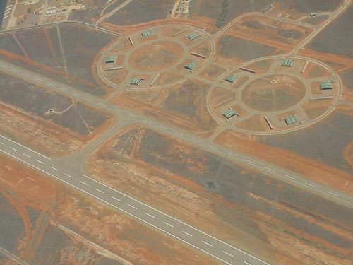 |
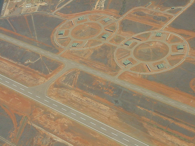
Photo credit: Transport (WA Govt)
(Click on the photo to enlarge) |
|
 |
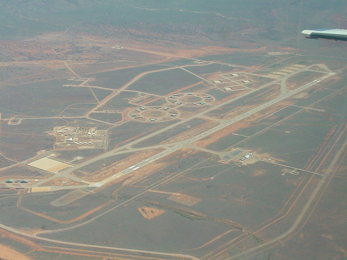
Photo credit: Transport (WA Govt)
(Click on the photo to enlarge) |
|
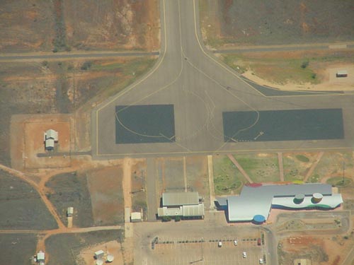 |
Photo credit: Transport (WA Govt)
(Click on the photo to enlarge) |
Images and information placed above are from
http://www.flightclub.com.au/wa-airstrips/learmonth/
We thank them for the data!
| General Info
|
| Country |
Australia
|
| ICAO ID |
YPLM
|
| Time |
UTC+8
|
| Latitude |
-22.235556
22° 14' 08.00" S
|
| Longitude |
114.088611
114° 05' 19.00" E
|
| Elevation |
19 feet
6 meters
|
| Type |
Joint (Civil and Military)
|
| Magnetic Variation |
000° E (01/06)
|
| Operating Agency |
MILITARY - CIVIL JOINT
USE AIRPORT
|
| International Clearance
Status |
Airport of Entry
|
| Communications
|
TWR
Opr by NOTAM.
|
257.8
118.3
|
| GND |
259.3
|
| MELBOURNE CNTR |
125.9
|
CTAF
(Outside twr hrs)
|
118.3
|
APP
Opr by NOTAM.
|
120.5
261.4
|
| Communications Remarks |
|
| FSS |
(on gnd)
|
| Runways
|
ID
|
Dimensions |
Surface |
PCN |
ILS
|
| 18/36 |
9997 x 148 feet
3047 x 45 meters |
ASPHALT |
043FAWT |
NO
|
| Navaids
|
| Type |
ID |
Name |
Channel |
Freq |
Distance From Field |
Bearing From Navaid
|
| VOR-DME |
LM |
LEARMONTH |
071X |
112.4 |
At Field |
-
|
| NDB |
LM |
LEARMONTH |
- |
396 |
At Field |
-
|
| Supplies/Equipment
|
| Fuel |
Jet A1, without icing nhibitor.
|
| Oil |
O-117, 1100, Reciprocating Engine Oil (MIL L 6082)
O-123, 1065,(Dispersant)Reciprocating Engine Oil(MIL L 22851 Type III)
O-128, 1100,(Dispersant)Reciprocating Engine Oil(MIL L 22851 Type II)
|
| Remarks
|
| CAUTION |
Animal haz. Acft to avoid lo level ovft of solar observatory 1.2 NM NE of fld. Unlgtd mast 433'AMSL 201 6.4 NM fr fld.
|
| CSTMS/AG/IMG |
PN rqr. Dep only.
|
| FUEL |
(NC-100LL, A1). Fone C089-949-1590.
|
| LGT |
Avbl 45 min PN, fone C089-949-1326, PAPI; Rwy 18-36 MEHT 50'.
|
| MISC |
Rwy 18-36 259' N end and 228' S end concrete.
|
| OIL |
O-117-123-128 (4 wk PN to Pearce)
|
| RSTD |
Imposed rwy wt limits: 747-621,000 lb, C5-701,000 lb. Mil opr rqr 24 hr PN fone C089-947-1326.
|
| TFC PAT |
No cir west of Rwy 18-36.
|
Runway 18/36
9997 x 148 feet
3047 x 45 meters
| Runway 18
|
| Surface |
ASPHALT
|
| True Heading |
184.0
|
| Latitude |
-22.219986
22° 13' 11.95" S
|
| Longitude |
114.091142
114° 05' 28.11" E
|
| Elevation |
13.0 feet
4 meters
|
| Slope |
0.1°
|
| Landing Distance |
9997 feet
3047 meters
|
| Takeoff Distance |
10997 feet
3352 meters
|
| Overrun Length |
1000 feet
305 meters
|
| Overrun Surface |
ASPHALT
|
| Lighting System |
HIRL
PAPI |
| Runway 36
|
| Surface |
ASPHALT
|
| True Heading |
004.0
|
| Latitude |
-22.247439
22° 14' 50.78" S
|
| Longitude |
114.089153
114° 05' 20.95" E
|
| Elevation |
19.0 feet
6 meters
|
| Slope |
-0.1°
|
| Landing Distance |
9997 feet
3047 meters
|
| Takeoff Distance |
10997 feet
3352 meters
|
| Overrun Length |
1000 feet
305 meters
|
| Overrun Surface |
ASPHALT
|
| Lighting System |
HIRL
PAPI |
Navaids
| LEARMONTH
|
| Type |
ID |
Channel |
Freq |
Country |
State
|
| VOR-DME |
LM |
071X |
112.4 |
Australia |
-
|
| Latitude |
Longitude |
Airport
|
-22.234722
22° 14' 05.00" S |
114.094167
114° 05' 39.00" E |
YPLM |
Navaids
| LEARMONTH
|
| Type |
ID |
Channel |
Freq |
Country |
State
|
| NDB |
LM |
- |
396 |
Australia |
-
|
| Latitude |
Longitude |
Airport
|
-22.241389
22° 14' 29.00" S |
114.095833
114° 05' 45.00" E |
YPLM |
The content above was published at Airports-Worldwide.com in 2004-2006.
We don't guarantee the information is fresh and accurate. The data may be wrong or outdated.
For more up-to-date information please refer to other sources.
|
 |