 |
 |
|
||||
|
Launceston lies on the River Tamar and its tributaries. The Tamar river flows another 55km north before its reaches the north coast of Tasmania. Tasmania is the only island state of Australia. The island is on the western side of the South Pacific. Located only one hour by air from Melbourne and less than three hours from Sydney.
Australia Pacific Airports Corporation (APAC), in conjunction with the Launceston City Council, acquired the lease for Launceston Airport in May 1998. The Airport is majority Australian owned and is managed locally for the benefit of the region. But now Launceston Airport has an added strength of the Launceston City Council and APACs shareholders (AMP, Henderson Global Investors Limited, Hastings Funds Management Limited, BAA plc. and DB Capital Partners) behind it. We are commited to the long-term safe and secure operation of the Airport. As an airport operator we have 3 main responsibilities. 1. We must maintain the quality, security and safety of Launceston Airport. 2. We have a duty to our stakeholders to ensure the business is successful and able to compete in the long term. 3. We must be a responsible member of the community to ensure the continued positive effects of the Airport. Specifically, we are responsible for the airfield, management of the car park and the car rental and cafeteria concessions, service infrastructure, the Airport's long term planning and development and aviation security compliance and environmental compliance. Air Traffic Control and Fire and Rescue Services are the responsibility of Air Services Australia.
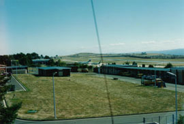
URL: www.launcestonairport.com.au Images and information placed above are from www.launcestonairport.com.au We thank them for the data!
Runway 14R/32L6499 x 148 feet
|
|||||||||||||||||||||||||||||||||||||||||||||||||||||||||||||||||||||||||||||||||||||||||||||||||||||||||||||||||||||||||||||||||||||||||||||||||||||||||||||||||||||||||||||||||||||||||||||||||||||||||||||||||||||||||||||||||||||||||||||||||||||||||||||||||||||||||||||||||||||||||||||||||||||||||||||||||||||||||||||||||||||||||||||||
| Runway 14R | |
|---|---|
| Surface | ASPHALT |
| True Heading | 147.0 |
| Latitude | -41.537072 41° 32' 13.46" S |
| Longitude | 147.204119 147° 12' 14.83" E |
| Elevation | 560.0 feet 171 meters |
| Slope | -0.2° |
| Landing Distance | 6499 feet 1981 meters |
| Takeoff Distance | 6694 feet 2040 meters |
| Overrun Length | 195 feet 59 meters |
| Overrun Surface | ASPHALT |
| Lighting System | PCL
LIRL VA |
| Runway 32L | |
|---|---|
| Surface | ASPHALT |
| True Heading | 327.0 |
| Latitude | -41.552072 41° 33' 07.46" S |
| Longitude | 147.216950 147° 13' 01.02" E |
| Elevation | 548.0 feet 167 meters |
| Slope | 0.2° |
| Landing Distance | 6499 feet 1981 meters |
| Takeoff Distance | 6694 feet 2040 meters |
| Overrun Length | 195 feet 59 meters |
| Overrun Surface | ASPHALT |
| Lighting System | PCL
HIRL J VA |
| Runway 14L | |
|---|---|
| Surface | GRASS OR EARTH NOT GRADED OR ROLLED. |
| True Heading | 148.0 |
| Latitude | -41.541203 41° 32' 28.33" S |
| Longitude | 147.214350 147° 12' 51.66" E |
| Elevation | 535.0 feet 163 meters |
| Slope | 0.4° |
| Landing Distance | 2297 feet 700 meters |
| Takeoff Distance | 2297 feet 700 meters |
| Runway 32R | |
|---|---|
| Surface | GRASS OR EARTH NOT GRADED OR ROLLED. |
| True Heading | 328.0 |
| Latitude | -41.546561 41° 32' 47.62" S |
| Longitude | 147.218769 147° 13' 07.57" E |
| Elevation | 545.0 feet 166 meters |
| Slope | -0.4° |
| Landing Distance | 2297 feet 700 meters |
| Takeoff Distance | 2297 feet 700 meters |
| Runway 18 | |
|---|---|
| Surface | GRASS OR EARTH NOT GRADED OR ROLLED. |
| True Heading | 196.0 |
| Latitude | -41.539339 41° 32' 21.62" S |
| Longitude | 147.217717 147° 13' 03.78" E |
| Landing Distance | 2264 feet 690 meters |
| Takeoff Distance | 2264 feet 690 meters |
| Runway 36 | |
|---|---|
| Surface | GRASS OR EARTH NOT GRADED OR ROLLED. |
| True Heading | 016.0 |
| Latitude | -41.545306 41° 32' 43.10" S |
| Longitude | 147.215406 147° 12' 55.46" E |
| Landing Distance | 2264 feet 690 meters |
| Takeoff Distance | 2264 feet 690 meters |
| LAUNCESTON | |||||
|---|---|---|---|---|---|
| Type | ID | Channel | Freq | Country | State |
| NDB | LT | - | 242 | Australia | - |
| Latitude | Longitude | Airport |
| -41.561111 41° 33' 40.00" S |
147.225000 147° 13' 30.00" E |
YMLT |
| LAUNCESTON | |||||
|---|---|---|---|---|---|
| Type | ID | Channel | Freq | Country | State |
| VOR-DME | LT | 073X | 112.6 | Australia | - |
| Latitude | Longitude | Airport |
| -41.543889 41° 32' 38.00" S |
147.213056 147° 12' 47.00" E |
YMLT |
| NILE | |||||
|---|---|---|---|---|---|
| Type | ID | Channel | Freq | Country | State |
| NDB | NIE | - | 230 | Australia | - |
| Latitude | Longitude | Airport |
| -41.652778 41° 39' 10.00" S |
147.303333 147° 18' 12.00" E |
YMLT |
The content above was published at Airports-Worldwide.com in 2004-2006.
We don't guarantee the information is fresh and accurate. The data may be wrong or outdated.
For more up-to-date information please refer to other sources.

 |
|
Copyright 2004-2026 © by Airports-Worldwide.com, Vyshenskoho st. 36, Lviv 79010, Ukraine Legal Disclaimer |
 Operator: Australia Pacific Airports (Launceston) Pty Ltd

