|
|
 Operator: Shire of Wyndham East Kimberley
Address:
P.O. Box 614
Kunnunarra WA 6743
Australia
Phone: +61 8 91682648
Fax: +61 8 91681904
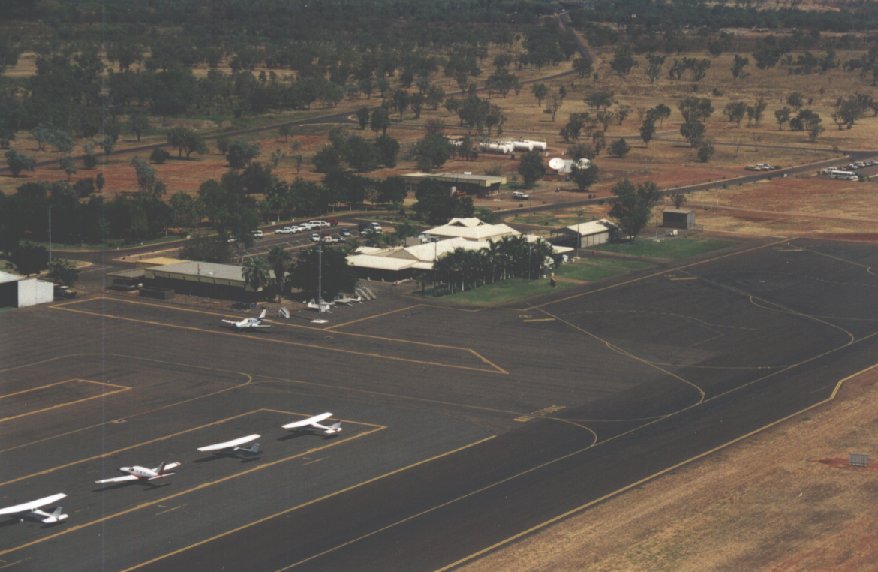
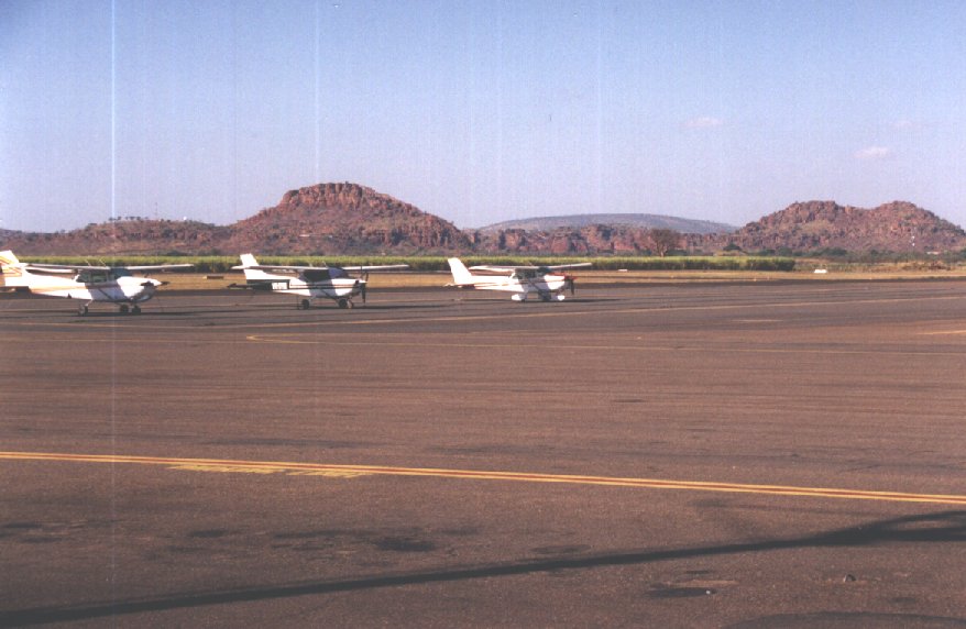
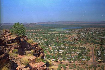
Kununurra is the main population centre of the East Kimberley region and
is the gateway to some of the most remote and spectacular landscapes on
the planet.
Images and information placed above are from
www.airportsaustralia.com
http://www.flightclub.com.au/wa-airstrips/kununurra/
We thank them for the data!
| General Info
|
| Country |
Australia
|
| ICAO ID |
YPKU
|
| Time |
UTC+8
|
| Latitude |
-15.778056
15° 46' 41.00" S
|
| Longitude |
128.707500
128° 42' 27.00" E
|
| Elevation |
145 feet
44 meters
|
| Magnetic Variation |
003° E (01/04)
|
| Operating Agency |
CIVIL GOVERNMENT, (LANDING FEES AND DIPLOMATIC CLEARANCE MAY BE REQUIRED)
|
| Communications
|
| MTAF |
127.0
|
| BRISBANE CNTR |
122.4
|
| Communications Remarks |
|
| MISC |
Nstd wi CTLZ to 5000' and associated with East Kimberley CTAF 127.3
|
| FSS |
(on grd)
|
| Runways
|
| ID |
Dimensions |
Surface |
PCN |
ILS
|
| 12/30 |
6001 x 98 feet
1829 x 30 meters |
ASPHALT |
040FCXT |
NO
|
| Navaids
|
| Type |
ID |
Name |
Channel |
Freq |
Distance From Field |
Bearing From Navaid
|
| VOR-DME |
KU |
KUNUNURRA |
112X |
116.5 |
At Field |
-
|
| NDB |
KU |
KUNUNURRA |
- |
221 |
At Field |
-
|
| Supplies/Equipment
|
| Fuel |
Jet A1, without icing nhibitor.
100/130 MIL Spec, low lead, aviation gasoline (BLUE)
|
| Oil |
O-117, 1100, Reciprocating Engine Oil (MIL L 6082)
O-123, 1065,(Dispersant)Reciprocating Engine Oil(MIL L 22851 Type III)
O-156, MIL L 23699 (Synthetic Base)Turboprop/Turboshaft Engine
|
| Remarks
|
| CAUTION |
Bird haz.
|
| FUEL |
Avbl 2200-1000Z Mon- Fri, OT HO, fone C08-9168-1810. (NC-100LL, A1)
|
| LGT |
ACTIVATE-Rwy 12-30-125.3. AT-VASI Rwy 12 MEHT 39'; Rwy 30 MEHT 41'.
|
| MISC |
Ldg fees.
|
| OIL |
0-117-123-156
|
| RSTD |
Acft abv 22,000 lb use rwy ends for 180 turns. Acft blw 22,000 lb max rad turnsonly. PN to prk acft abv 12,500 lb.
|
| TFC PAT |
Rgt hand circuits Rwy 30.
|
Runway 12/30
6001 x 98 feet
1829 x 30 meters
| Runway 12
|
| Surface |
ASPHALT
|
| True Heading |
120.0
|
| Latitude |
-15.773844
15° 46' 25.84" S
|
| Longitude |
128.701686
128° 42' 06.07" E
|
| Elevation |
141.0 feet
43 meters
|
| Slope |
0.0°
|
| Landing Distance |
6001 feet
1829 meters
|
| Takeoff Distance |
6001 feet
1829 meters
|
| Lighting System |
PCL
MIRL
VA |
| Runway 30
|
| Surface |
ASPHALT
|
| True Heading |
300.0
|
| Latitude |
-15.782028
15° 46' 55.30" S
|
| Longitude |
128.716517
128° 42' 59.46" E
|
| Elevation |
144.0 feet
44 meters
|
| Slope |
0.0°
|
| Landing Distance |
6001 feet
1829 meters
|
| Takeoff Distance |
6001 feet
1829 meters
|
| Lighting System |
PCL
MIRL
VA |
Navaids
| KUNUNURRA
|
| Type |
ID |
Channel |
Freq |
Country |
State
|
| NDB |
KU |
- |
221 |
Australia |
-
|
| Latitude |
Longitude |
Airport
|
-15.783889
15° 47' 02.00" S |
128.703889
128° 42' 14.00" E |
YPKU
|
| KUNUNURRA
|
| Type |
ID |
Channel |
Freq |
Country |
State
|
| VOR-DME |
KU |
112X |
116.5 |
Australia |
-
|
| Latitude |
Longitude |
Airport
|
-15.775556
15° 46' 32.00" S |
128.708889
128° 42' 32.00" E |
YPKU
|
The content above was published at Airports-Worldwide.com in 2004-2006.
We don't guarantee the information is fresh and accurate. The data may be wrong or outdated.
For more up-to-date information please refer to other sources.
|
 |