Airport Code : HTU
Longitude : 142° 21’ 0” E
City : Hopetoun
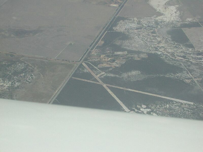
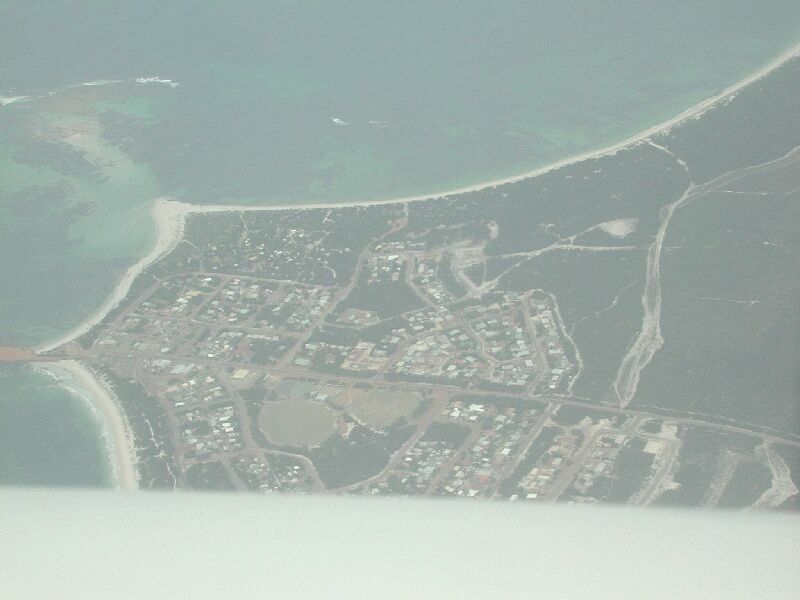
Photo credit: Dawie Botes(Click on the photo to enlarge)
Photo credit: Dawie Botes (Click on the photo to enlarge)
Images and
information placed above are from http://www.flightclub.com.au/wa-airstrips/hopetoun/
General Info
Country Australia
ICAO ID YHPN
Time UTC+10(+11DT)
Latitude -35.715278
Longitude 142.359722
Elevation 256 feet
Magnetic Variation 010° E (01/06)
Operating Agency CIVIL GOVERNMENT, (LANDING
FEES AND DIPLOMATIC CLEARANCE MAY BE REQUIRED)
Communications
MELBOURNE CNTR
125.8
CTAF
126.7
Communications Remarks
FSS
(circuit area)
Runways
ID
Dimensions
Surface
PCN
ILS
01/19
3730 x 60 feet
ASPHALT
010FBYU
NO
08/26
1598 x 98 feet
GRASS OR EARTH NOT GRADED OR ROLLED.
-
NO
Remarks
LGT
ACTIVATE-Rwy 01-19-123.9. Portable lgt PN, emerg only.
Runway 01/19
Runway 01
Surface
ASPHALT
True Heading
021.0
Latitude
-35.719875
Longitude
142.358322
Landing Distance
3642 feet
Takeoff Distance
3730 feet
Displaced Threshold Length
88 feet
Lighting System
PCL
Runway 19
Surface
ASPHALT
True Heading
201.0
Latitude
-35.710486
Longitude
142.362553
Landing Distance
3730 feet
Takeoff Distance
3730 feet
Lighting System
PCL
1598 x 98 feet
Runway 08
Surface
GRASS OR EARTH NOT GRADED OR ROLLED.
True Heading
091.0
Latitude
-35.713981
Longitude
142.357606
Landing Distance
1598 feet
Takeoff Distance
1598 feet
Lighting System
PORTABLE
Runway 26
Surface
GRASS OR EARTH NOT GRADED OR ROLLED.
True Heading
271.0
Latitude
-35.713967
Longitude
142.362981
Landing Distance
1598 feet
Takeoff Distance
1598 feet
Lighting System
PORTABLE
The content above was published at Airports-Worldwide.com in 2004-2006.