|
|
|
|
|
|
Operator: Greenough Shire Council
Address:
PO Box 6530
Geraldton WA 6530
Australia
Phone: +61 8 99233207
In a near-perfect year-round climate Geraldton, the heart of the Batavia
Coast in the Mid West Region of Western Australia, offers all of the cultural,
entertainment and shopping facilities of a major regional city, and boasts
a range of sporting facilities second to none. The Airport is located
11km from the town centre.
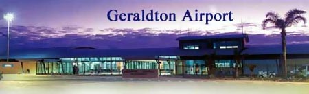
Modern spacious design, attention to passenger comforts and the latest
in security, that�s what you get at the new Greenough Terminal at the
Geraldton Airport.
With its aeronautical streamline curves and outlook over the Moresby Ranges,
the steel and rammed earth terminal makes an impressive entry statement
to the 60,000 passengers utilising it each year.
 The project was a triumph for the Shire of Greenough and a showcase for
the talent of local businesses including architects, Eastman & Poletti,
construction company Crothers Construction and a host of local trade contractors.
The project was a triumph for the Shire of Greenough and a showcase for
the talent of local businesses including architects, Eastman & Poletti,
construction company Crothers Construction and a host of local trade contractors.
The Greenough terminal is designed for passenger comfort featuring conference
facilities, outdoor and indoor seating, a licensed cafe and a luggage
conveyor belt for baggage collection.
A large salt water aquarium is another feature to capture the attention
of visitors. Created to mimic life on the reefs of the Abrolhos Islands,
the aquarium includes live coral, local crayfish and a variety of commercial
fish caught in the region.
Ample parking is provided at the new terminal, with security of vehicles
and passenger given top priority. A digitally recorded, 24-hour surveillance
system monitors all aspects of the car park and terminal.
AIRPORT MANAGER: Mr Bob Urquhart
PO Box 21 GERALDTON WA 6530
TEL. (08) 9923 3207
Mobile 0417 187 023
Fax: (08) 9923 3208
URL: Geraldton
Airport
|
 |
|
|
 |
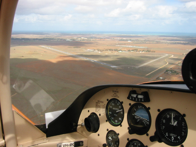
Photo credit: Karratha Aero Club
Here VH-POC flies into the Geraldton Seafood Spectacular Fly-in
in 2003
(Click on the photo to enlarge) |
Images and information placed above are from
Geraldton
Airport
http://www.flightclub.com.au/wa-airstrips/geraldton/
We thank them for the data!
| General Info
|
| Country |
Australia
|
| ICAO ID |
YGEL
|
| Time |
UTC+8
|
| Latitude |
-28.796111
28° 47' 46.00" S
|
| Longitude |
114.707500
114° 42' 27.00" E
|
| Elevation |
121 feet
37 meters
|
| Magnetic Variation |
001° W (01/04)
|
| Operating Agency |
CIVIL GOVERNMENT, (LANDING FEES AND DIPLOMATIC CLEARANCE MAY BE REQUIRED)
|
| Communications
|
| MTAF UNICOM |
126.7
|
| MELBOURNE CNTR |
121.2
|
| Communications Remarks |
|
| FSS |
(on gnd)
|
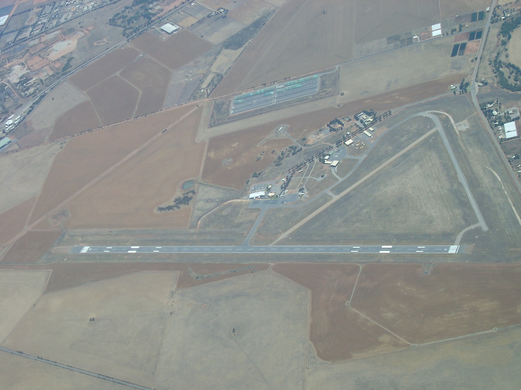
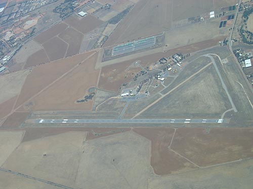
| Runways
|
| ID |
Dimensions |
Surface |
PCN |
ILS
|
| 03/21 |
6499 x 148 feet
1981 x 45 meters |
ASPHALT |
034FBWT |
NO
|
| 08/26 |
2953 x 59 feet
900 x 18 meters |
GRAVEL. |
- |
NO
|
| 14/32 |
2769 x 59 feet
844 x 18 meters |
GRAVEL. |
- |
NO
|
| Navaids
|
| Type |
ID |
Name |
Channel |
Freq |
Distance From Field |
Bearing From Navaid
|
| VOR-DME |
GEL |
GERALDTON |
086X |
113.9 |
At Field |
-
|
| NDB |
GEL |
GERALDTON |
- |
359 |
At Field |
-
|
| Supplies/Equipment
|
| Fuel |
Jet A1, without icing nhibitor.
100/130 MIL Spec, low lead, aviation gasoline (BLUE)
|
| Oil |
O-117, 1100, Reciprocating Engine Oil (MIL L 6082)
|
| Remarks
|
| CAUTION |
Bird haz.
|
| FUEL |
Avbl 2330-0830Z Mon-Fri; OT 1 hr PN fone C08 9923 3624. (NC-100LL, A1)
|
| LGT |
ACTIVATE-Rwy 03-21 rwy lgt only - 121.3.
|
| MISC |
Ldg fee. Arpt opr fone C08 9923 3207.
|
| RSTD |
All acft to bcst intentions when entering tfc pat.
|
Runway 03/21
6499 x 148 feet
1981 x 45 meters
| Runway 03
|
| Surface |
ASPHALT
|
| True Heading |
018.0
|
| Latitude |
-28.804489
28° 48' 16.16" S
|
| Longitude |
114.703386
114° 42' 12.19" E
|
| Elevation |
98.0 feet
30 meters
|
| Slope |
0.3°
|
| Landing Distance |
6499 feet
1981 meters
|
| Takeoff Distance |
6499 feet
1981 meters
|
| Lighting System |
PCL
LIRL
PAPI |
| Runway 21
|
| Surface |
ASPHALT
|
| True Heading |
198.0
|
| Latitude |
-28.787525
28° 47' 15.09" S
|
| Longitude |
114.709789
114° 42' 35.24" E
|
| Elevation |
120.0 feet
37 meters
|
| Slope |
-0.3°
|
| Landing Distance |
6499 feet
1981 meters
|
| Takeoff Distance |
6499 feet
1981 meters
|
| Lighting System |
PCL
LIRL
PAPI |
Runway 08/26
2953 x 59 feet
900 x 18 meters
| Runway 08
|
| Surface |
GRAVEL.
|
| True Heading |
080.0
|
| Latitude |
-28.787956
28° 47' 16.64" S
|
| Longitude |
114.699531
114° 41' 58.31" E
|
| Elevation |
113.0 feet
34 meters
|
| Slope |
0.3°
|
| Landing Distance |
2953 feet
900 meters
|
| Takeoff Distance |
2953 feet
900 meters
|
| Runway 26
|
| Surface |
GRAVEL.
|
| True Heading |
260.0
|
| Latitude |
-28.786481
28° 47' 11.33" S
|
| Longitude |
114.708594
114° 42' 30.94" E
|
| Elevation |
121.0 feet
37 meters
|
| Slope |
-0.3°
|
| Landing Distance |
2953 feet
900 meters
|
| Takeoff Distance |
2953 feet
900 meters
|
Runway 14/32
2769 x 59 feet
844 x 18 meters
| Runway 14
|
| Surface |
GRAVEL.
|
| True Heading |
143.0
|
| Latitude |
-28.788072
28° 47' 17.06" S
|
| Longitude |
114.700461
114° 42' 01.66" E
|
| Elevation |
112.0 feet
34 meters
|
| Slope |
-0.1°
|
| Landing Distance |
2769 feet
844 meters
|
| Takeoff Distance |
2769 feet
844 meters
|
| Runway 32
|
| Surface |
GRAVEL.
|
| True Heading |
323.0
|
| Latitude |
-28.794133
28° 47' 38.88" S
|
| Longitude |
114.705708
114° 42' 20.55" E
|
| Elevation |
110.0 feet
34 meters
|
| Slope |
0.1°
|
| Landing Distance |
2769 feet
844 meters
|
| Takeoff Distance |
2769 feet
844 meters
|
Navaids
| GERALDTON
|
| Type |
ID |
Channel |
Freq |
Country |
State
|
| VOR-DME |
YGQ |
089X |
114.2 |
Canada |
-
|
| Latitude |
Longitude |
Airport
|
49.769772
49° 46' 11.18" N |
-86.984456
086° 59' 04.04" W |
CYGQ
|
| GERALDTON
|
| Type |
ID |
Channel |
Freq |
Country |
State
|
| NDB |
GEL |
- |
359 |
Australia |
-
|
| Latitude |
Longitude |
Airport
|
-28.798333
28° 47' 54.00" S |
114.701667
114° 42' 06.00" E |
YGEL
|
| GERALDTON
|
| Type |
ID |
Channel |
Freq |
Country |
State
|
| VOR-DME |
GEL |
086X |
113.9 |
Australia |
-
|
| Latitude |
Longitude |
Airport
|
-28.790278
28° 47' 25.00" S |
114.706111
114° 42' 22.00" E |
YGEL
|
| GERALDTON
|
| Type |
ID |
Channel |
Freq |
Country |
State
|
| NDB |
C7 |
- |
362 |
Canada |
-
|
| Latitude |
Longitude |
Airport
|
49.772272
49° 46' 20.18" N |
-86.971397
086° 58' 17.03" W |
CYGQ
|
The content above was published at Airports-Worldwide.com in 2004-2006.
We don't guarantee the information is fresh and accurate. The data may be wrong or outdated.
For more up-to-date information please refer to other sources.
|
 |