 |
 |
|
||||
|
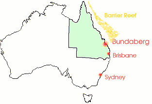
Visitors to Bundaberg arriving by air are greeted by the Air Terminal's clean and modern lines. More than 50 000 people pass through the terminal annually. Services to and from major centres and the Coral Isles leave daily as well as very popular local scenic flights. The Bundaberg City Council has rentable land available for the construction of hangers. If you have any aviation industry related inquiries please direct them to the Corporate Services Department of the Bundaberg City Council. The Bundaberg Airport will be home again to the biggest airshow in Queensland as it returns to our skies from 16th-17th July, 2005. The air show will include displays by formation aerobatic teams, military helicopters and jets, individual warbirds and much much more. Bundaberg is serviced several times daily by regular Airline transport from Brisbane Airport, with the flight time approximately one hour. Lady Elliot Island pictured, is the only coral island on the great barrier reef with an airstrip. It's just a 25 minutes scenic flight from Bundaberg. Fly there or stay longer at the resort for a totally relaxing holiday. Historical Note Officially opened by the Minister for Customers, Hon. F.M. Forde, M.H.R. On Saturday, December 12th 1931. Late 1940 it was decided to develop the Bundaberg Aerodrome as a RAAF Flying Training School. The Airport was used as a base for pilot training and for active missions against Japanese forces from 1941 to 1946 and catered for more than 1,000 service personnel. Department of Civil Aviation assumed full responsibility for Bundaberg Aerodrome on 31st July 1946. June 1967 the Dpt. Civil Aviation was raising the question of "Local Ownership". January 1974 Bundaberg City Council was still in strong opposition to "Local Ownership" of the Aerodrome. July 1977 the grass runway was shortened by 448 metres and the main bitumen runway was narrowed from 150 to 100 feet. June 1983 saw the Bundaberg City Council Unanimously adopt a resolution to take over ownership of the Bundaberg Aerodrome. (9th May 1986 the Hon. Peter Morris, MHR, Federal Minister of Aviation, officially opened the new terminal. Images and information placed above are from Bundaberg Airport We thank them for the data!
Runway 07/253701 x 98 feet
|
|||||||||||||||||||||||||||||||||||||||||||||||||||||||||||||||||||||||||||||||||||||||||||||||||||||||||||||||||||||||||||||||||||||||||||||||||||||||||||||||||||||||||||||||||||||||||||||||||||||||||||||||||||||||||||||||||||||||||
| Runway 07 | |
|---|---|
| Surface | CLAY |
| True Heading | 069.0 |
| Latitude | -24.906356 24° 54' 22.88" S |
| Longitude | 152.313794 152° 18' 49.66" E |
| Elevation | 107.0 feet 33 meters |
| Slope | -0.2° |
| Landing Distance | 3701 feet 1128 meters |
| Takeoff Distance | 3701 feet 1128 meters |
| Runway 25 | |
|---|---|
| Surface | CLAY |
| True Heading | 249.0 |
| Latitude | -24.902678 24° 54' 09.64" S |
| Longitude | 152.324208 152° 19' 27.15" E |
| Elevation | 101.0 feet 31 meters |
| Slope | 0.2° |
| Landing Distance | 3701 feet 1128 meters |
| Takeoff Distance | 3701 feet 1128 meters |
| Runway 14 | |
|---|---|
| Surface | ASPHALT |
| True Heading | 148.0 |
| Latitude | -24.896544 24° 53' 47.56" S |
| Longitude | 152.316731 152° 19' 00.23" E |
| Elevation | 101.0 feet 31 meters |
| Slope | 0.0° |
| Landing Distance | 4701 feet 1433 meters |
| Takeoff Distance | 5230 feet 1594 meters |
| Displaced Threshold Length | 329 feet 100 meters |
| Overrun Length | 200 feet 61 meters |
| Overrun Surface | GRADED OR ROLLED EARTH, GRASS ON GRADED EARTH. |
| Lighting System | PCL
LIRL VA |
| Runway 32 | |
|---|---|
| Surface | ASPHALT |
| True Heading | 328.0 |
| Latitude | -24.908222 24° 54' 29.60" S |
| Longitude | 152.324817 152° 19' 29.34" E |
| Elevation | 101.0 feet 31 meters |
| Slope | 0.0° |
| Landing Distance | 5030 feet 1533 meters |
| Takeoff Distance | 5230 feet 1594 meters |
| Overrun Length | 200 feet 61 meters |
| Overrun Surface | GRADED OR ROLLED EARTH, GRASS ON GRADED EARTH. |
| Lighting System | PCL
LIRL VA |
| BUNDABERG | |||||
|---|---|---|---|---|---|
| Type | ID | Channel | Freq | Country | State |
| NDB | BUD | - | 266 | Australia | - |
| Latitude | Longitude | Airport |
| -24.896667 24° 53' 48.00" S |
152.320556 152° 19' 14.00" E |
YBUD |
The content above was published at Airports-Worldwide.com in 2004-2006.
We don't guarantee the information is fresh and accurate. The data may be wrong or outdated.
For more up-to-date information please refer to other sources.

 |
|
Copyright 2004-2026 © by Airports-Worldwide.com, Vyshenskoho st. 36, Lviv 79010, Ukraine Legal Disclaimer |

 Operator: Bundaberg City Council