|
 Bathurst
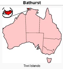
Island Airport (IATA: BTI, ICAO: YBTI) is located at Nguiu, on
the south east coast of Bathurst Island, Australia. Bathurst
Island Airport (IATA: BTI, ICAO: YBTI) is located at Nguiu, on
the south east coast of Bathurst Island, Australia.
The Royal Australian Air Force utilised the airfield during World War II.
Airport type - Public
Operator - Government
Serves - Bathurst Island, Australia
Location - Nguiu, Northern Territory
Elevation AMSL - 67 ft / 20 m
Coordinates 11°46′09″S 130°37′11″E
Runways
Direction - 15/33
Length - 1,470 m, 4,823 ft
Surface - Asphalt
Images and information placed above are from
http://en.wikipedia.org/wiki/Bathurst_Island_Airport
We thank them for the data!
| General Info
|
| Country |
Australia
|
| ICAO ID |
YBTI
|
| Time |
UTC+9:30
|
| Latitude |
-11.769167
11° 46' 09.00" S
|
| Longitude |
130.619722
130° 37' 11.00" E
|
| Elevation |
67 feet
20 meters
|
| Magnetic Variation |
003° E (05/06)
|
| Operating Agency |
CIVIL GOVERNMENT, (LANDING FEES AND DIPLOMATIC CLEARANCE MAY BE REQUIRED)
|
| Communications
|
| BRISBANE CNTR |
118.15
|
| CTAF |
126.7
|
| Communications Remarks |
|
| FSS |
(circuit area)
|
| Runways
|
| ID |
Dimensions |
Surface |
PCN |
ILS
|
| 15/33 |
4823 x 98 feet
1470 x 30 meters |
ASPHALT |
008FAYU |
NO
|
| Remarks
|
| CAUTION |
Animal haz at dawn and dusk.
|
| LGT |
ACTIVATE-Rwy 15-33-121.3. Portable lgt emerg only
|
| MISC |
Ldg fees.
|
The content above was published at Airports-Worldwide.com in 2004-2006.
We don't guarantee the information is fresh and accurate. The data may be wrong or outdated.
For more up-to-date information please refer to other sources.
|


