|
|
Albany Airport (IATA: ALH, ICAO: YABA) is an airport
located in Albany, Western Australia. The IATA airport code is sometimes
listed as ABA and the ICAO airport code was previously YPAL.
Also known as Harry Riggs Albany Regional airport, Albany
Airport is the largest airport in the Great Southern Region.
The airport services 18 Skywest flights per week transporting over 50,000
passengers per year. The Royal Flying Doctors Service, General Charter
Flights and RAAF flights are also serviced by the airport.
The airport is equipped with an instrument landing system that enables
all-weather capability for passenger transport. The sealed 1,800 m (5,906
ft) sealed runway is capable of allowing a Boeing 737 craft to land.
|
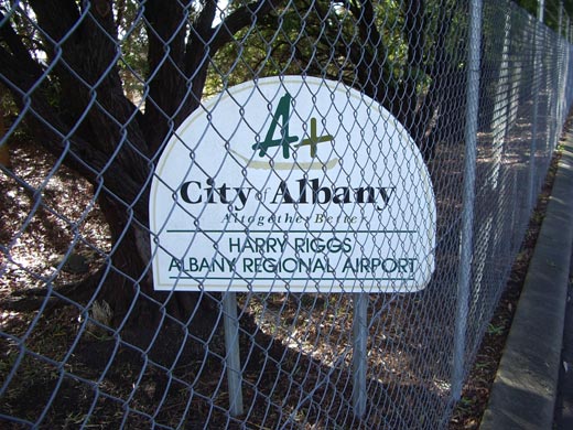 |
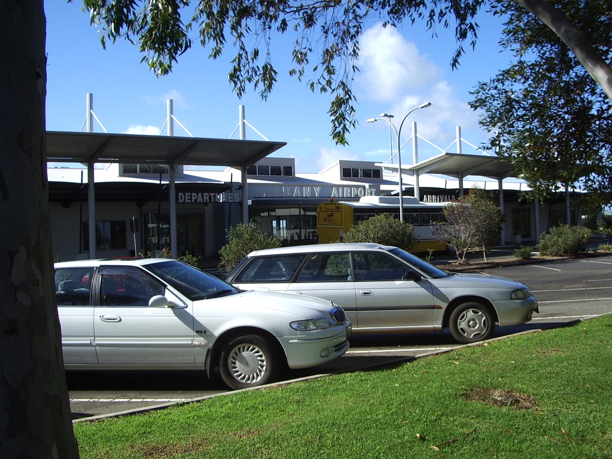
Albany Airport Sign
(Click on the photo to enlarge) |
|
 |
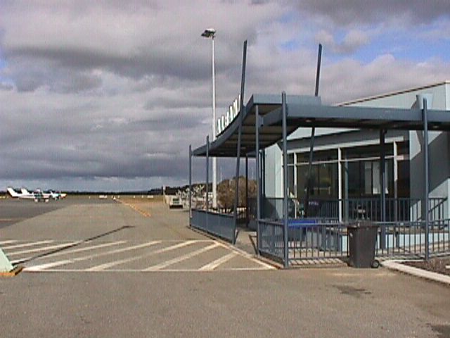
Albany Airport Entrance
(Click on the photo to enlarge) |
| Airlines |
Destinations |
| Skywest Airlines |
Perth |
 Albany is a thriving regional centre in rural Western
Australia. With cool summers and warm winters, it's a popular place to
visit all year round. Famous for a rich history, magnificent scenery and
a wealth of attractions and activities. The airport is located 11km from
the city centre.
Albany is a thriving regional centre in rural Western
Australia. With cool summers and warm winters, it's a popular place to
visit all year round. Famous for a rich history, magnificent scenery and
a wealth of attractions and activities. The airport is located 11km from
the city centre.
Airport Services
The Albany Airport terminal is a modern building with windows to view
the aircraft. The comfortable waiting area has plentiful seating & has
facilities including public telephones, television & disabled toilets.
Cafeteria serving hot & cold drinks & snacks opening half an hour before
departure of RPT services & on arrangement for functions.
Other facilities include:
Personalised check-in for Skywest Airlines
Hire car outlets & taxis
Conference Room comfortably seating 15 people, with TV, video, telephone,
overhead projector & tea & coffee facilities. For bookings & hire fees
please phone the Airport Manager on 0418 945489.
And a display of local art.
 The two main taxiways are used to allow transport of aircraft from runways
to the apron & parking areas. Taxiway Alpha connects the main RPT apron
to runway 14/32. It is 15m wide & sealed with taxiway lighting. Taxiway
Bravo connects the main RPT apron to runway 05/32. This taxiway is sealed
& 15m wide. The RPT apron is located directly adjacent to the terminal
& has the capacity to hold two RPT jets.
The two main taxiways are used to allow transport of aircraft from runways
to the apron & parking areas. Taxiway Alpha connects the main RPT apron
to runway 14/32. It is 15m wide & sealed with taxiway lighting. Taxiway
Bravo connects the main RPT apron to runway 05/32. This taxiway is sealed
& 15m wide. The RPT apron is located directly adjacent to the terminal
& has the capacity to hold two RPT jets.
Adjacent to the RPT apron area is a general aviation apron for itinerant
parking including hardstand area & grassed area for tying down small aircraft.
Both bays are services by hydrant fuel facilities, the major refueller
is BP Australia, staffed during business hours with 24 hr call out service
(20min) 50,000 litre storage capacity for Avgas/Jet A1 (dispensed by bowzer).
Operator: City of Albany
Address:
PO Box 484
Albany WA 6330
Australia
Phone: +61 8 6820 3777
Fax: Nil
E-mail: staff@albany.wa.gov.au
URL: www.albany.wa.gov.au
|
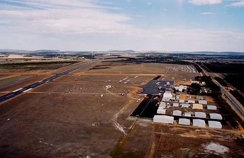 |
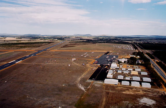
Photo credit: Rainbow Aerial
Photography - Albany 9845 1174
(Click on the photo to enlarge) |
|
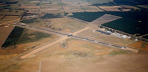 |
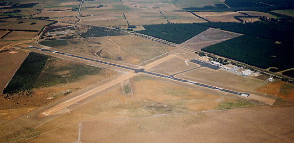
Photo credit: Rainbow Aerial
Photography - Albany 9845 1174
(Click on the photo to enlarge) |
|
 |
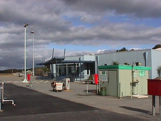
Photo credit: Transport (WA Govt)
(Click on the photo to enlarge) |
|
 |
Photo credit: Transport (WA Govt)
(Click on the photo to enlarge) |
Images and information placed above are from
http://airport.albany.wa gov
au/
http://www.flightclub
com au/wa-airstrips/albany/
http://en.wikipedia.org/wiki/Albany_Airport_%28Australia%29
We thank them for the data!
| General Info
|
| Country |
Australia
|
| ICAO ID |
YABA
|
| Time |
UTC+8
|
| Latitude |
-34.943333
34° 56' 36.00" S
|
| Longitude |
117.808889
117° 48' 32.00" E
|
| Elevation |
233 feet
71 meters
|
| Magnetic Variation |
002° W (01/04)
|
| Operating Agency |
CIVIL GOVERNMENT, (LANDING FEES AND DIPLOMATIC CLEARANCE MAY BE REQUIRED)
|
| Communications
|
| MTAF UNICOM |
126.7
|
| MELBOURNE CNTR |
123.9
|
| Communications Remarks |
|
| FSS |
(on gnd)
|
| Runways
|
| ID |
Dimensions |
Surface |
PCN |
ILS
|
| 05/23 |
3596 x 98 feet
1096 x 30 meters |
GRAVEL. |
012FCZU |
NO
|
| 14/32 |
5906 x 98 feet
1800 x 30 meters |
ASPHALT |
021FAYT |
NO
|
| Navaids
|
| Type |
ID |
Name |
Channel |
Freq |
Distance From Field |
Bearing From Navaid
|
| NDB-DME |
ABA |
ALBANY |
034X |
240 |
At Field |
-
|
| Supplies/Equipment
|
| Fuel |
Jet A1, without icing nhibitor.
100/130 MIL Spec, low lead, aviation gasoline (BLUE)
|
| Oil |
O-117, 1100, Reciprocating Engine Oil (MIL L 6082)
|
| JASU |
-
|
| Remarks
|
| CAUTION |
Animal haz.
|
| FUEL |
Avbl 30 min PN. Fone C08 9841 7372. (NC-100LL, A1)
|
| JASU |
1(E1)
|
| LGT |
ACTIVATE - Rwy 14-32 and PAPI - 119.6. Portable lgt emerg only.
|
| MISC |
Ldg fees.
|
| OIL |
O-117
|
| RSTD |
Acft abv 12,500 lb must turn on rwy ends; wide turns only.
|
Runway 05/23 3596 x 98 feet
1096 x 30 meters
| Runway 05
|
| Surface |
GRAVEL.
|
| True Heading |
045.0
|
| Latitude |
-34.947128
34° 56' 49.66" S
|
| Longitude |
117.805811
117° 48' 20.92" E
|
| Elevation |
223.0 feet
68 meters
|
| Slope |
0.3°
|
| Landing Distance |
3596 feet
1096 meters
|
| Takeoff Distance |
3596 feet
1096 meters
|
| Lighting System |
PORTABLE
|
| Runway 23
|
| Surface |
GRAVEL.
|
| True Heading |
225.0
|
| Latitude |
-34.940122
34° 56' 24.44" S
|
| Longitude |
117.814278
117° 48' 51.40" E
|
| Elevation |
232.0 feet
71 meters
|
| Slope |
-0.3°
|
| Landing Distance |
3596 feet
1096 meters
|
| Takeoff Distance |
3596 feet
1096 meters
|
| Lighting System |
PORTABLE
|
Runway 14/32
5906 x 98 feet
1800 x 30 meters
| Runway 14
|
| Surface |
ASPHALT
|
| True Heading |
134.0
|
| Latitude |
-34.940272
34° 56' 24.98" S
|
| Longitude |
117.803658
117° 48' 13.17" E
|
| Elevation |
226.0 feet
69 meters
|
| Slope |
-0.2°
|
| Landing Distance |
5906 feet
1800 meters
|
| Takeoff Distance |
5906 feet
1800 meters
|
| Lighting System |
PCL
LIRL
PAPI
PORTABLE |
| Runway 32
|
| Surface |
ASPHALT
|
| True Heading |
314.0
|
| Latitude |
-34.951625
34° 57' 05.85" S
|
| Longitude |
117.817728
117° 49' 03.82" E
|
| Elevation |
217.0 feet
66 meters
|
| Slope |
0.2°
|
| Landing Distance |
5906 feet
1800 meters
|
| Takeoff Distance |
5906 feet
1800 meters
|
| Lighting System |
PCL
LIRL
PAPI
PORTABLE |
Navaids
| ALBANY
|
| Type |
ID |
Channel |
Freq |
Country |
State
|
| VORTAC |
ALB |
100X |
115.3 |
United States |
NEW YORK
|
| Latitude |
Longitude |
Airport
|
42.747203
42° 44' 49.93" N |
-73.803194
073° 48' 11.50" W |
KALB
|
| ALBANY
|
| Type |
ID |
Channel |
Freq |
Country |
State
|
| NDB-DME |
ABA |
034X |
240 |
Australia |
-
|
| Latitude |
Longitude |
Airport
|
-34.952222
34° 57' 08.00" S |
117.810556
117° 48' 38.00" E |
YABA
|
The content above was published at Airports-Worldwide.com in 2021.
We don't guarantee the information is fresh and accurate. The data may be wrong or outdated.
For more up-to-date information please refer to other sources.
|
 |