|
 |
|
||||
|
By
Wikipedia, An unmanned aerial vehicle (UAV) (or uncrewed aerial vehicle, commonly known as a drone) is an aircraft without a human pilot on board. UAVs are a component of an unmanned aircraft system (UAS); which include a UAV, a ground-based controller, and a system of communications between the two. The flight of UAVs may operate with various degrees of autonomy: either under remote control by a human operator or autonomously by onboard computers. Compared to crewed aircraft, UAVs were originally used for missions too «dull, dirty or dangerous» for humans. While they originated mostly in military applications, their use is rapidly expanding to commercial, scientific, recreational, agricultural, and other applications, such as policing, peacekeeping, and surveillance, product deliveries, aerial photography, smuggling,and drone racing. Civilian UAVs now vastly outnumber military UAVs, with estimates of over a million sold by 2015. 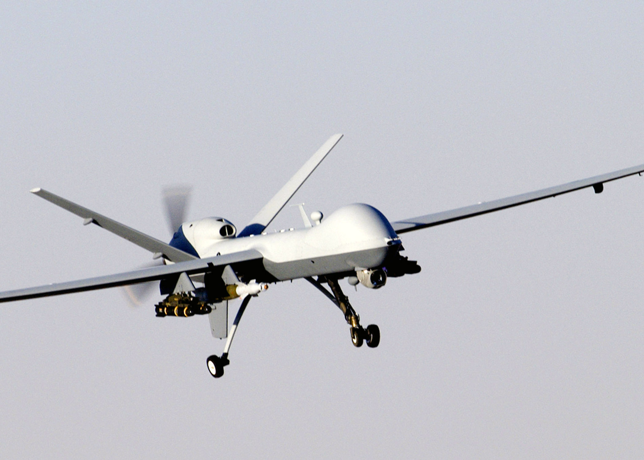
A General Atomics MQ-9 Reaper, a hunter-killer surveillance UAV 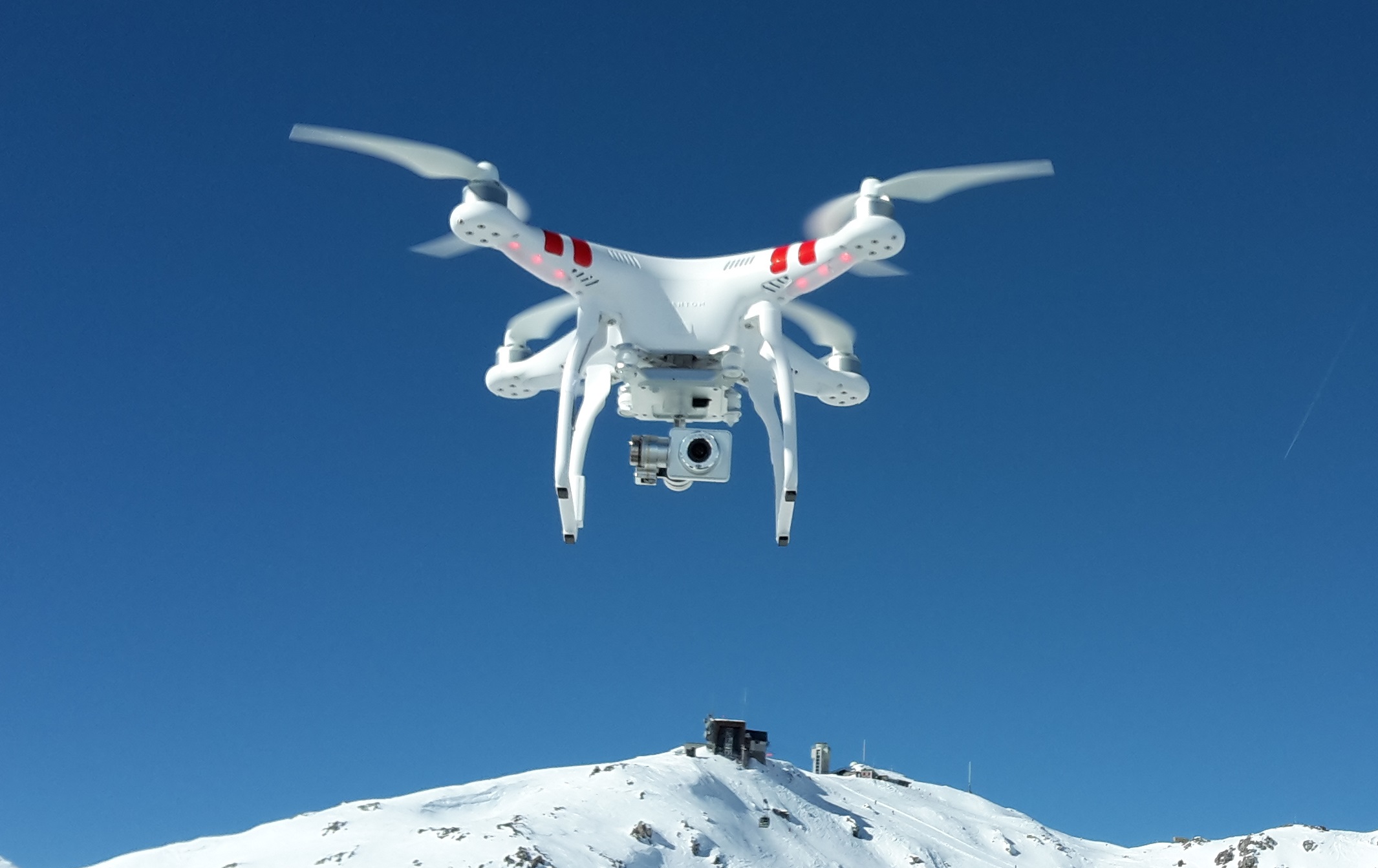
A DJI Phantom quadcopter UAV for commercial and recreational aerial photography 
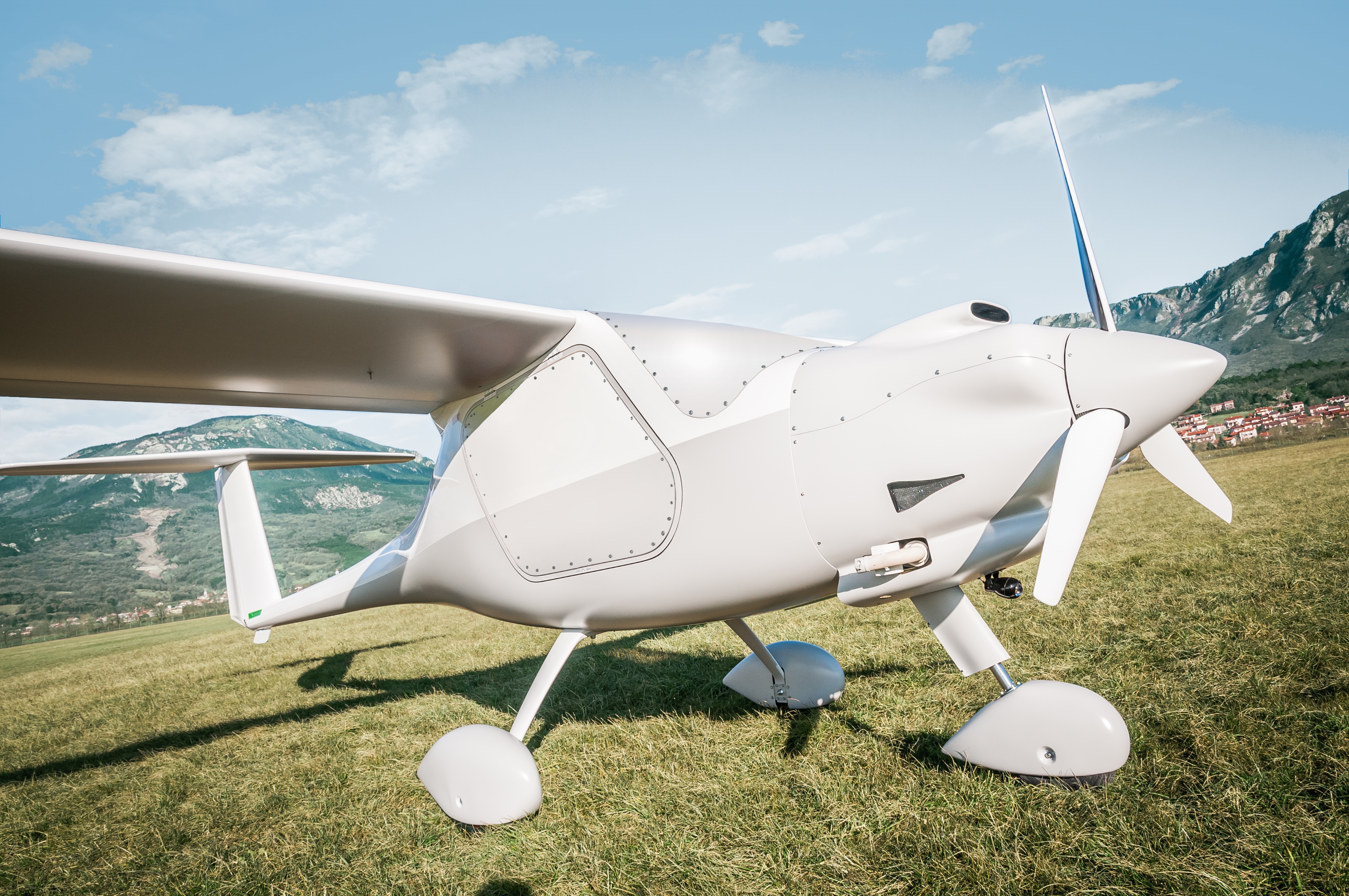
A DeltaQuad VTOL fixed wing surveillance UAV 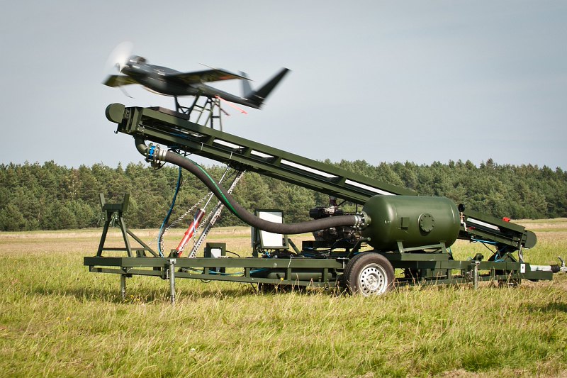
UAV launch from an air-powered catapult 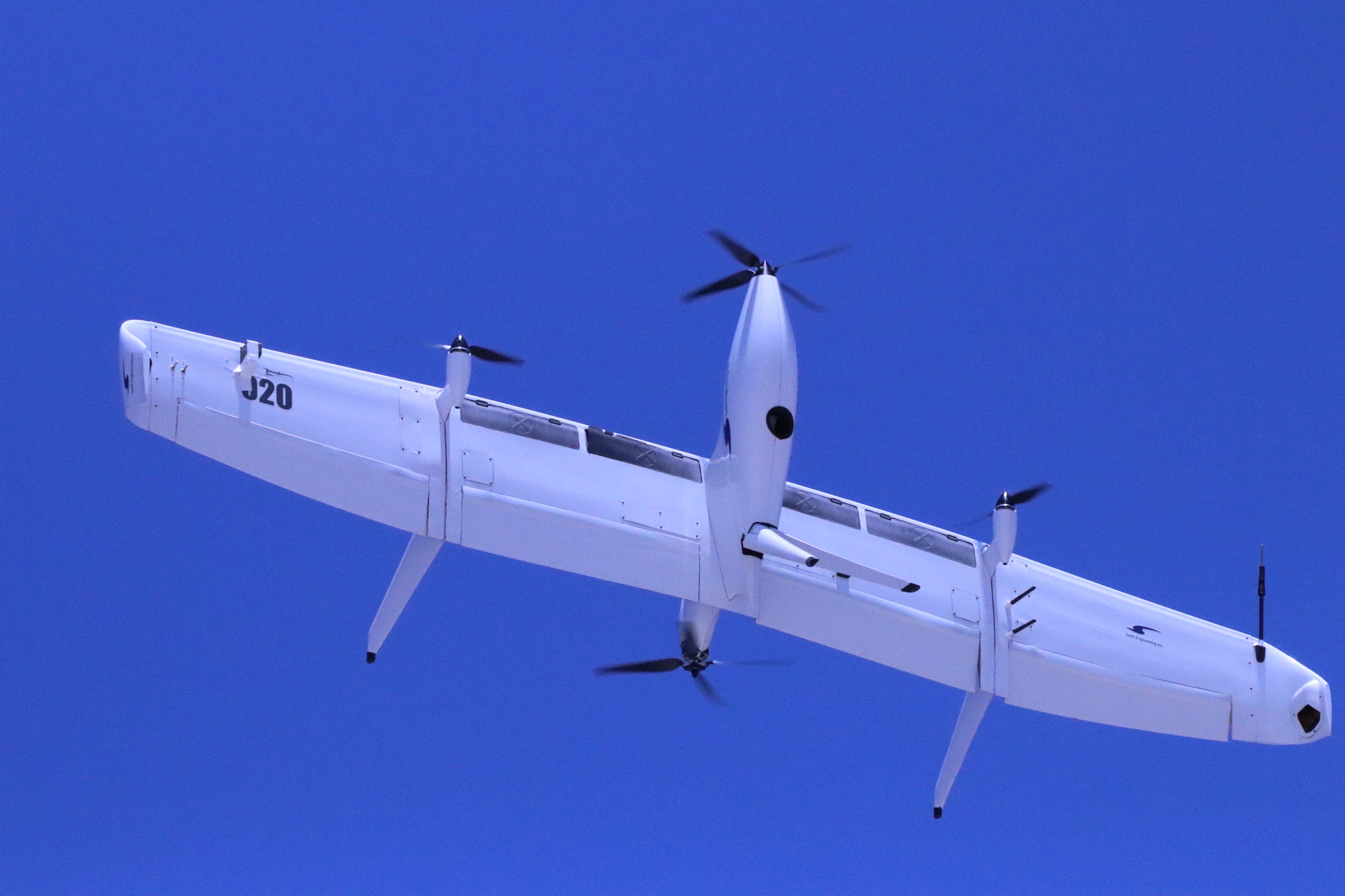
Swift020/021 TerminologyMultiple terms are used for unmanned aerial vehicles, which generally refer to the same concept. The term drone, more widely used by the public, was coined in reference to the early remotely-flown target aircraft used for practice firing of a battleship’s guns, and the term was first used with the 1920s Fairey Queen and 1930’s de Havilland Queen Bee target aircraft. These two were followed in service by the similarly-named Airspeed Queen Wasp and Miles Queen Martinet, before ultimate replacement by the GAF Jindivik. The term unmanned aircraft system (UAS) was adopted by the United States Department of Defense (DoD) and the United States Federal Aviation Administration in 2005 according to their Unmanned Aircraft System Roadmap 2005–2030. The International Civil Aviation Organization (ICAO) and the British Civil Aviation Authority adopted this term, also used in the European Union’s Single-European-Sky (SES) Air-Traffic-Management (ATM) Research (SESAR Joint Undertaking) roadmap for 2020. This term emphasizes the importance of elements other than the aircraft. It includes elements such as ground control stations, data links and other support equipment. A similar term is an unmanned-aircraft vehicle system (UAVS), remotely piloted aerial vehicle (RPAV), remotely piloted aircraft system (RPAS). Many similar terms are in use. A UAV is defined as a «powered, aerial vehicle that does not carry a human operator, uses aerodynamic forces to provide vehicle lift, can fly autonomously or be piloted remotely, can be expendable or recoverable, and can carry a lethal or nonlethal payload». Therefore, missiles are not considered UAVs because the vehicle itself is a weapon that is not reused, though it is also uncrewed and in some cases remotely guided. The relation of UAVs to remote controlled model aircraft is unclear. UAVs may or may not include model aircraft. Some jurisdictions base their definition on size or weight; however, the US Federal Aviation Administration defines any uncrewed flying craft as a UAV regardless of size. For recreational uses, a drone (as opposed to a UAV) is a model aircraft that has first-person video, autonomous capabilities, or both. History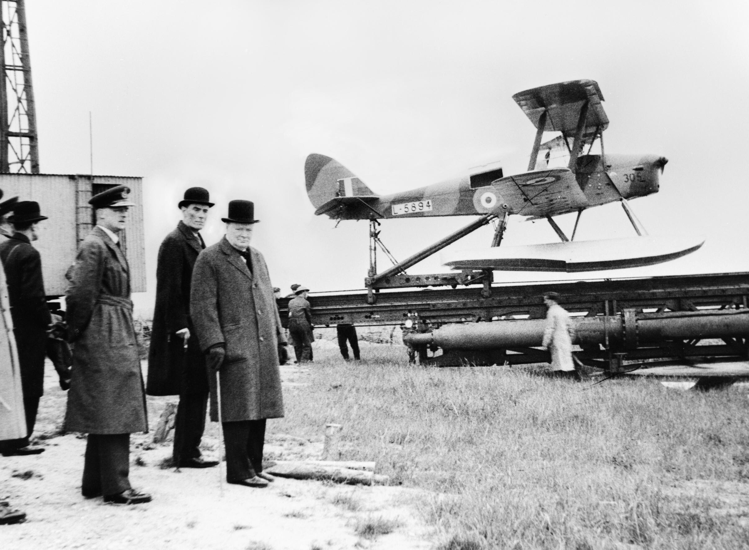
Winston Churchill and others waiting to watch the launch of a de Havilland Queen Bee target drone, 6 June 1941 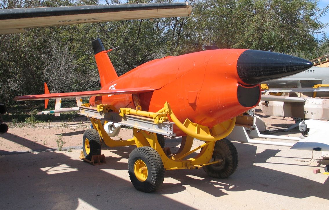
A Ryan Firebee, one of a series of target drones/unpiloted aerial vehicles that first flew in 1951. Israeli Air Force Museum, Hatzerim airbase, Israel, 2006 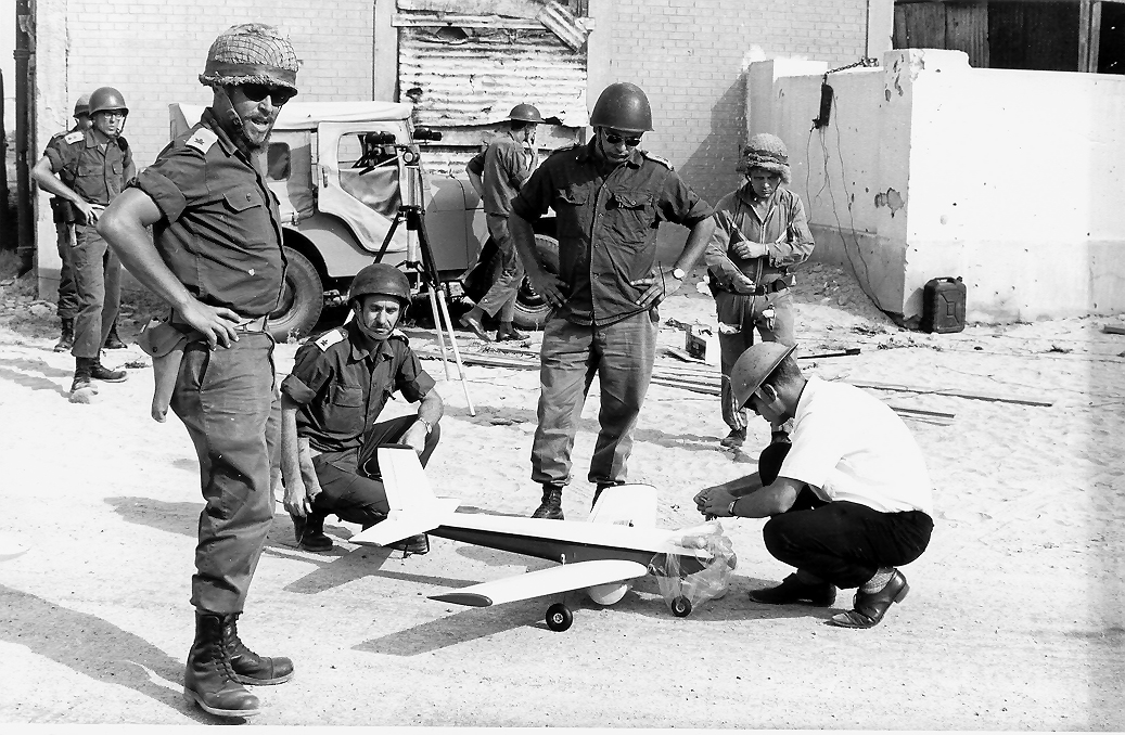
Last preparations before the first tactical UVA mission across the Suez canal (1969). Standing: Major Shabtai Brill from the Israeli intelligence corps, the innovator of the tactical UAV. 
The Israeli Tadiran Mastiff, which first flew in 1975, is seen by many as the first modern battlefield UAV, due to its data-link system, endurance-loitering, and live video-streaming. The earliest recorded use of an unmanned aerial vehicle for warfighting occurred on July 1849, serving as a balloon carrier (the precursor to the aircraft carrier) in the first offensive use of air power in naval aviation. Austrian forces besieging Venice attempted to launch some 200 incendiary balloons at the besieged city. The balloons were launched mainly from land; however, some were also launched from the Austrian ship SMS Vulcano. At least one bomb fell in the city; however, due to the wind changing after launch, most of the balloons missed their target, and some drifted back over Austrian lines and the launching ship Vulcano. UAV innovations started in the early 1900s and originally focused on providing practice targets for training military personnel. UAV development continued during World War I, when the Dayton-Wright Airplane Company invented a pilotless aerial torpedothat would explode at a preset time. The earliest attempt at a powered UAV was A. M. Low’s «Aerial Target» in 1916. Nikola Tesla described a fleet of uncrewed aerial combat vehicles in 1915. Advances followed during and after World War I, including the Hewitt-Sperry Automatic Airplane. This developments also inspired the development of the Kettering Bug by Charles Kettering from Dayton, Ohio. This was initially meant as an uncrewed plane that would carry an explosive payload to a predetermined target. The first scaled remote piloted vehicle was developed by film star and model-airplane enthusiast Reginald Denny in 1935. More emerged during World War II – used both to train antiaircraft gunners and to fly attack missions. Nazi Germany produced and used various UAV aircraft during the war. Jet engines entered service after World War II in vehicles such as the Australian GAF Jindivik, and Teledyne Ryan Firebee I of 1951, while companies like Beechcraft offered their Model 1001 for the U.S. Navy in 1955. Nevertheless, they were little more than remote-controlled airplanes until the Vietnam War. In 1959, the U.S. Air Force, concerned about losing pilots over hostile territory, began planning for the use of uncrewed aircraft. Planning intensified after the Soviet Union shot down a U-2 in 1960. Within days, a highly classified UAV program started under the code name of «Red Wagon». The August 1964 clash in the Tonkin Gulf between naval units of the U.S. and North Vietnamese Navy initiated America’s highly classified UAVs (Ryan Model 147, Ryan AQM-91 Firefly, Lockheed D-21) into their first combat missions of the Vietnam War. When the Chinese government showed photographs of downed U.S. UAVs via Wide World Photos, the official U.S. response was «no comment». During the War of Attrition (1967–1970) the first tactical UAVs installed with reconnaissance cameras were first tested by the Israeli intelligence, successfully bringing photos from across the Suez canal. This was the first time that tactical UAVs, which could be launched and landed on any short runway (unlike the heavier jet-based UAVs), were developed and tested in battle. In the 1973 Yom Kippur War, Israel used UAVs as decoys to spur opposing forces into wasting expensive anti-aircraft missiles. After the 1973 Yom Kippur war, a few key people from the team that developed this early UAV joined a small startup company that aimed to develop UAVs into a commercial product, eventually purchased by Tadiran and leading to the development of the first Israeli UVA. In 1973, the U.S. military officially confirmed that they had been using UAVs in Southeast Asia (Vietnam). Over 5,000 U.S. airmen had been killed and over 1,000 more were missing or captured. The USAF 100th Strategic Reconnaissance Wing flew about 3,435 UAV missions during the war at a cost of about 554 UAVs lost to all causes. In the words of USAF GeneralGeorge S. Brown, Commander, Air Force Systems Command, in 1972, «The only reason we need (UAVs) is that we don’t want to needlessly expend the man in the cockpit.» Later that year, General John C. Meyer, Commander in Chief, Strategic Air Command, stated, «we let the drone do the high-risk flying … the loss rate is high, but we are willing to risk more of them … they save lives!« During the 1973 Yom Kippur War, Soviet-supplied surface-to-air missile batteries in Egypt and Syria caused heavy damage to Israeli fighter jets. As a result, Israel developed the first UAV with real-time surveillance. The images and radar decoys provided by these UAVs helped Israel to completely neutralize the Syrian air defenses at the start of the 1982 Lebanon War, resulting in no pilots downed. The first time UAVs were used as proof-of-concept of super-agility post-stall controlled flight in combat-flight simulations involved tailless, stealth technology-based, three-dimensional thrust vectoring flight control, jet-steering UAVs in Israel in 1987. With the maturing and miniaturization of applicable technologies in the 1980s and 1990s, interest in UAVs grew within the higher echelons of the U.S. military. In the 1990s, the U.S. DoD gave a contract to AAI Corporation along with Israeli company Malat. The U.S. Navy bought the AAI Pioneer UAV that AAI and Malat developed jointly. Many of these UAVs saw service in the 1991 Gulf War. UAVs demonstrated the possibility of cheaper, more capable fighting machines, deployable without risk to aircrews. Initial generations primarily involved surveillance aircraft, but some carried armaments, such as the General Atomics MQ-1 Predator, that launched AGM-114 Hellfire air-to-ground missiles. CAPECON was a European Union project to develop UAVs, running from 1 May 2002 to 31 December 2005. As of 2012, the USAF employed 7,494 UAVs – almost one in three USAF aircraft. The Central Intelligence Agency also operated UAVs. In 2013 at least 50 countries used UAVs. China, Iran, Israel, Pakistan, and others designed and built their own varieties. Classification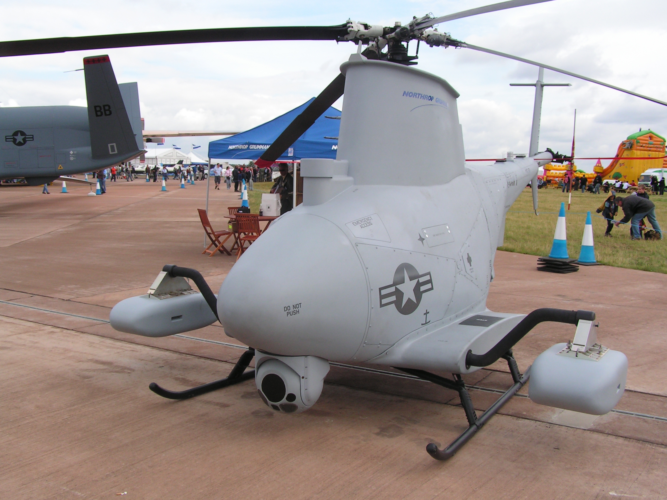
Although most military UAVs are fixed-wing aircraft, rotorcraft designs (i.e., RUAVs) such as this MQ-8B Fire Scout are also used. UAVs typically fall into one of six functional categories (although multi-role airframe platforms are becoming more prevalent):
The U.S. Military UAV tier system is used by military planners to designate the various individual aircraft elements in an overall usage plan. 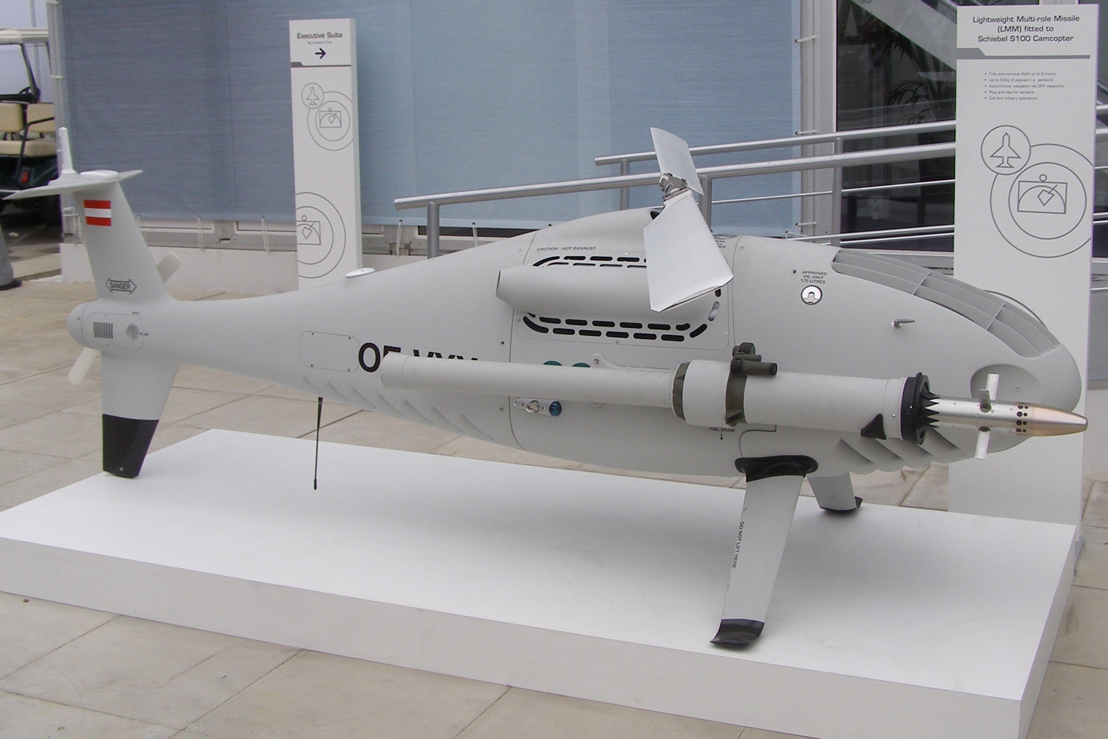
Schiebel S-100 fitted with a Lightweight Multirole Missile Vehicles can be categorised in terms of range/altitude. The following has been advanced as relevant at industry events such as ParcAberporth Unmanned Systems forum:
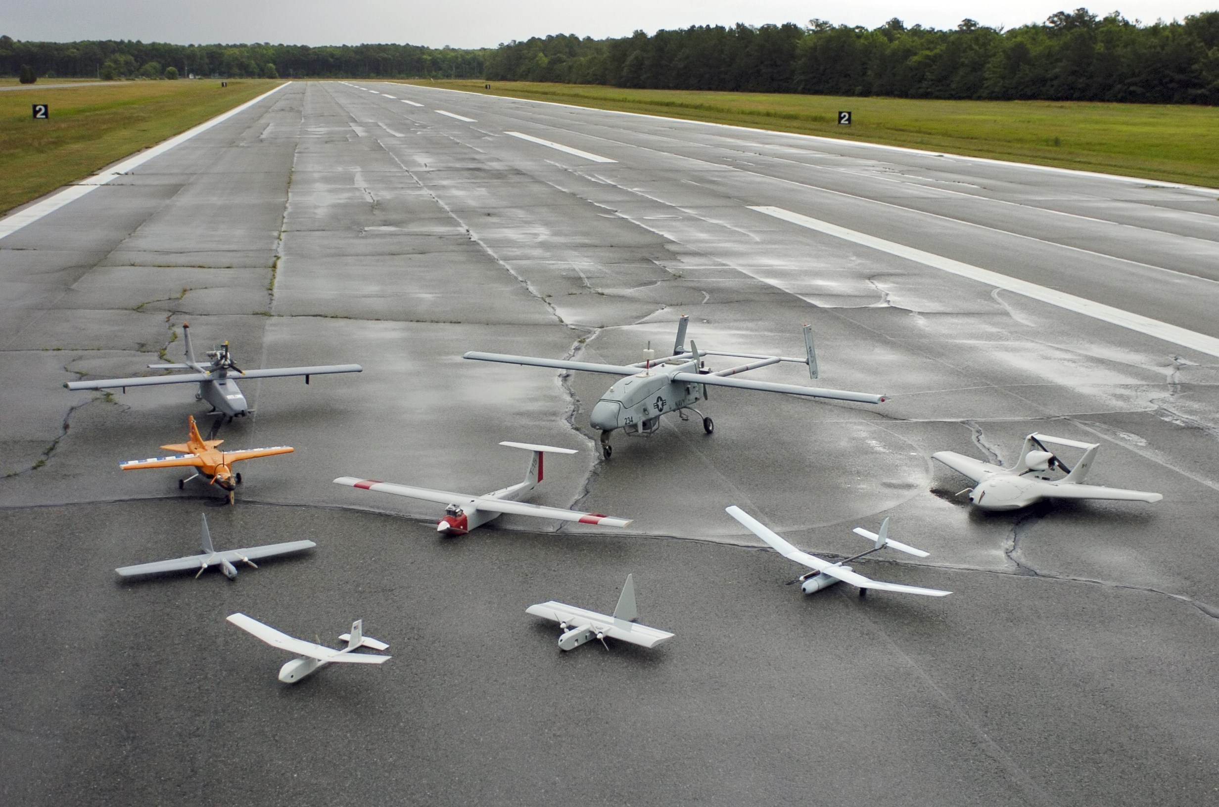
U.S. UAV demonstrators in 2005 Other categories include:
Classifications according to aircraft weight are quite simpler:
UAV components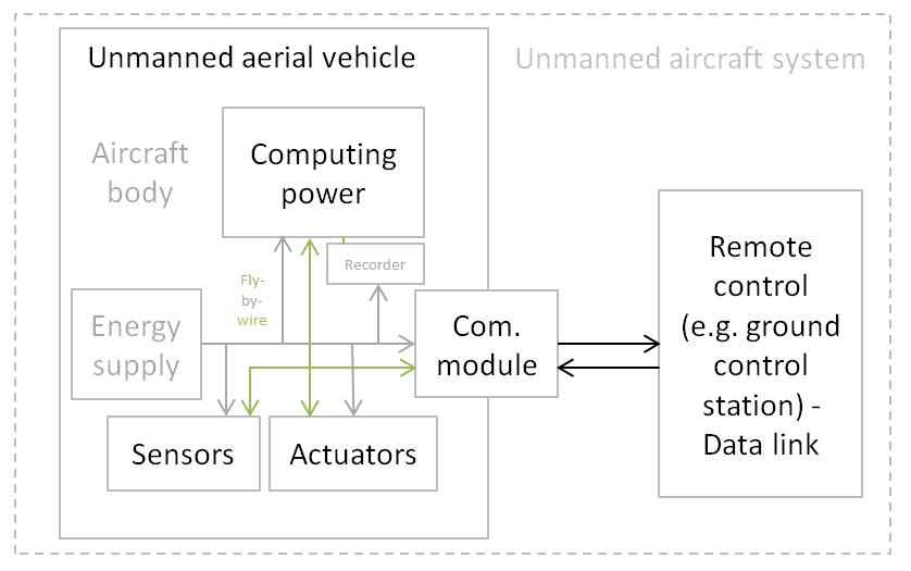
General physical structure of an UAV Crewed and uncrewed aircraft of the same type generally have recognizably similar physical components. The main exceptions are the cockpit and environmental control system or life support systems. Some UAVs carry payloads (such as a camera) that weigh considerably less than an adult human, and as a result can be considerably smaller. Though they carry heavy payloads, weaponized military UAVs are lighter than their crewed counterparts with comparable armaments. Small civilian UAVs have no life-critical systems, and can thus be built out of lighter but less sturdy materials and shapes, and can use less robustly tested electronic control systems. For small UAVs, the quadcopter design has become popular, though this layout is rarely used for crewed aircraft. Miniaturization means that less-powerful propulsion technologies can be used that are not feasible for crewed aircraft, such as small electric motors and batteries. Control systems for UAVs are often different than crewed craft. For remote human control, a camera and video link almost always replace the cockpit windows; radio-transmitted digital commands replace physical cockpit controls. Autopilot software is used on both crewed and uncrewed aircraft, with varying feature sets. BodyThe primary difference for planes is the absence of the cockpit area and its windows. Tailless quadcopters are a common form factor for rotary wing UAVs while tailed mono- and bi-copters are common for crewed platforms. Power supply and platformSmall UAVs mostly use lithium-polymer batteries (Li-Po), while larger vehicles rely on conventional airplane engines. Scale or size of aircraft is not the defining or limiting characteristic of energy supply for a UAV. At present, the energy density of Li-Po is far less than gasoline. The record of travel for a UAV (built from balsa wood and mylar skin) across the North Atlantic Ocean is held by a gasoline model airplane or UAV. Manard Hill in «in 2003 when one of his creations flew 1,882 miles across the Atlantic Ocean on less than a gallon of fuel» holds this record. See: Electric power is used as less work is required for a flight and electric motors are quieter. Also, properly designed, the thrust to weight ratio for an electric or gasoline motor driving a propeller can hover or climb vertically. Botmite airplane is an example of an electric UAV which can climb vertically. Battery elimination circuitry (BEC) is used to centralize power distribution and often harbors a microcontroller unit (MCU). Costlier switching BECs diminish heating on the platform. ComputingUAV computing capability followed the advances of computing technology, beginning with analog controls and evolving into microcontrollers, then system-on-a-chip(SOC) and single-board computers (SBC). System hardware for small UAVs is often called the flight controller (FC), flight controller board (FCB) or autopilot. SensorsPosition and movement sensors give information about the aircraft state. Exteroceptive sensors deal with external information like distance measurements, while exproprioceptive ones correlate internal and external states. Non-cooperative sensors are able to detect targets autonomously so they are used for separation assurance and collision avoidance. Degrees of freedom (DOF) refers to both the amount and quality of sensors on-board: 6 DOF implies 3-axis gyroscopes and accelerometers (a typical inertial measurement unit – IMU), 9 DOF refers to an IMU plus a compass, 10 DOF adds a barometer and 11 DOF usually adds a GPS receiver. ActuatorsUAV actuators include digital electronic speed controllers (which control the RPM of the motors) linked to motors/engines and propellers, servomotors (for planes and helicopters mostly), weapons, payload actuators, LEDs and speakers. SoftwareUAV software called the flight stack or autopilot. UAVs are real-time systems that require rapid response to changing sensor data. Examples include Raspberry Pis, Beagleboards, etc. shielded with NavIO, PXFMini, etc. or designed from scratch such as Nuttx, preemptive-RT Linux, Xenomai, Orocos-Robot Operating System or DDS-ROS 2.0.
Civil-use open-source stacks include:
Loop principles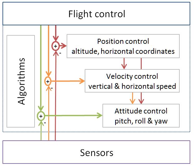
Typical flight-control loops for a multirotor UAVs employ open-loop, closed-loop or hybrid control architectures.
Flight controlsUAVs can be programmed to perform aggressive manœuvres or landing/perching on inclined surfaces, and then to climb toward better communication spots. Some UAVs can control flight with varying flight modelisation, such as VTOL designs. UAVs can also implement perching on a flat vertical surface. CommunicationsMost UAVs use a radio for remote control and exchange of video and other data. Early UAVs had only narrowband uplink. Downlinks came later. These bi-directional narrowband radio links carried command and control (C&C) and telemetry data about the status of aircraft systems to the remote operator. For very long range flights, military UAVs also use satellite receivers as part of satellite navigation systems. In cases when video transmission was required, the UAVs will implement a separate analog video radio link. In the most modern UAV applications, video transmission is required. So instead of having 2 separate links for C&C, telemetry and video traffic, a broadband link is used to carry all types of data on a single radio link. These broadband links can leverage quality of service techniques to optimize the C&C traffic for low latency. Usually these broadband links carry TCP/IP traffic that can be routed over the Internet. The radio signal from the operator side can be issued from either:
Autonomy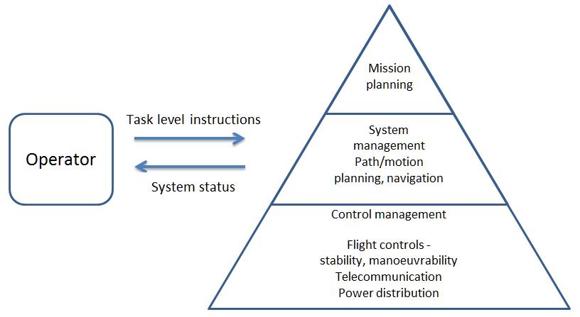
Autonomous control basics ICAO classifies uncrewed aircraft as either remotely piloted aircraft or fully autonomous. Actual UAVs may offer intermediate degrees of autonomy. E.g., a vehicle that is remotely piloted in most contexts may have an autonomous return-to-base operation. Basic autonomy comes from proprioceptive sensors. Advanced autonomy calls for situational awareness, knowledge about the environment surrounding the aircraft from exterioceptive sensors: sensor fusion integrates information from multiple sensors. Basic principlesOne way to achieve autonomous control employs multiple control-loop layers, as in hierarchical control systems. As of 2016 the low-layer loops (i.e. for flight control) tick as fast as 32,000 times per second, while higher-level loops may cycle once per second. The principle is to decompose the aircraft’s behavior into manageable «chunks», or states, with known transitions. Hierarchical control system types range from simple scripts to finite state machines, behavior trees and hierarchical task planners. The most common control mechanism used in these layers is the PID controller which can be used to achieve hover for a quadcopter by using data from the IMU to calculate precise inputs for the electronic speed controllers and motors. Examples of mid-layer algorithms:
Evolved UAV hierarchical task planners use methods like state tree searches or genetic algorithms. Autonomy features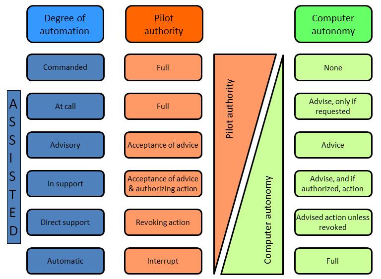
UAV’s degrees of autonomy UAV manufacturers often build in specific autonomous operations, such as:
FunctionsFull autonomy is available for specific tasks, such as airborne refueling or ground-based battery switching; but higher-level tasks call for greater computing, sensing and actuating capabilities. One approach to quantifying autonomous capabilities is based on OODA terminology, as suggested by a 2002 US Air Force Research Laboratory, and used in the table below: Medium levels of autonomy, such as reactive autonomy and high levels using cognitive autonomy, have already been achieved to some extent and are very active research fields. Reactive autonomyReactive autonomy, such as collective flight, real-time collision avoidance, wall following and corridor centring, relies on telecommunication and situational awarenessprovided by range sensors: optic flow, lidars (light radars), radars, sonars. Most range sensors analyze electromagnetic radiation, reflected off the environment and coming to the sensor. The cameras (for visual flow) act as simple receivers. Lidars, radars and sonars (with sound mechanical waves) emit and receive waves, measuring the round-trip transit time. UAV cameras do not require emitting power, reducing total consumption. Radars and sonars are mostly used for military applications. Reactive autonomy has in some forms already reached consumer markets: it may be widely available in less than a decade. 
Cutting-edge (2013) autonomous levels for existing systems Simultaneous localization and mappingSLAM combines odometry and external data to represent the world and the position of the UAV in it in three dimensions. High-altitude outdoor navigation does not require large vertical fields-of-view and can rely on GPS coordinates (which makes it simple mapping rather than SLAM). Two related research fields are photogrammetry and LIDAR, especially in low-altitude and indoor 3D environments.
SwarmingFuture military potentialIn the military sector, American Predators and Reapers are made for counterterrorism operations and in war zones in which the enemy lacks sufficient firepower to shoot them down. They are not designed to withstand antiaircraft defenses or air-to-air combat. In September 2013, the chief of the US Air Combat Command stated that current UAVs were «useless in a contested environment» unless crewed aircraft were there to protect them. A 2012 Congressional Research Service (CRS) report speculated that in the future, UAVs may be able to perform tasks beyond intelligence, surveillance, reconnaissance and strikes; the CRS report listed air-to-air combat («a more difficult future task») as possible future undertakings. The Department of Defense’s Unmanned Systems Integrated Roadmap FY2013-2038 foresees a more important place for UAVs in combat. Issues include extended capabilities, human-UAV interaction, managing increased information flux, increased autonomy and developing UAV-specific munitions. DARPA’s project of systems of systems, or General Atomics work may augur future warfare scenarios, the latter disclosing Avenger swarms equipped with High Energy Liquid Laser Area Defense System (HELLADS). Cognitive radioCognitive radio technology may have UAV applications. Learning capabilitiesUAVs may exploit distributed neural networks. MarketMilitaryThe global military UAV market is dominated by companies based in the United States and Israel. By sale numbers, The US held over 60% military-market share in 2017. Four of top five military UAV manufactures are American including General Atomics, Lockheed Martin, Northrop Grumman and Boeing, followed by the Chinese company CASC. Israel companies mainly focus on small surveillance UAV system and by quantity of drones, Israel exported 60.7% (2014) of UAV on the market while the United States export 23.9% (2014); top importers of military UAV are The United Kingdom (33.9%) and India (13.2%). United States alone operated over 9,000 military UAVs in 2014. General Atomics is the dominant manufacturer with the Global Hawk and Predator/Mariner systems product-line. CivilianThe civilian drone market is dominated by Chinese companies. Chinese drone manufacturer DJI alone has 75% of civilian-market share in 2017 with $11 billion forecast global sales in 2020. Followed by French company Parrot with $110m and US company 3DRobotics with $21.6m in 2014. As of March 2018, more than one million UAVs (878,000 hobbyist and 122,000 commercial) were registered with the U.S. FAA. 2018 NPD point to consumers increasingly purchasing drones with more advanced features with 33 percent growth in both the $500+ and $1000+ market segments. The civilian UAV market is relatively new compared to the military one. Companies are emerging in both developed and developing nations at the same time. Many early stage startups have received support and funding from investors like in United States and by government agencies as the case in India. Some universities offer research and training programs or degrees. Private entities also provide online and in-person training programs for both recreational and commercial UAV use. Consumer drones are also widely used by military organizations worldwide because of the cost-effective nature of consumer product. In 2018, Israeli military started to use DJI Mavic and Matrice series of UAV for light reconnaissance mission since the civilian drones are easier to use and have higher reliability. DJI drones is also the most widely used commercial unmanned aerial system that the US Army has employed. The global UAV market will reach US$21.47 billion, with the Indian market touching the US$885.7 million mark, by 2021. Lighted drones are beginning to be used in nighttime displays for artistic and advertising purposes. TransportThe AIA reports large cargo and passengers drones should be certified and introduced over the next 20 years. Sensor-carrying large drones are expected from 2018; short-haul, low altitude freighters outside cities from 2025; long-haul cargo flights by the mid-2030s and then passenger flights by 2040. Spending should rise from a few hundred million dollars on research and development in 2018 to $4 billion by 2028 and $30 billion by 2036. Development considerationsAnimal imitation – ethologyFlapping-wing ornithopters, imitating birds or insects, are a research field in microUAVs. Their inherent stealth recommends them for spy missions. The Nano Hummingbird is commercially available, while sub-1g microUAVs inspired by flies, albeit using a power tether, can «land» on vertical surfaces. Other projects include uncrewed «beetles» and other insects. Research is exploring miniature optic-flow sensors, called ocellis, mimicking the compound insect eyes formed from multiple facets, which can transmit data to neuromorphic chips able to treat optic flow as well as light intensity discrepancies. Endurance
UEL UAV-741 Wankel engine for UAV operations 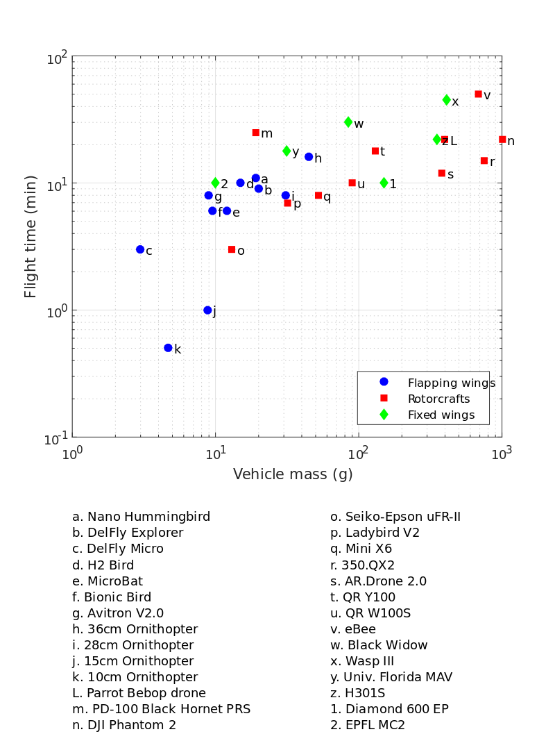
Flight time against mass of small (less than 1 kg) drones UAV endurance is not constrained by the physiological capabilities of a human pilot. Because of their small size, low weight, low vibration and high power to weight ratio, Wankel rotary engines are used in many large UAVs. Their engine rotors cannot seize; the engine is not susceptible to shock-cooling during descent and it does not require an enriched fuel mixture for cooling at high power. These attributes reduce fuel usage, increasing range or payload. Proper drone cooling is essential for long-term drone endurance. Overheating and subsequent engine failure is the most common cause of drone failure. Hydrogen fuel cells, using hydrogen power, may be able to extend the endurance of small UAVs, up to several hours. Micro air vehicles endurance is so far best achieved with flapping-wing UAVs, followed by planes and multirotors standing last, due to lower Reynolds number. Solar-electric UAVs, a concept originally championed by the AstroFlight Sunrise in 1974, have achieved flight times of several weeks. Solar-powered atmospheric satellites («atmosats») designed for operating at altitudes exceeding 20 km (12 miles, or 60,000 feet) for as long as five years could potentially perform duties more economically and with more versatility than low earth orbitsatellites. Likely applications include weather monitoring, disaster recovery, earth imaging and communications. Electric UAVs powered by microwave power transmission or laser power beaming are other potential endurance solutions. Another application for a high endurance UAV would be to «stare» at a battlefield for a long interval (ARGUS-IS, Gorgon Stare, Integrated Sensor Is Structure) to record events that could then be played backwards to track battlefield activities.
ReliabilityReliability improvements target all aspects of UAV systems, using resilience engineering and fault tolerance techniques. Individual reliability covers robustness of flight controllers, to ensure safety without excessive redundancy to minimize cost and weight. Besides, dynamic assessment of flight envelope allows damage-resilient UAVs, using non-linear analysis with ad-hoc designed loops or neural networks. UAV software liability is bending toward the design and certifications of crewed avionics software. Swarm resilience involves maintaining operational capabilities and reconfiguring tasks given unit failures. ApplicationsThere are numerous civilian, commercial, military, and aerospace applications for UAVs. These include:
Existing UAVsThe export of UAVs or technology capable of carrying a 500 kg payload at least 300 km is restricted in many countries by the Missile Technology Control Regime. EventsSafety and security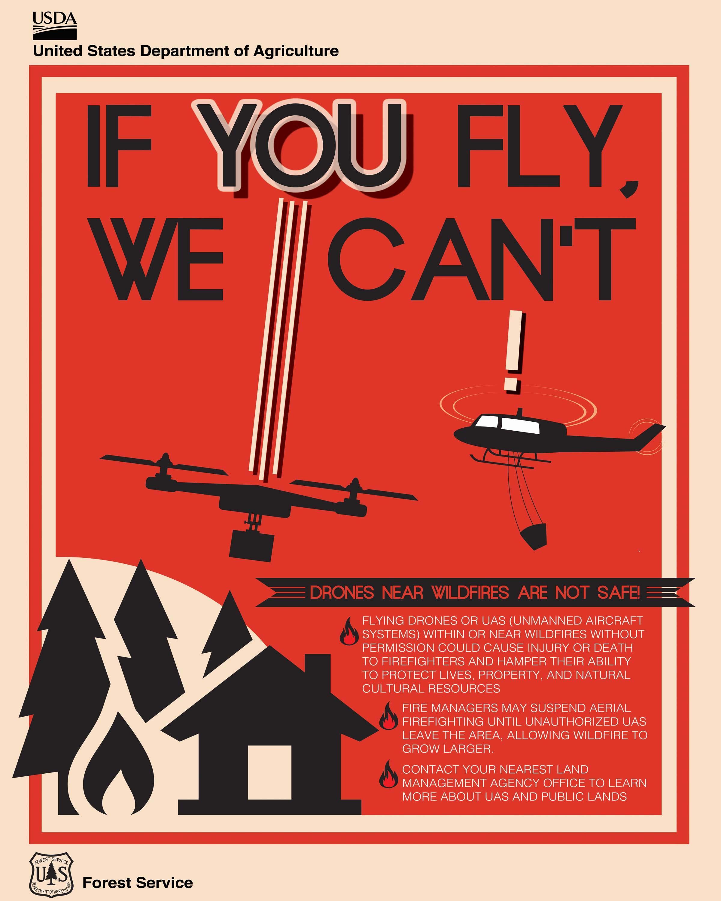
US Department of Agriculture poster warning about the risks of flying UAVs near wildfires Air trafficUAVs can threaten airspace security in numerous ways, including unintentional collisions or other interference with other aircraft, deliberate attacks or by distracting pilots or flight controllers. The first incident of a drone-airplane collision occurred in mid-October 2017 in Quebec City, Canada. The first recorded instance of a drone collision with a hot air balloon occurred on 10 August 2018 in Driggs, Idaho, United States; although there was no significant damage to the balloon nor any injuries to its 3 occupants, the balloon pilot reported the incident to the NTSB, stating that «I hope this incident helps create a conversation of respect for nature, the airspace, and rules and regulations.” In recent events UAVs flying into or near airports shutting them down for long periods of time. Malicious useUAVs could be loaded with dangerous payloads, and crashed into vulnerable targets. Payloads could include explosives, chemical, radiologial or biological hazards. UAVs with generally non-lethal payloads could possibly be hacked and put to malicious purposes. Anti-UAV systems are being developed by states to counter this threat. This is, however, proving difficult. As Dr J. Rogers stated in an interview to A&T «There is a big debate out there at the moment about what the best way is to counter these small UAVs, whether they are used by hobbyists causing a bit of a nuisance or in a more sinister manner by a terrorist actor.” By 2017, drones were being used to drop contraband into prisons. Drones caused significant disruption at Gatwick Airport during December 2018, needing the deployment of the British Army. Counter unmanned air systemThe malicious use of UAVs has led to the development of counter unmanned air system (C-UAS) technologies such as the Rafael Drone Dome and the Raytheon Coyote. Anti-aircraft missile systems, such as the Iron Dome are also being enhanced with C-UAS technologies. Security vulnerabilitiesThe interest in UAVs cyber security has been raised greatly after the Predator UAV video stream hijacking incident in 2009, where Islamic militants used cheap, off-the-shelf equipment to stream video feeds from a UAV. Another risk is the possibility of hijacking or jamming a UAV in flight. Several security researchers have made public some vulnerabilities in commercial UAVs, in some cases even providing full source code or tools to reproduce their attacks. At a workshop on UAVs and privacy in October 2016, researchers from the Federal Trade Commission showed they were able to hack into three different consumer quadcopters and noted that UAV manufacturers can make their UAVs more secure by the basic security measures of encrypting the Wi-Fi signal and adding password protection. WildfiresIn the United States, flying close to a wildfire is punishable by a maximum $25,000 fine. Nonetheless, in 2014 and 2015, firefighting air support in California was hindered on several occasions, including at the Lake Fire and the North Fire. In response, California legislators introduced a bill that would allow firefighters to disable UAVs which invaded restricted airspace. The FAA later required registration of most UAVs. The use of UAVs is also being investigated to help detect and fight wildfires, whether through observation or launching pyrotechnic devices to start backfires. RegulationEthical concerns and UAV-related accidents have driven nations to regulate the use of UAVs. IrelandThe Irish Aviation Authority (IAA) requires all UAVs over 1 kg to be registered with UAVs weighing 4 kg or more requiring a license to be issued by the IAA. NetherlandsAs of May 2016, the Dutch police are testing trained bald eagles to intercept offending UAVs. CanadaIn 2016, Transport Canada proposed the implementation of new regulations that would require all UAVs over 250 grams to be registered and insured and that operators would be required to be a minimum age and pass an exam in order to get a license. These regulations are expected to be introduced in 2018. South AfricaIn April 2014, the South African Civil Aviation Authority announced that it would clamp down on the illegal flying of UAVs in South African airspace. «Hobby drones» with a weight of less than 7 kg at altitudes up to 500m with restricted visual line-of-sight below the height of the highest obstacle within 300m of the UAV are allowed. No license is required for such vehicles. United Arab EmiratesIn order to fly a drone in Dubai, citizens have to obtain a no objection certificate from Dubai Civil Aviation Authority (DCAA). This certificate can be obtained online. ItalyThe ENAC (Ente Nazionale per l’Aviazione Civile), that is, the Italian Civil Aviation Authority for technical regulation, certification, supervision and control in the field of civil aviation, issued on 31 May 2016 a very detailed regulation for all UAV, determining which types of vehicles can be used, where, for which purposes, and who can control them. The regulation deals with the usage of UAV for either commercial and recreational use. The last version was published on 22 December 2016. JapanIn 2015, Civil Aviation Bureau in Japan announced that «UA/Drone” (refers to any airplane, rotorcraft, glider or airship which cannot accommodate any person on board and can be remotely or automatically piloted) should (A) not fly near or above airports, (B) not fly over 150 meter above ground/water surface, (C) not fly over urban area and suburb (so only rural area is allowed.) UA/drone should be operated manually and at Visual Line of Sight (VLOS) and so on. UA/drone should not fly near any important buildings or facilities of the country including nuclear facilities. UA/drone must follow the Japan Radio Act exactly. United StatesRecreational useFrom 21 December 2015, all hobby type UAVs between 250 grams and 25 kilograms needed to be registered with FAA no later than 19 February 2016. The new FAA UAV registration process includes requirements for:
On 19 May 2017, in the case Taylor v. Huerta, the U.S. Court of Appeals for the District of Columbia Circuit held that the FAA’s 2015 drone registration rules were in violation of the 2012 FAA Modernization and Reform Act. Under the court’s holding, although commercial drone operators are required to register, recreational operators are not. On 25 May 2017, one week after the Taylor decision, Senator Dianne Feinstein introduced S. 1272, the Drone Federalism Act of 2017, in Congress. Commercial useOn 21 June 2016, the Federal Aviation Administration announced regulations for commercial operation of small UAS craft (sUAS), those between 0.55 and 55 pounds (about 250 gm to 25 kg) including payload. The rules, which exclude hobbyists, require the presence at all operations of a licensed Remote Pilot in Command. Certification of this position, available to any citizen at least 16 years of age, is obtained solely by passing a written test and then submitting an application. For those holding a sport pilot license or higher, and with a current flight review, a rule-specific exam can be taken at no charge online at the faasafety.gov website. Other applicants must take a more comprehensive examination at an aeronautical testing center. All licensees are required to take a review course every two years. At this time no ratings for heavier UAS are available. Commercial operation is restricted to daylight, line-of-sight, under 100 mph, under 400 feet, and Class G airspace only, and may not fly over people or be operated from a moving vehicle. Some organizations have obtained a waiver or Certificate of Authorization that allows them to exceed these rules. On 20 September 2018, State Farm Insurance, in partnership with the Virginia Tech Mid-Atlantic Aviation Partnership and FAA Integration Pilot Program, became the first in the United States to fly a UAV ‘Beyond-Visual-Line-Of-Sight’ (BVLOS) and over people under an FAA Part 107 Waiver. The flight was made at the Virginia Tech Kentland Farms outside the Blacksburg campus with an SenseFly eBee vehicle, Pilot-In-Command was Christian Kang, a State Farm Weather Catastrophe Claims Services employee (Part 107 & 61 pilot). Additionally, CNN’s waiver for UAVs modified for injury prevention to fly over people, while other waivers allow night flying with special lighting, or non-line-of-sight operations for agriculture or railroad track inspection. Previous to this announcement, any commercial use required a full pilot’s license and an FAA waiver, of which hundreds had been granted. Government useThe use of UAVs for law-enforcement purposes is regulated at a state level. In Oregon, law enforcement is allowed to operate non-weaponized drones without a warrant if there is enough reason to believe that the current environment poses imminent danger to which the drone can acquire information or assist individuals. Otherwise, a warrant, with a maximum period of 30 days of interaction, must be acquired. United KingdomAs of December 2018, UAVs of 20 kilograms (44 lb) or less must fly within the operator’s eyesight. In built up areas, UAVs must be 150 feet (46 m) away from people and cannot be flown over large crowds or built up areas. In July 2018, it became illegal to fly a UAV over 400 feet (120 m) and to fly within 1 kilometre (0.62 mi) of aircraft, airports and airfields.
Text from Wikipedia is available under the Creative Commons Attribution/Share-Alike License; additional terms may apply.
Published in May 2019. Click here to read more articles related to aviation and space!
|

 |
|
Copyright 2004-2026 © by Airports-Worldwide.com, Vyshenskoho st. 36, Lviv 79010, Ukraine Legal Disclaimer |