|
|
Kuito (Joaquim Kapango, Cuíto Airport) |
Kuito Airport (Portuguese: Aeroporto de Kuito) (IATA: SVP, ICAO: FNKU) is an airport serving Kuito (known as Silva Porto before 1975), a city in the Bié Province in Angola.
The Kuito non-directional beacon (Ident: KU) is located on the field.
|
Kuito (Joaquim Kapango, Cuíto Airport)
Aeroporto de Kuito
|
|
|
| Summary |
| Airport type |
Public |
| Operator |
Government |
| Serves |
Kuito, Angola |
| Elevation AMSL |
5,618 ft / 1,712 m |
| Coordinates |
12°24′15″S
16°56′55″E |
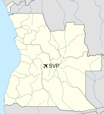
| Map |
Location of Kuito Airport in Angola
|
| Runways |
| Direction |
Length |
Surface |
| m |
ft |
| 08/26 |
2,680 |
8,793 |
Asphalt |
|
Airlines and destinations
| Destinations |
| TAAG Angola Airlines |
Luanda |
The above content comes from Wikipedia and is published under free licenses – click here to read more.
| General Info
|
| Country |
Angola
|
| ICAO ID |
FNKU
|
| Time |
UTC+1
|
| Latitude |
-12.404633
12° 24' 16.68" S
|
| Longitude |
16.947414
016° 56' 50.69" E
|
| Elevation |
5618 feet
1712 meters
|
| Magnetic Variation |
006° W (05/06)
|
| Operating Agency |
CIVIL GOVERNMENT, (LANDING FEES AND DIPLOMATIC CLEARANCE MAY BE REQUIRED)
|
| Near City |
Bie
|
| Operating Hours |
SUNRISE TO SUNSET (SR-SS)
|
| Communications
|
| AFIS |
118.7
|
| Runways
|
| ID |
Dimensions |
Surface |
PCN |
ILS
|
| 08/26 |
8202 x 98 feet
2500 x 30 meters |
ASPHALT |
- |
NO
|
| Navaids
|
| Type |
ID |
Name |
Channel |
Freq |
Distance From Field |
Bearing From Navaid
|
| NDB |
KU |
KUITO |
- |
320 |
1.1 NM |
055.3
|
| Supplies/Equipment
|
| Fuel |
Jet fuel avaiable but type is unknown.
100/130 MIL Spec, low lead, aviation gasoline (BLUE)
|
| Remarks
|
| FUEL |
Not avbl UFN. (NC-100LL, J)
|
| LGT |
Rwy lgt O/S UFN.
|
| OPR HOURS |
Opr SR-SS.
|
The content above was published at Airports-Worldwide.com in 2020.
We don't guarantee the information is fresh and accurate. The data may be wrong or outdated.
For more up-to-date information please refer to other sources.
|
|