|
|
| Wake Island Airfield |
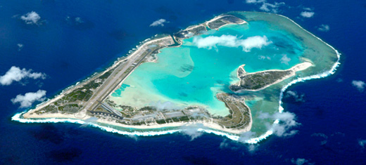 |
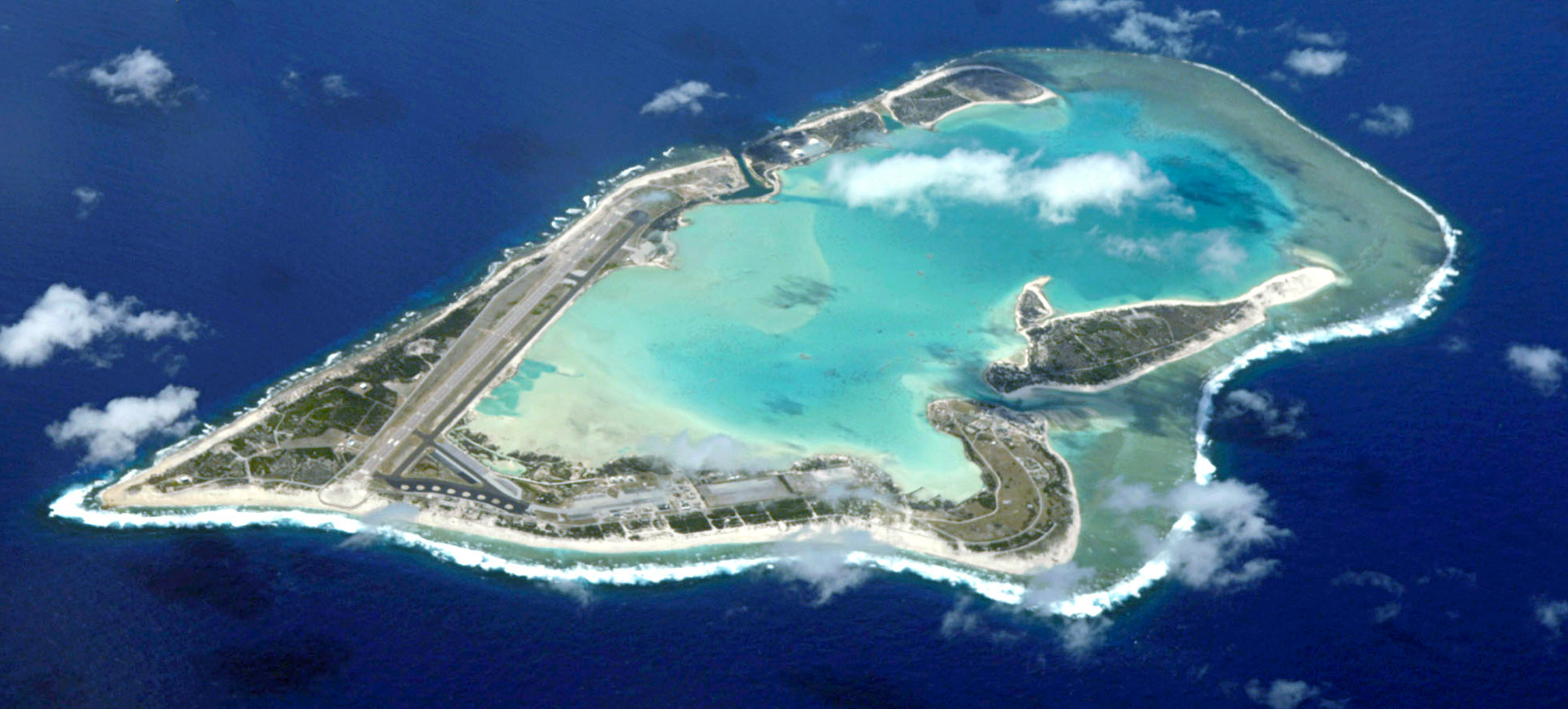
| Aerial photo of Wake Island Airfield |
| IATA: AWK – ICAO: PWAK |
| Summary |
| Airport type |
Private |
| Operator |
U.S. Air Force |
| Location |
Wake Island |
| Elevation AMSL |
14 ft / 4.3 m |
| Coordinates |
19°16′54.46″N 166°38′27.19″E / 19.2817944°N 166.6408861°E / 19.2817944; 166.6408861 |
| Runways |
| Direction |
Length |
Surface |
| m |
ft |
| 10/28 |
3,000 |
9,844 |
Asphalt |
Wake Island Airfield (IATA: AWK, ICAO: PWAK) is a military airport located on Wake Island, which is known for the Battle of Wake Island. It is owned by the U.S. Air Force and operated by the Thirteenth Air Force servicing practically only to military purposes within the Wake Island region, yet little military presence is currently encountered. It can be used for emergency landings of transpacific airliners.
History
The first intentions on building an airbase began in 1935, when Pan American Airways selected Wake Island as a useful intermediate base for their routes to the Far East, especially the Philippines. A year before jurisdiction over Wake Island was passed to the Navy Department, which cooperated with PAA with updating topographical surveys due to the potential military value of having a suitable airbase near the USSR eastern border.
Between 5 and 29 May 1935, Pan American's air base construction vessel, North Haven, landed supplies and equipment on Wilkes Island for eventual re handling to Peale Island which, because of its more suitable soil and geology, had been selected as site for the PAA seaplane base. By the time of North Haven's return to Wake, after a month's voyage westward to Manila, the project was well under way, and, 3 months later, on 9 August a Pan American Boeing 314 Clipper made the first aerial landing in the atoll.
From 1935 until 1940, when two typhoons swept Wake with resultant extensive damage to the now elaborate Pan American facilities, development and use of the base were steady but uneventful. A hotel was built, farm animals imported, and hydroponic truck farming commenced. The seaplane base on Peale Island was too petty for any realistic military activity on the atoll, making intentions grow for a full-scale Air Force Base.
On 26 December 1940, in implementation of the Hepburn Board's recommendations, a pioneer party including 80 men and some 2,000 tons of equipment, sailed for Wake Island from Oahu, as the advance detachment to commence establishment of a naval air station on Wake Island, which included in their plans a runway to be used by F4F Wildcat airplanes and commercial airliners of greater size, which couldn't land on water. The burrows made here landfall on 9 January 1941, lay-to off Wilkes Island, and next day commenced landing naval supplies and advance base equipment for development of the base. The company contracted to build the base was Morrison-Knudsen Co. (acquired by Washington Group International), which together with other seven companies built many of the U.S. naval bases around the Pacific Ocean. During the construction several military personnel were already deployed. Nearly a year later the Battle of Wake Island began.
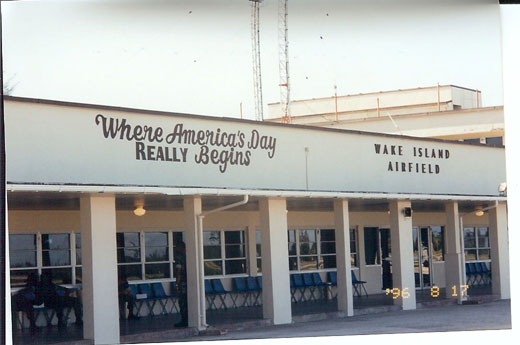 | |
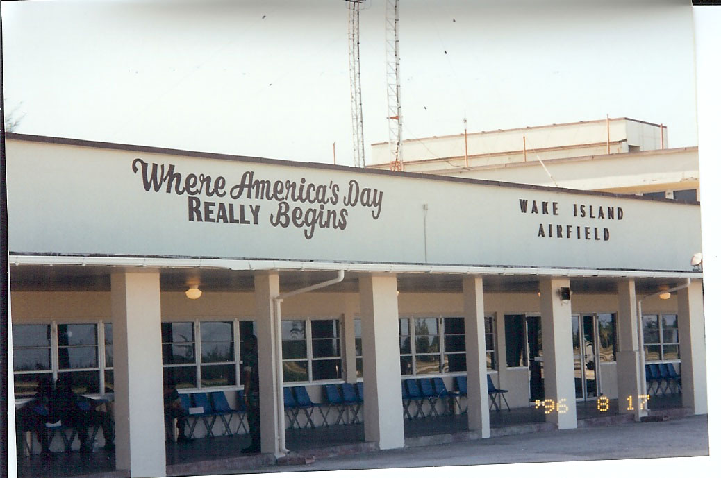
Wake Island Air Terminal building |
On Aug. 31, 2006, the super typhoon Ioke (class 5) struck Wake Island. After the typhoon, great damage was expected on all structures, if not complete devastation, including the runway. Members of the 36th Contingency Response Group at Andersen Air Force Base in Guam were already calculating astronomical costs to repair the Airfield. On Sept. 8, 16 members of the Group arrived at Wake to make the initial assessments and found out that the runway and taxiways were still in conditions for use, just requiring clearing of the debris. Other structures were considerably damaged, but in 5 days of intense work the base was already up and running, allowing for another 53 members to arrive by air and give continuation to the reconstruction.
The above content comes from Wikipedia and is published under free licenses – click here to read more.
| General Info
|
| Country |
Wake Island
|
| ICAO ID |
PWAK
|
| Time |
UTC+12
|
| Latitude |
19.282067
19° 16' 55.44" N
|
| Longitude |
166.636444
166° 38' 11.20" E
|
| Elevation |
14 feet
4 meters
|
| Type |
Military
|
| Magnetic Variation |
005° E (01/06)
|
| Beacon |
Yes
|
| Operating Agency |
U.S.AIR FORCE
|
| Operating Hours |
SEE REMARKS FOR OPERATING HOURS OR COMMUNICATIONS FOR POSSIBLE HOURS
|
| Communications
|
| OAKLAND OCEANIC |
8843
|
| OPS AAS |
128.0
349.4
|
| Runways
|
| ID |
Dimensions |
Surface |
PCN |
ILS
|
| 10/28 |
9843 x 150 feet
3000 x 46 meters |
ASPHALT |
075FAWT |
NO
|
| Navaids
|
| Type |
ID |
Name |
Channel |
Freq |
Distance From Field |
Bearing From Navaid
|
| VORTAC |
AWK |
WAKE ISLAND |
082X |
113.5 |
At Field |
-
|
| Supplies/Equipment
|
| Fuel |
JP-5, Keroscene MIL Spec T-5624
|
| Other Fluids |
W, Water Thrust Augmentation - Jet Aircraft
SP, Single Point Refueling
PRESAIR, Air Compressors rated 3,000PSI or more
|
| JASU |
A/M32A-86
AC:115/200v, 3 phase, 90 kva, 0.8pf, 4 wire, DC: 28v,1500 amp, 72kw
MA-1A
82lb/min (1123cfm) at 130 deg air inlet temp,45psia(min) air outlet
|
| Remarks
|
| A-GEAR |
30 min PN rqr.
|
| CAUTION |
Bird haz on apch Rwy 10 or Rwy 28 dep. Ocean vessels with mast aprx 125' periodically lctd at mooring buoys 3600' W of thld Rwy 10.
|
| FLUID |
W, SP, PRESAIR
|
| FUEL |
Flt crew rqr to assist in reful. J5.
|
| LGT |
PAPI Rwy 10 GS 3.0 , Rwy 28 GS 3.0 .
|
| MISC |
Inbd acft should exp descent and apch clnc fr OAKLAND ARTCC thru SAN FRANCISCO ARINC. Wake OPS will monitor 128.0 349.4. Inbd acft should ctc Wake OPS 100 NM out for AAS and advs svcg rqr. Make all dep rpt to ARTCC via HF. No ATC avbl to ovft. DD 175.1 wx briefing/fcst avbl via DSN 449-8335, C808-449-8335. When nml SATCOM O/S, IMARSAT is avbl. Space avbl pax are NA to RON on Islands unless prior apvl has been obtained.
|
| OPR HOURS |
Opr 1930-0530Z Mon-Sat, exc hol. See FLIP AP/3 Rte and Area Rstd.
|
| RSTD |
PPR for all acft at least 24 hr in advance. PPR phone only DSN 424-2101, C808-424-2101. Caretaker status, avbl for emerg ldg and min priority tfc. Clsd to foreign acft. No acft maint avbl. New twy line restriction lctd at intersection of Twy E and D. Restriction cont W onto warm-up pad does not provide wingtip clnc to acft with wingspan greater than 60'.
|
| TFC PAT |
Rgt break Rwy 10 for ftr acft.
|
The content above was published at Airports-Worldwide.com in 2010.
We don't guarantee the information is fresh and accurate. The data may be wrong or outdated.
For more up-to-date information please refer to other sources.
|
|