 |
|
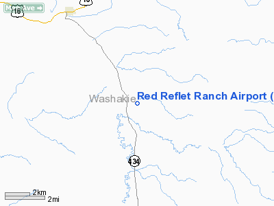
Location & QuickFacts
| FAA Information Effective: | 2008-09-25 |
| Airport Identifier: | WY00 |
| Airport Status: | Operational |
| Longitude/Latitude: | 107-22-46.1391W/43-58-03.7361N
-107.379483/43.967704 (Estimated) |
| Elevation: | 4619 ft / 1407.87 m (Estimated) |
| Land: | 50 acres |
| From nearest city: | 5 nautical miles S of Ten Sleep, WY |
| Location: | Washakie County, WY |
| Magnetic Variation: | 11E (2010) |
Owner & Manager
| Ownership: | Privately owned |
| Owner: | Robert B. Kaplan |
| Address: | 595 State Hwy 434
Ten Sleep, WY 82442 |
| Phone number: | 307-366-2355 |
| Manager: | Anthony Cirincione |
| Address: | 595 State Hwy 434
Ten Sleep, WY 82442 |
| Phone number: | 307-366-2355 |
Airport Operations and Facilities
| Airport Use: | Private |
| Wind indicator: | Yes |
| Control Tower: | No |
| Lighting Schedule: | RDO-CTL
ACTVT VASI RY 10 - 122.9. |
| Sectional chart: | Cheyenne |
| Region: | ANM - Northwest Mountain |
| Boundary ARTCC: | ZLC - Salt Lake City |
| Tie-in FSS: | CPR - Casper |
| FSS Toll Free: | 1-800-WX-BRIEF |
Runway Information
Runway 10/28
| Dimension: | 5000 x 75 ft / 1524.0 x 22.9 m |
| Surface: | ASPH, |
| |
Runway 10 |
Runway 28 |
| Longitude: | 107-23-17.5405W | 107-22-14.7376W |
| Latitude: | 43-58-13.4969N | 43-57-53.9752N |
| Elevation: | 4576.00 ft | 4732.00 ft |
| Traffic Pattern: | Left | Left |
| Crossing Height: | 10.00 ft | 0.00 ft |
| VASI: | pulsating/steady burning on right side | |
| Visual Glide Angle: | 3.00° | 0.00° |
|
Radio Navigation Aids
| ID |
Type |
Name |
Ch |
Freq |
Var |
Dist |
| GEY | NDB | Greybull | | 275.00 | 14E | 44.6 nm |
| RLY | VOR/DME | Worland | 095X | 114.80 | 13E | 24.7 nm |
| CZI | VOR/DME | Crazy Woman | 120X | 117.30 | 13E | 40.9 nm |
Remarks
- LAND RY 10 & DEPART RY 28 DUE TO HIGH TERRAIN ALL QUADRANTS & RY SLOPE.
Images and information placed above are from
http://www.airport-data.com/airport/WY00/
We thank them for the data!
|
|


