|
|
 |
(Click on the photo to enlarge) |
Location & QuickFacts
| FAA Information Effective: | 2008-09-25 |
| Airport Identifier: | HAD |
| Airport Status: | Operational |
| Longitude/Latitude: | 106-18-34.0920W/42-55-27.8760N
-106.309470/42.924410 (Estimated) |
| Elevation: | 5370 ft / 1636.78 m (Estimated) |
| Land: | 160 acres |
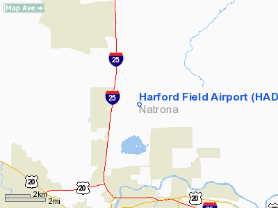
| From nearest city: | 5 nautical miles N of Casper, WY |
| Location: | Natrona County, WY |
| Magnetic Variation: | 13E (1985) |
Owner & Manager
| Ownership: | Privately owned |
| Owner: | J.l. Irwin, Jr/robin Irwin |
| Address: | Box 2001
Casper, WY 82602 |
| Phone number: | 307-234-6161 |
| Manager: | J. L. Irwin, Jr. |
| Address: | Box 2001
Casper, WY 82602 |
| Phone number: | 307-234-6161 |
Airport Operations and Facilities
| Airport Use: | Open to public |
| Wind indicator: | Yes |
| Segmented Circle: | No |
| Control Tower: | No |
| Landing fee charge: | No |
| Sectional chart: | Cheyenne |
| Region: | ANM - Northwest Mountain |
| Boundary ARTCC: | ZDV - Denver |
| Tie-in FSS: | CPR - Casper |
| FSS on Airport: | No |
| FSS Toll Free: | 1-800-WX-BRIEF |
| NOTAMs Facility: | CPR (NOTAM-d service avaliable) |
Airport Communications
Airport Services
| Fuel available: | 100LL
FOR FUEL CALL AMGR 307-234-6161 |
| Airframe Repair: | NONE |
| Power Plant Repair: | NONE |
| Bottled Oxygen: | NONE |
| Bulk Oxygen: | NONE |
Runway Information
Runway 07/25
| Dimension: | 3810 x 30 ft / 1161.3 x 9.1 m |
| Surface: | DIRT, Good Condition
FIRST 270 FT OF RY FROM THR CAN BE MUDDY WITH STANDING WATER AFTER RAIN. |
| |
Runway 07 |
Runway 25 |
| Traffic Pattern: | Left | Left |
| Obstruction: | 15 ft bldg, 190.0 ft from runway, 120 ft right of centerline, 12:1 slope to clear
RY 07 +15 FT BLDG, 102 FT FROM RY END, 60 FT LEFT, CLEARANCE 6:1. | , 50:1 slope to clear |
|
Radio Navigation Aids
| ID |
Type |
Name |
Ch |
Freq |
Var |
Dist |
| CP | NDB | Johno | | 375.00 | 12E | 11.5 nm |
| DDY | VORTAC | Muddy Mountain | 109X | 116.20 | 12E | 10.1 nm |
Remarks
- ABNDD APT 1.5 MI W.
- ANTELOPE ON & INVOF ARPT.
- RY 07/25 HAS +2 TO 4 FT BERMS 40 FT EITHER SIDE OF CNTRLN.
- OLD STYLE RWY CONES/LGTS MARK RWYS 40' EITHER SIDE OF CRTLN - RWYS 07/25.
- LINE OF SIGHT PROBLEM BTN RY 07 & 25 THR; RY 25 SLOPES UPHILL FIRST 510'.
Images and information placed above are from
http://www.airport-data.com/airport/HAD/
We thank them for the data!
| General Info
|
| Country |
United States
|
| State |
WYOMING
|
| FAA ID |
HAD
|
| Latitude |
42-55-27.876N
|
| Longitude |
106-18-34.092W
|
| Elevation |
5370 feet
|
| Near City |
CASPER
|
We don't guarantee the information is fresh and accurate. The data may
be wrong or outdated.
For more up-to-date information please refer to other sources.
|
|