 |
|
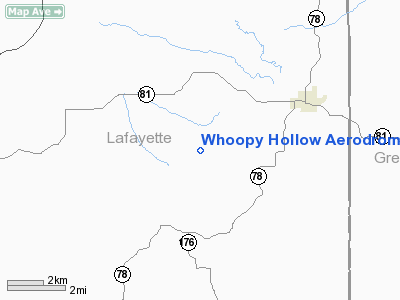
Whoopy Hollow Aerodrome Airport |
Location & QuickFacts
| FAA Information Effective: | 2008-09-25 |
| Airport Identifier: | 65WN |
| Airport Status: | Operational |
| Longitude/Latitude: | 089-56-16.7465W/42-40-35.2132N
-89.937985/42.676448 (Estimated) |
| Elevation: | 925 ft / 281.94 m (Estimated) |
| Land: | 2 acres |
| From nearest city: | 3 nautical miles N of Wiota, WI |
| Location: | Lafayette County, WI |
| Magnetic Variation: | 01W (2000) |
Owner & Manager
| Ownership: | Privately owned |
| Owner: | Michael & Barbara Dinges |
| Address: | 5813 Whiteside Rd.
Argyle, WI 53504 |
| Phone number: | 608-968-3469 |
| Manager: | Michael & Barbara Dinges |
| Address: | 5813 Whiteside Rd.
Argyle, WI 53504 |
| Phone number: | 608-968-3469 |
Airport Operations and Facilities
| Airport Use: | Private |
| Wind indicator: | Yes |
| Segmented Circle: | No |
| Control Tower: | No |
| Sectional chart: | Chicago |
| Region: | AGL - Great Lakes |
| Boundary ARTCC: | ZAU - Chicago |
| Tie-in FSS: | GRB - Green Bay |
| FSS Toll Free: | 1-800-WX-BRIEF |
Runway Information
Runway 13/31
| Dimension: | 1800 x 75 ft / 548.6 x 22.9 m |
| Surface: | TURF, |
| |
Runway 13 |
Runway 31 |
| Traffic Pattern: | Left | Left |
|
Radio Navigation Aids
| ID |
Type |
Name |
Ch |
Freq |
Var |
Dist |
| MRJ | NDB | Mineral Point | | 365.00 | 00W | 18.0 nm |
| PVB | NDB | Platteville | | 203.00 | 01E | 22.0 nm |
| FEP | NDB | Freeport | | 335.00 | 00E | 30.2 nm |
| MS | NDB | Monah | | 400.00 | 00E | 34.9 nm |
| JVL | NDB | Janesville | | 375.00 | 03E | 39.8 nm |
| JVL | VOR/DME | Janesville | 090X | 114.30 | 03E | 37.5 nm |
| LNR | VOR/DME | Lone Rock | 075X | 112.80 | 00E | 38.1 nm |
| RFD | VOR/DME | Rockford | 045X | 110.80 | 01E | 42.5 nm |
| PLL | VOR/DME | Polo | 049X | 111.20 | 03E | 46.5 nm |
| DBQ | VORTAC | Dubuque | 105X | 115.80 | 04E | 37.9 nm |
| MSN | VORTAC | Madison | 023X | 108.60 | 03E | 38.6 nm |
Remarks
- ANY OBSTRUCTIONS IN RY APPROACH SLOPE SURFACE BE LOWERED OR REMOVED; 125 FT EITHER SIDE OF CENTERLINE & 200 FT OFF RUNWAY ENDS CLEAR OF OBSTRUCTIONS.
Images and information placed above are from
http://www.airport-data.com/airport/65WN/
We thank them for the data!
| General Info
|
| Country |
United States
|
| State |
WISCONSIN
|
| FAA ID |
65WN
|
| Latitude |
42-40-35.213N
|
| Longitude |
089-56-16.747W
|
| Elevation |
925 feet
|
| Near City |
WIOTA
|
We don't guarantee the information is fresh and accurate. The data may
be wrong or outdated.
For more up-to-date information please refer to other sources.
|
|


