 |
|
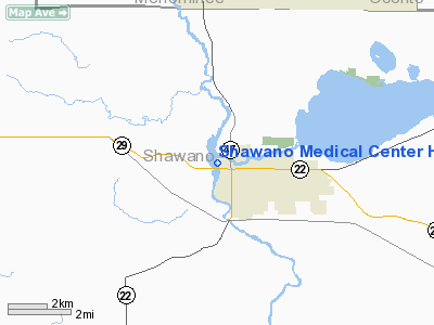
Shawano Medical Center Heliport |
Location & QuickFacts
| FAA Information Effective: | 2008-09-25 |
| Airport Identifier: | 98WI |
| Airport Status: | Operational |
| Longitude/Latitude: | 088-37-03.8700W/44-47-04.9420N
-88.617742/44.784706 (Estimated) |
| Elevation: | 812 ft / 247.50 m (Estimated) |
| Land: | 0 acres |
| From nearest city: | 0 nautical miles N of Shawano, WI |
| Location: | Shawano County, WI |
| Magnetic Variation: | 02W (1995) |
Owner & Manager
| Ownership: | Privately owned |
| Owner: | Shawano Medical Center |
| Address: | 309 North Bartlette Street
Shawano, WI 54166 |
| Phone number: | 715-526-7390 |
| Manager: | Shawano Medical Center |
| Address: | 309 North Bartlette Street
Shawano, WI 54166 |
| Phone number: | 715-526-7390 |
Airport Operations and Facilities
| Airport Use: | Private
MEDICAL USE. |
| Segmented Circle: | No |
| Control Tower: | No |
| Sectional chart: | Green Bay |
| Region: | AGL - Great Lakes |
| Boundary ARTCC: | ZMP - Minneapolis |
| Tie-in FSS: | GRB - Green Bay |
| FSS on Airport: | No |
| FSS Toll Free: | 1-800-WX-BRIEF |
Runway Information
Helipad H1
| Dimension: | 70 x 70 ft / 21.3 x 21.3 m |
| Surface: | TURF, |
| |
Runway H1 |
Runway |
| Traffic Pattern: | Left | Left |
|
Radio Navigation Aids
| ID |
Type |
Name |
Ch |
Freq |
Var |
Dist |
| CLI | NDB | Clintonville | | 209.00 | 02W | 11.1 nm |
| OCQ | NDB | Oconto | | 388.00 | 03W | 30.6 nm |
| AIG | NDB | Antigo | | 347.00 | 02W | 30.8 nm |
| SG | NDB | Depre | | 332.00 | 02W | 31.1 nm |
| PCZ | NDB | Waupaca | | 382.00 | 01W | 32.1 nm |
| AQ | NDB | Kooky | | 407.00 | 02W | 35.5 nm |
| FZK | NDB | Wausau | | 243.00 | 01E | 43.8 nm |
| MNM | VOR/DME | Menominee | 033X | 109.60 | 00E | 47.6 nm |
| GRB | VORTAC | Green Bay | 102X | 115.50 | 01E | 22.7 nm |
| AUW | VORTAC | Wausau | 053X | 111.60 | 02E | 41.5 nm |
| STE | VORTAC | Stevens Point | 043X | 110.60 | 01W | 41.6 nm |
| OSH | VORTAC | Oshkosh | 055X | 111.80 | 02E | 47.8 nm |
Remarks
- PRVDD APCH/DEP 200-330 CLKWS; NOT OBSTRUCTIVE WIND INDICATOR MAINTAINED; AREA SECURED; UNAUZD PERSONS RESTRAINED FM LNDG AREA; FIRE PROTECTION PER LOCAL FIRE CODE AND/OR FAA AC 150/5390-2.
Images and information placed above are from
http://www.airport-data.com/airport/98WI/
We thank them for the data!
| General Info
|
| Country |
United States
|
| State |
WISCONSIN
|
| FAA ID |
98WI
|
| Latitude |
44-47-04.942N
|
| Longitude |
088-37-03.870W
|
| Elevation |
812 feet
|
| Near City |
SHAWANO
|
We don't guarantee the information is fresh and accurate. The data may
be wrong or outdated.
For more up-to-date information please refer to other sources.
|
|


