 |
|
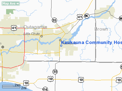
Kaukauna Community Hospital Heliport |
Location & QuickFacts
| FAA Information Effective: | 2008-09-25 |
| Airport Identifier: | WI80 |
| Airport Status: | Operational |
| Longitude/Latitude: | 088-16-11.3810W/44-16-08.9550N
-88.269828/44.269154 (Estimated) |
| Elevation: | 705 ft / 214.88 m (Estimated) |
| Land: | 0 acres |
| From nearest city: | 0 nautical miles SE of Kaukauna, WI |
| Location: | Outagamie County, WI |
| Magnetic Variation: | 01W (1985) |
Owner & Manager
| Ownership: | Privately owned |
| Owner: | Kaukauna Community Hospital |
| Address: | 308 E 14th St
Kaukauna, WI 54130 |
| Phone number: | 414-766-4211 |
| Manager: | Will Zimmerman |
| Address: | 308 E 14th St
Kaukauna, WI 54130 |
| Phone number: | 414-766-4211 |
Airport Operations and Facilities
| Airport Use: | Private
MEDICAL |
| Wind indicator: | Yes |
| Segmented Circle: | No |
| Control Tower: | No |
| Lighting Schedule: | PHONE REQ
RY H1 AND H2 FOR PERIMETER LGTS PHONE 414-766-4211. |
| Sectional chart: | Green Bay |
| Region: | AGL - Great Lakes |
| Boundary ARTCC: | ZAU - Chicago |
| Tie-in FSS: | GRB - Green Bay |
| FSS Toll Free: | 1-800-WX-BRIEF |
Runway Information
Helipad H1
| Dimension: | 300 x 90 ft / 91.4 x 27.4 m |
| Surface: | ASPH, |
| |
Runway H1 |
Runway |
| Traffic Pattern: | Left | Left |
| Markings: | Basic, Poor Condition | , |
| Obstruction: | 26 ft bldg, 200.0 ft from runway | |
|
Helipad H2
| Dimension: | 114 x 54 ft / 34.7 x 16.5 m |
| Surface: | ASPH, |
| |
Runway H2 |
Runway |
| Traffic Pattern: | Left | Left |
| Markings: | Basic, Good Condition | , |
| Obstruction: | 26 ft bldg, 100.0 ft from runway | |
|
Radio Navigation Aids
| ID |
Type |
Name |
Ch |
Freq |
Var |
Dist |
| AQ | NDB | Kooky | | 407.00 | 02W | 6.4 nm |
| SG | NDB | Depre | | 332.00 | 02W | 9.8 nm |
| CLI | NDB | Clintonville | | 209.00 | 02W | 28.9 nm |
| PCZ | NDB | Waupaca | | 382.00 | 01W | 32.3 nm |
| OCQ | NDB | Oconto | | 388.00 | 03W | 39.5 nm |
| SUE | NDB | Sturgeon Bay | | 414.00 | 03W | 49.8 nm |
| MTW | VOR/DME | Manitowoc | 047X | 111.00 | 02W | 26.8 nm |
| FAH | VOR/DME | Falls | 37X | 110.00 | 02W | 35.2 nm |
| GRB | VORTAC | Green Bay | 102X | 115.50 | 01E | 17.5 nm |
| OSH | VORTAC | Oshkosh | 055X | 111.80 | 02E | 20.8 nm |
Remarks
- FILED FOR RECORD PURPOSES ONLY.
Images and information placed above are from
http://www.airport-data.com/airport/WI80/
We thank them for the data!
| General Info
|
| Country |
United States
|
| State |
WISCONSIN
|
| FAA ID |
WI80
|
| Latitude |
44-16-08.955N
|
| Longitude |
088-16-11.381W
|
| Elevation |
705 feet
|
| Near City |
KAUKAUNA
|
We don't guarantee the information is fresh and accurate. The data may
be wrong or outdated.
For more up-to-date information please refer to other sources.
|
|


