 |
|
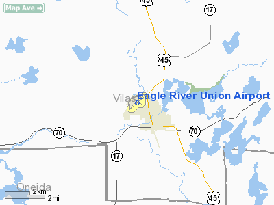
Eagle River Union Airport |
| Eagle River Union Airport |
| IATA: EGV – ICAO: KEGV – FAA LID: EGV |
| Summary |
| Airport type |
Public |
| Owner/Operator |
City of Eagle River |
| Location |
Eagle River, Wisconsin |
| Elevation AMSL |
1,642 ft / 500.5 m |
| Coordinates |
45°55.94′N 089°16.097′W / 45.93233°N 89.268283°W / 45.93233; -89.268283Coordinates: 45°55.94′N 089°16.097′W / 45.93233°N 89.268283°W / 45.93233; -89.268283 |
| Runways |
| Direction |
Length |
Surface |
| ft |
m |
| 4/22 |
5,000 |
1,524 |
Asphalt |
| 13/31 |
3,400 |
1,036 |
Asphalt |
| Helipads |
| Number |
Length |
Surface |
| ft |
m |
| H1 |
60 |
18 |
Concrete |
| Statistics (2005) |
| Operations |
20,626 |
| Stats for 12 months ending September 20 2005 |
Eagle River Union Airport (IATA: EGV, ICAO: KEGV, FAA LID: EGV) is a public airport located in Eagle River, Wisconsin.
Facilities
- Runway 4/22 5,000 x 76 ft. (1,524 x 23 m), asphalt, LOC/DME equipped.
- Runway 13/31 3,400 x 60 ft. (1,036 x 18 m), asphalt
- Helipad H1 60 x 60 ft. (18 x 18 m), concrete
- EAGLE RIVER (EGV) non-directional beacon, 341 kHz, is located at the field.
The above content comes from Wikipedia and is published under free licenses – click here to read more.
Location & QuickFacts
| FAA Information Effective: | 2008-09-25 |
| Airport Identifier: | EGV |
| Airport Status: | Operational |
| Longitude/Latitude: | 089-16-05.8000W/45-55-56.4000N
-89.268278/45.932333 (Estimated) |
| Elevation: | 1642 ft / 500.48 m (Surveyed) |
| Land: | 400 acres |
| From nearest city: | 0 nautical miles NW of Eagle River, WI |
| Location: | Vilas County, WI |
| Magnetic Variation: | 02W (1995) |
Owner & Manager
| Ownership: | Publicly owned |
| Owner: | City Of Eagle River |
| Address: | Po Box 2320
Eagle River, WI 54521 |
| Phone number: | 715-479-7442 |
| Manager: | Scott Volberding |
| Address: | Po Box 2320
Eagle River, WI 54521 |
| Phone number: | 715-479-7442 |
Airport Operations and Facilities
| Airport Use: | Open to public |
| Wind indicator: | Yes |
| Segmented Circle: | No |
| Control Tower: | No |
| Lighting Schedule: | DUSK-DAWN
ACTVT MIRL RYS 04/22 & RY 13/31& REIL RYS 04 & 22 AND TWY LGTS - CTAF. |
| Beacon Color: | Clear-Green (lighted land airport) |
| Landing fee charge: | No |
| Sectional chart: | Green Bay |
| Region: | AGL - Great Lakes |
| Boundary ARTCC: | ZMP - Minneapolis |
| Tie-in FSS: | GRB - Green Bay |
| FSS on Airport: | No |
| FSS Toll Free: | 1-800-WX-BRIEF |
| NOTAMs Facility: | EGV (NOTAM-d service avaliable) |
| Federal Agreements: | NGY |
Airport Communications
| CTAF: | 122.800 |
| Unicom: | 122.800 |
Airport Services
| Fuel available: | 100LLA |
| Airframe Repair: | MAJOR |
| Power Plant Repair: | MAJOR |
| Bottled Oxygen: | NONE |
| Bulk Oxygen: | NONE |
Runway Information
Runway 04/22
| Dimension: | 5000 x 76 ft / 1524.0 x 23.2 m |
| Surface: | ASPH, Fair Condition |
| Weight Limit: | Single wheel: 12500 lbs. |
| Edge Lights: | Medium |
| |
Runway 04 |
Runway 22 |
| Longitude: | 089-16-33.7893W | 089-15-43.4470W |
| Latitude: | 45-55-37.1441N | 45-56-11.8204N |
| Elevation: | 1641.00 ft | 1637.00 ft |
| Alignment: | 45 | 127 |
| ILS Type: | LOC/DME | |
| Traffic Pattern: | Left | Left |
| Markings: | Non-precision instrument, Good Condition | Non-precision instrument, Good Condition |
| Crossing Height: | 0.00 ft | 34.00 ft |
| VASI: | | 4-light PAPI on left side |
| Visual Glide Angle: | 0.00° | 3.00° |
| Runway End Identifier: | Yes | Yes
REIL RY 22 OTS INDEFLY. |
| Centerline Lights: | No | No |
| Touchdown Lights: | No | No |
| Obstruction: | 46 ft trees, 1550.0 ft from runway, 330 ft left of centerline, 29:1 slope to clear | 15 ft road, 450.0 ft from runway, 280 ft left of centerline, 16:1 slope to clear |
|
Runway 13/31
| Dimension: | 3400 x 60 ft / 1036.3 x 18.3 m |
| Surface: | ASPH, Good Condition |
| Edge Lights: | Medium |
| |
Runway 13 |
Runway 31 |
| Longitude: | 089-16-19.4334W | 089-15-43.9255W |
| Latitude: | 45-56-10.5846N | 45-55-47.9431N |
| Elevation: | 1640.00 ft | 1640.00 ft |
| Alignment: | 127 | 127 |
| Traffic Pattern: | Left | Left |
| Markings: | Basic, Good Condition | Basic, Good Condition |
| Runway End Identifier: | No | |
| Centerline Lights: | No | |
| Touchdown Lights: | No | No |
| Obstruction: | 103 ft tree, 2600.0 ft from runway, 50 ft left of centerline, 23:1 slope to clear | 50 ft tree, 1500.0 ft from runway, 50 ft right of centerline, 26:1 slope to clear |
|
Helipad H1
| Dimension: | 60 x 60 ft / 18.3 x 18.3 m |
| Surface: | CONC, |
| |
Runway H1 |
Runway |
| Traffic Pattern: | Left | Left |
|
Radio Navigation Aids
| ID |
Type |
Name |
Ch |
Freq |
Var |
Dist |
| EGV | NDB | Eagle River | | 341.00 | 02W | 0.2 nm |
| LNL | NDB | Land O Lakes | | 396.00 | 02W | 13.3 nm |
| ARV | NDB | Arbor Vitae | | 221.00 | 01W | 19.3 nm |
| BDJ | NDB | Boulder Junction | | 206.00 | 02E | 20.2 nm |
| DO | NDB | Dougy | | 236.00 | 01W | 20.2 nm |
| RXW | NDB | Watersmeet | | 407.00 | 01E | 21.4 nm |
| MHA | NDB | Manitowish | | 364.00 | 01W | 28.1 nm |
| AIG | NDB | Antigo | | 347.00 | 02W | 47.0 nm |
| RRL | NDB | Merrill | | 257.00 | 01W | 47.8 nm |
| PKF | NDB | Park Falls | | 371.00 | 01W | 48.4 nm |
| PBH | NDB | Phillips | | 263.00 | 00E | 49.9 nm |
| IMT | VOR/DME | Iron Mountain | 049X | 111.20 | 02W | 48.9 nm |
| RHI | VORTAC | Rhinelander | 029X | 109.20 | 02E | 19.6 nm |
Remarks
- ULTRALIGHT ACTVTY ON & INVOF ARPT.
- GCO AVBL ON FREQ 121.725 THRU FLT SVCS.
Images and information placed above are from
http://www.airport-data.com/airport/EGV/
We thank them for the data!
| General Info
|
| Country |
United States
|
| State |
WISCONSIN
|
| FAA ID |
EGV
|
| Latitude |
45-55-54.467N
|
| Longitude |
089-16-08.644W
|
| Elevation |
1642 feet
|
| Near City |
EAGLE RIVER
|
We don't guarantee the information is fresh and accurate. The data may
be wrong or outdated.
For more up-to-date information please refer to other sources.
|
|


