 |
|
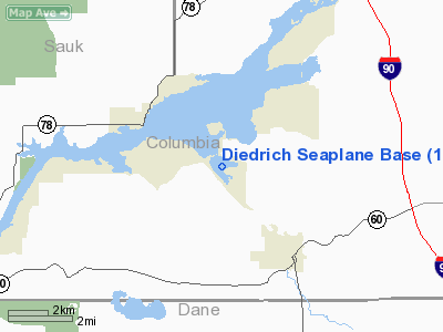
Diedrich Seaplane Base Airport |
Location & QuickFacts
| FAA Information Effective: | 2008-09-25 |
| Airport Identifier: | 11WN |
| Airport Status: | Operational |
| Longitude/Latitude: | 089-34-16.4300W/43-21-14.9500N
-89.571231/43.354153 (Estimated) |
| Elevation: | 774 ft / 235.92 m (Estimated) |
| Land: | 0 acres |
| From nearest city: | 3 nautical miles NW of Lodi, WI |
| Location: | Columbia County, WI |
| Magnetic Variation: | 01W (1995) |
Owner & Manager
| Ownership: | Privately owned |
| Owner: | Lawrence F. Diedrich |
| Address: | W11305 County Hwy V
Lodi, WI 53555 |
| Phone number: | 608-592-3519 |
| Manager: | Lawrence F. Diedrich |
| Address: | W11305 County Hwy V.
Lodi, WI 53555 |
| Phone number: | 608-592-3519 |
Airport Operations and Facilities
| Airport Use: | Private |
| Wind indicator: | Yes |
| Segmented Circle: | No |
| Control Tower: | No |
| Sectional chart: | Chicago |
| Region: | AGL - Great Lakes |
| Boundary ARTCC: | ZAU - Chicago |
| Tie-in FSS: | GRB - Green Bay |
| FSS Toll Free: | 1-800-WX-BRIEF |
Runway Information
Runway 09/27
| Dimension: | 3000 x 350 ft / 914.4 x 106.7 m |
| Surface: | WATER, |
| |
Runway 09 |
Runway 27 |
| Traffic Pattern: | Left | Left |
|
Runway 17/35
| Dimension: | 1800 x 350 ft / 548.6 x 106.7 m |
| Surface: | WATER, |
| |
Runway 17 |
Runway 35 |
| Traffic Pattern: | Left | Left |
|
Radio Navigation Aids
| ID |
Type |
Name |
Ch |
Freq |
Var |
Dist |
| MS | NDB | Monah | | 400.00 | 00E | 20.1 nm |
| HBW | NDB | Kickapoo | | 251.00 | 03E | 37.8 nm |
| UNU | NDB | Juneau | | 344.00 | 01W | 38.2 nm |
| RYV | NDB | Rock River | | 371.00 | 01W | 38.6 nm |
| MRJ | NDB | Mineral Point | | 365.00 | 00W | 40.1 nm |
| VOK | TACAN | Volk | 041X | | 00E | 46.3 nm |
| LNR | VOR/DME | Lone Rock | 075X | 112.80 | 00E | 24.8 nm |
| DLL | VORTAC | Dells | 117X | 117.00 | 03E | 14.5 nm |
| MSN | VORTAC | Madison | 023X | 108.60 | 03E | 16.2 nm |
Remarks
- PRVDD ACFT OPNS FOR 09/27 FLY N OF THAT SEALANE; TFC OPNS FOR 17/35 FLY E OF THAT SEALANE.
Images and information placed above are from
http://www.airport-data.com/airport/11WN/
We thank them for the data!
| General Info
|
| Country |
United States
|
| State |
WISCONSIN
|
| FAA ID |
11WN
|
| Latitude |
43-21-14.950N
|
| Longitude |
089-34-16.430W
|
| Elevation |
774 feet
|
| Near City |
LODI
|
We don't guarantee the information is fresh and accurate. The data may
be wrong or outdated.
For more up-to-date information please refer to other sources.
|
|


