 |
|
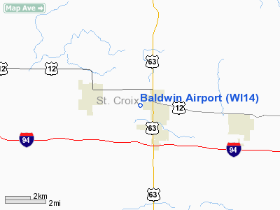
Location & QuickFacts
| FAA Information Effective: | 2008-09-25 |
| Airport Identifier: | WI14 |
| Airport Status: | Operational |
| Longitude/Latitude: | 092-23-15.6880W/44-57-59.8760N
-92.387691/44.966632 (Estimated) |
| Elevation: | 1104 ft / 336.50 m (Surveyed) |
| Land: | 51 acres |
| From nearest city: | 1 nautical miles W of Baldwin, WI |
| Location: | St Croix County, WI |
| Magnetic Variation: | 02E (1985) |
Owner & Manager
| Ownership: | Privately owned |
| Owner: | David E. Mills
AND MICHAEL F. HAYDEN; ALSO, A14 MICHAEL F. HAYDEN |
| Address: | 2235 Oakgreen Ave., N
Stillwater, MN 55082 |
| Phone number: | 612-436-5225 |
| Manager: | David E. Mills |
| Address: | 2235 Oakgreen Ave., N
Stillwater, MN 55082 |
| Phone number: | 612-436-5225 |
Airport Operations and Facilities
| Airport Use: | Private |
| Wind indicator: | Yes |
| Segmented Circle: | No |
| Control Tower: | No |
| Landing fee charge: | No |
| Sectional chart: | Green Bay |
| Region: | AGL - Great Lakes |
| Traffic Pattern Alt: | 1000 ft |
| Boundary ARTCC: | ZMP - Minneapolis |
| Tie-in FSS: | GRB - Green Bay |
| FSS on Airport: | No |
| FSS Toll Free: | 1-800-WX-BRIEF |
Airport Services
| Airframe Repair: | NONE |
| Power Plant Repair: | NONE |
| Bottled Oxygen: | NONE |
| Bulk Oxygen: | NONE |
Runway Information
Runway 18/36
| Dimension: | 1950 x 120 ft / 594.4 x 36.6 m |
| Surface: | TURF, |
| |
Runway 18 |
Runway 36 |
| Traffic Pattern: | Left | Left |
| Markings: | None, | None, |
| Runway End Identifier: | No | No |
| Centerline Lights: | No | No |
| Touchdown Lights: | No | No |
|
Radio Navigation Aids
| ID |
Type |
Name |
Ch |
Freq |
Var |
Dist |
| RNH | NDB | New Richmond | | 257.00 | 02E | 12.5 nm |
| AHH | NDB | Ameron | | 278.00 | 01E | 18.9 nm |
| PPI | NDB | Hopey | | 400.00 | 03E | 24.3 nm |
| OEO | NDB | Osceola | | 233.00 | 01E | 24.3 nm |
| MS | NDB | Narco | | 266.00 | 02E | 31.1 nm |
| UBE | NDB | Cumberland | | 375.00 | 01E | 37.0 nm |
| SSQ | NDB | Shell Lake | | 212.00 | 01E | 49.8 nm |
| MSP | VOR/DME | Minneapolis | 100X | 115.30 | 02E | 36.4 nm |
| RPD | VOR/DME | Rice Lake | 037X | 110.00 | 01E | 37.3 nm |
| FCM | VOR/DME | Flying Cloud | 055X | 111.80 | 06E | 46.3 nm |
| EAU | VORTAC | Eau Claire | 076X | 112.90 | 04E | 38.9 nm |
| FGT | VORTAC | Farmington | 104X | 115.70 | 06E | 39.4 nm |
| GEP | VORTAC | Gopher | 120X | 117.30 | 06E | 43.2 nm |
| STP | VOT | St Paul | | 114.40 | | 28.6 nm |
| MSP | VOT | Minneapolis St Paul | | 111.00 | | 35.6 nm |
Remarks
- CLOSED DECEMBER THRU MAY.
- RWY 18/36 HAS A 530' X 120' TURF STOPWAY NORTH END.
- EXTENSIVE PARACHUTE JUMPING MAY THRU NOVEMBER.
- ESTBD PRIOR 1959.
Images and information placed above are from
http://www.airport-data.com/airport/WI14/
We thank them for the data!
| General Info
|
| Country |
United States
|
| State |
WISCONSIN
|
| FAA ID |
WI14
|
| Latitude |
44-57-59.876N
|
| Longitude |
092-23-15.688W
|
| Elevation |
1104 feet
|
| Near City |
BALDWIN
|
We don't guarantee the information is fresh and accurate. The data may
be wrong or outdated.
For more up-to-date information please refer to other sources.
|
|


