 |
|
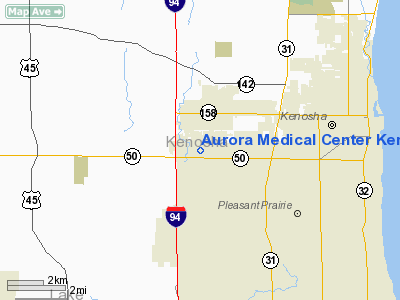
Aurora Medical Center Kenosha Heliport |
Location & QuickFacts
| FAA Information Effective: | 2008-09-25 |
| Airport Identifier: | WI01 |
| Airport Status: | Operational |
| Longitude/Latitude: | 087-56-10.0000W/42-34-14.0000N
-87.936111/42.570556 (Estimated) |
| Elevation: | 698 ft / 212.75 m (Estimated) |
| Land: | 0 acres |
| From nearest city: | 2 nautical miles W of Kenosha, WI |
| Location: | Kenosha County, WI |
| Magnetic Variation: | 02W () |
Owner & Manager
| Ownership: | Privately owned |
| Owner: | Auror Health Care |
| Address: | 10400 75 Th St
Kenosha, WI 53142 |
| Phone number: | 414-942-5801 |
| Manager: | Seonaid Ritz |
| Address: | 10400 75 Th St
Kenosha, WI 53142 |
| Phone number: | 414-942-5801 |
Airport Operations and Facilities
| Airport Use: | Private |
| Segmented Circle: | No |
| Control Tower: | No |
| Lighting Schedule: | PHONE REQ
FOR PERIMETER LGTS CALL 414-942-5801. |
| Sectional chart: | Chicago |
| Region: | AGL - Great Lakes |
| Boundary ARTCC: | ZMP - Minneapolis |
| Tie-in FSS: | GRB - Green Bay |
| FSS Toll Free: | 1-800-WX-BRIEF |
Runway Information
Helipad H1
| Dimension: | 50 x 50 ft / 15.2 x 15.2 m |
| Surface: | CONC, |
| |
Runway H1 |
Runway |
| Traffic Pattern: | Left | Left |
|
Radio Navigation Aids
| ID |
Type |
Name |
Ch |
Freq |
Var |
Dist |
| RA | NDB | Paser | | 206.00 | 00E | 6.9 nm |
| GM | NDB | Teels | | 242.00 | 02W | 20.9 nm |
| BL | NDB | Yanks | | 260.00 | 02W | 29.5 nm |
| LVV | NDB | Lake Lawn | | 404.00 | 00W | 30.1 nm |
| UES | NDB | Waukesha | | 359.00 | 01W | 31.4 nm |
| ME | NDB | Deana | | 350.00 | 00E | 36.5 nm |
| JVL | NDB | Janesville | | 375.00 | 03E | 49.0 nm |
| ENW | VOR/DME | Kenosha | 029X | 109.20 | 02W | 1.7 nm |
| HRK | VOR/DME | Horlick | 124X | 117.70 | 02W | 12.7 nm |
| BUU | VOR/DME | Burbun | 092X | 114.50 | 01W | 17.7 nm |
| OBK | VOR/DME | Northbrook | 077X | 113.00 | 02W | 21.0 nm |
| LJT | VOR/DME | Timmerman | 072X | 112.50 | 02W | 32.7 nm |
| ORD | VOR/DME | Chicago O'hare | 086X | 113.90 | 02E | 35.1 nm |
| DPA | VOR/DME | Dupage | 021X | 108.40 | 02E | 44.8 nm |
| BAE | VORTAC | Badger | 111X | 116.40 | 02E | 36.2 nm |
| MKE | VOT | Milwaukee | | 109.00 | | 22.8 nm |
| ORD | VOT | Chicago O'hare Intl | | 112.00 | | 35.4 nm |
| MDW | VOT | Chicago Midway | | 111.00 | | 47.9 nm |
Remarks
- PRVDD APCH/DEP USE A HEADING OF 060 OR 240 DEGS, AREWA IS MKD, WIND INDICATOR MAINTAINED.
Images and information placed above are from
http://www.airport-data.com/airport/WI01/
We thank them for the data!
| General Info
|
| Country |
United States
|
| State |
WISCONSIN
|
| FAA ID |
WI01
|
| Latitude |
42-34-14.000N
|
| Longitude |
087-56-10.000W
|
| Elevation |
698 feet
|
| Near City |
KENOSHA
|
We don't guarantee the information is fresh and accurate. The data may
be wrong or outdated.
For more up-to-date information please refer to other sources.
|
|


