 |
|
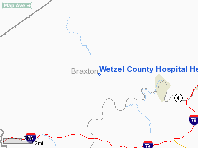
Wetzel County Hospital Heliport |
Location & QuickFacts
| FAA Information Effective: | 2008-09-25 |
| Airport Identifier: | WV20 |
| Airport Status: | Operational |
| Longitude/Latitude: | 080-51-07.3680W/38-41-00.3490N
-80.852047/38.683430 (Estimated) |
| Elevation: | 675 ft / 205.74 m (Estimated) |
| Land: | 2 acres |
| From nearest city: | 3 nautical miles N of New Martinsville, WV |
| Location: | Wetzel County, WV |
| Magnetic Variation: | 07W (1990) |
Owner & Manager
| Ownership: | Publicly owned |
| Owner: | Wetzel County Hospital Assoc |
| Address: | 3 East Benjamin Drive
New Martinsville, WV 26155 |
| Phone number: | 304-455-8000 |
| Manager: | Terry Weber |
| Address: | 3 East Benjamin Drive
New Martinsville, WV 26155 |
| Phone number: | 304-455-8000 |
Airport Operations and Facilities
| Airport Use: | Private
MEDICAL USE ONLY. |
| Wind indicator: | Yes |
| Segmented Circle: | No |
| Control Tower: | No |
| Lighting Schedule: | PHONE REQ
FOR PERIMETER LGTS AND ROTG BCN CALL 304-455-8000. |
| Beacon Color: | Clear-Green-Yellow (heliport) |
| Sectional chart: | Cincinnati |
| Region: | AEA - Eastern |
| Boundary ARTCC: | ZID - Indianapolis |
| Tie-in FSS: | EKN - Elkins |
| FSS Toll Free: | 1-800-WX-BRIEF |
Runway Information
Helipad H1
| Dimension: | 20 x 20 ft / 6.1 x 6.1 m |
| Surface: | ASPH-CONC, |
| |
Runway H1 |
Runway |
| Traffic Pattern: | Left | Left |
|
Radio Navigation Aids
| ID |
Type |
Name |
Ch |
Freq |
Var |
Dist |
| PKB | FAN MARKER | Marietta Ohio | | | 03W | 49.7 nm |
| JTM | NDB | Braxton | | 234.00 | 06W | 9.4 nm |
| IJZ | NDB | Nicholas | | 272.00 | 05W | 30.7 nm |
| RQY | NDB | Randolph County | | 284.00 | 07W | 48.2 nm |
| RNL | VOR | Rainelle | | 116.60 | 04W | 42.6 nm |
| CKB | VOR/DME | Clarksburg | 073X | 112.60 | 04W | 43.8 nm |
| EKN | VORTAC | Elkins | 089X | 114.20 | 07W | 37.9 nm |
| HVQ | VORTAC | Charleston | 121X | 117.40 | 03W | 47.6 nm |
| CRW | VOT | Charleston Kanawha | | 108.80 | | 39.5 nm |
Remarks
- PRVDD THE PARKING LOT LGT POLES TO THE SOUTE BE MARKED AND OBSTRUCTION LIGHTED AND THE INGRESS AND EGRESS ROUTES SHOULD BE LIMITED TO NE AND SE QUAD.(360-080).
Images and information placed above are from
http://www.airport-data.com/airport/WV20/
We thank them for the data!
| General Info
|
| Country |
United States
|
| State |
WEST VIRGINIA
|
| FAA ID |
WV20
|
| Latitude |
38-41-00.349N
|
| Longitude |
080-51-07.368W
|
| Elevation |
675 feet
|
| Near City |
NEW MARTINSVILLE
|
We don't guarantee the information is fresh and accurate. The data may
be wrong or outdated.
For more up-to-date information please refer to other sources.
|
|


