 |
|
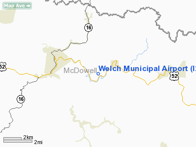
Location & QuickFacts
| FAA Information Effective: | 2008-09-25 |
| Airport Identifier: | I25 |
| Airport Status: | Operational |
| Longitude/Latitude: | 081-31-44.3790W/37-25-00.4100N
-81.528994/37.416781 (Estimated) |
| Elevation: | 2118 ft / 645.57 m (Estimated) |
| Land: | 65 acres |
| From nearest city: | 3 nautical miles SE of Welch, WV |
| Location: | Mc Dowell County, WV |
| Magnetic Variation: | 05W (1985) |
Owner & Manager
| Ownership: | Publicly owned |
| Owner: | City Of Welch |
| Address: | 88 Howard St
Welch, WV 24801 |
| Phone number: | 304-436-3114
CITY HALL. |
| Manager: | Robert Lee |
| Address: | 88 Howard St
Welch, WV 24801 |
| Phone number: | 304-436-2214
AMGR HOME PHONE 304-436-3882. |
Airport Operations and Facilities
| Airport Use: | Open to public |
| Wind indicator: | Yes |
| Segmented Circle: | No |
| Control Tower: | No |
| Landing fee charge: | No |
| Sectional chart: | Cincinnati |
| Region: | AEA - Eastern |
| Boundary ARTCC: | ZID - Indianapolis |
| Tie-in FSS: | EKN - Elkins |
| FSS on Airport: | No |
| FSS Toll Free: | 1-800-WX-BRIEF |
| NOTAMs Facility: | EKN (NOTAM-d service avaliable) |
Airport Communications
Airport Services
| Airframe Repair: | NONE |
| Power Plant Repair: | NONE |
| Bottled Oxygen: | NONE |
| Bulk Oxygen: | NONE |
Runway Information
Runway 09/27
| Dimension: | 2695 x 50 ft / 821.4 x 15.2 m |
| Surface: | ASPH, Poor Condition
PAVEMENT SFC ROUGH & CRACKING. |
| Edge Lights: | Non-standard lighting system
NSTD MIRL; NO THLD LGTS; SPACING. NSTD MIRL OTS INDEFLY. |
| |
Runway 09 |
Runway 27 |
| Traffic Pattern: | Left | Left |
| Markings: | Nonstandard, Poor Condition
09/27 MARKINGS SMALL; FADED; POOR CONDITION. | Nonstandard, Poor Condition |
| Runway End Identifier: | No | |
| Obstruction: | 20 ft tree, 245.0 ft from runway, 100 ft left of centerline, 2:1 slope to clear
+12-15 FT BRUSH & TREES 75 FT FM THLD 85 FT L. | , 50:1 slope to clear
+12 FT BRUSH 20 FT FM THLD 35 FT R TO 125 FT L. |
|
Radio Navigation Aids
| ID |
Type |
Name |
Ch |
Freq |
Var |
Dist |
| GTC | NDB | Guyandot | | 293.00 | 03W | 28.4 nm |
| MK | NDB | Suzze | | 335.00 | 06W | 32.8 nm |
| VJ | NDB | Whine | | 236.00 | 05W | 45.7 nm |
| RNL | VOR | Rainelle | | 116.60 | 04W | 48.0 nm |
| GZG | VOR/DME | Glade Spring | 039X | 110.20 | 02W | 44.3 nm |
| BLF | VORTAC | Bluefield | 037X | 110.00 | 03W | 17.3 nm |
| BKW | VORTAC | Beckley | 124X | 117.70 | 06W | 29.2 nm |
| PSK | VORTAC | Pulaski | 115X | 116.80 | 06W | 43.8 nm |
Remarks
- ARPT CLSD SS-SR.
- NO LINE OF SIGHT BETWEEN RY ENDS.
- TAXI TRANSITION TO APRON RY 09/27 UNMARKED.
- EXISTED PRIOR TO 1959.
Images and information placed above are from
http://www.airport-data.com/airport/I25/
We thank them for the data!
| General Info
|
| Country |
United States
|
| State |
WEST VIRGINIA
|
| FAA ID |
I25
|
| Latitude |
37-25-00.410N
|
| Longitude |
081-31-44.379W
|
| Elevation |
2118 feet
|
| Near City |
WELCH
|
We don't guarantee the information is fresh and accurate. The data may
be wrong or outdated.
For more up-to-date information please refer to other sources.
|
|


