 |
|
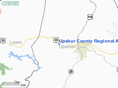
Upshur County Rgnl Airport |
Location & QuickFacts
| FAA Information Effective: | 2008-09-25 |
| Airport Identifier: | W22 |
| Airport Status: | Operational |
| Longitude/Latitude: | 080-16-25.4400W/39-00-01.6450N
-80.273733/39.000457 (Estimated) |
| Elevation: | 1635 ft / 498.35 m (Surveyed) |
| Land: | 255 acres |
| From nearest city: | 2 nautical miles W of Buckhannon, WV |
| Location: | Upshur County, WV |
| Magnetic Variation: | 08W (2005) |
Owner & Manager
| Ownership: | Publicly owned |
| Owner: | Buckhannon-upshur Arpt Auth |
| Address: | Box 1042
Buckhannon, WV 26201 |
| Phone number: | 304-472-9437 |
| Manager: | William Wellings |
| Address: | Rt 3 Box 305-7
Buckhannon, WV 26201 |
| Phone number: | 304-472-0582 |
Airport Operations and Facilities
| Airport Use: | Open to public |
| Wind indicator: | Yes |
| Segmented Circle: | Yes |
| Control Tower: | No |
| Lighting Schedule: | DUSK-DAWN
ACTVT MIRL RY 11/29; REIL RY 29; PAPI RY 29 & TWY LGTS - CTAF. |
| Beacon Color: | Clear-Green (lighted land airport) |
| Sectional chart: | Cincinnati |
| Region: | AEA - Eastern |
| Boundary ARTCC: | ZDC - Washington |
| Tie-in FSS: | EKN - Elkins |
| FSS on Airport: | No |
| FSS Toll Free: | 1-800-WX-BRIEF |
| NOTAMs Facility: | EKN (NOTAM-d service avaliable) |
| Federal Agreements: | NGY |
Airport Communications
| CTAF: | 122.800 |
| Unicom: | 122.800 |
Airport Services
| Fuel available: | 100LLA
SELF SERVICE 100LL |
| Airframe Repair: | MAJOR |
| Power Plant Repair: | MAJOR |
| Bottled Oxygen: | NONE |
| Bulk Oxygen: | NONE |
Runway Information
Runway 11/29
| Dimension: | 4200 x 75 ft / 1280.2 x 22.9 m |
| Surface: | ASPH, Good Condition |
| Weight Limit: | Single wheel: 12500 lbs.
Dual wheel: 30000 lbs. |
| Edge Lights: | Medium |
| |
Runway 11 |
Runway 29 |
| Longitude: | 080-16-56.1547W | 080-16-03.5024W |
| Latitude: | 39-00-05.1132N | 38-59-59.1728N |
| Elevation: | 1631.00 ft | 1634.00 ft |
| Alignment: | 98 | 127 |
| Traffic Pattern: | Left | Left |
| Markings: | Non-precision instrument, Good Condition | Non-precision instrument, Good Condition |
| Crossing Height: | 0.00 ft | 26.00 ft |
| VASI: | | 2-light PAPI on left side |
| Visual Glide Angle: | 0.00° | 3.00° |
| Runway End Identifier: | | Yes |
| Obstruction: | 281 ft trees, 5549.0 ft from runway, 556 ft left of centerline, 19:1 slope to clear | 25 ft trees, 886.0 ft from runway, 161 ft right of centerline, 27:1 slope to clear |
|
Radio Navigation Aids
| ID |
Type |
Name |
Ch |
Freq |
Var |
Dist |
| RQY | NDB | Randolph County | | 284.00 | 07W | 20.4 nm |
| JTM | NDB | Braxton | | 234.00 | 06W | 25.9 nm |
| CKB | VOR/DME | Clarksburg | 073X | 112.60 | 04W | 15.2 nm |
| EKN | VORTAC | Elkins | 089X | 114.20 | 07W | 9.7 nm |
| MGW | VORTAC | Morgantown | 053X | 111.60 | 05W | 38.6 nm |
Remarks
- DEER ON & INVOF ARPT.
- PRVDD THAT LAVES FIELD (S/N 26552.A) PRIOR TO CMSNG OF THIS ARPT.
Images and information placed above are from
http://www.airport-data.com/airport/W22/
We thank them for the data!
| General Info
|
| Country |
United States
|
| State |
WEST VIRGINIA
|
| FAA ID |
W22
|
| Latitude |
39-00-01.290N
|
| Longitude |
080-16-26.140W
|
| Elevation |
1635 feet
|
| Near City |
BUCKHANNON
|
We don't guarantee the information is fresh and accurate. The data may
be wrong or outdated.
For more up-to-date information please refer to other sources.
|
|


