 |
|
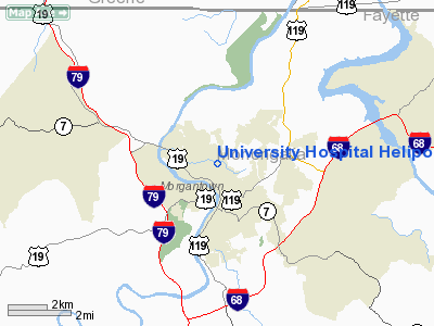
University Hospital Heliport |
Location & QuickFacts
| FAA Information Effective: | 2008-09-25 |
| Airport Identifier: | WV51 |
| Airport Status: | Operational |
| Longitude/Latitude: | 079-57-29.2260W/39-39-00.2910N
-79.958118/39.650081 (Estimated) |
| Elevation: | 1120 ft / 341.38 m (Estimated) |
| Land: | 1 acres |
| From nearest city: | 0 nautical miles N of Morgantown, WV |
| Location: | Monongalia County, WV |
| Magnetic Variation: | 07W (1985) |
Owner & Manager
| Ownership: | Privately owned |
| Owner: | Wvu Medical Center |
| Address: | P O Box 8221
Morgantown, WV 26506-8221
C/O HEALTHNET AEROMEDICAL |
| Phone number: | 304-598-4100 |
| Manager: | Steven A Edmond |
| Address: | P O Box 8221
Morgantown, WV 26506-8221 |
| Phone number: | 800-255-2146 |
Airport Operations and Facilities
| Airport Use: | Private
MEDICAL USE. |
| Wind indicator: | Yes |
| Segmented Circle: | No |
| Control Tower: | No |
| Lighting Schedule: | PHONE REQ
FOR ROTG BCN CALL 304-598-4100. |
| Beacon Color: | Clear-Green-Yellow (heliport) |
| Sectional chart: | Cincinnati |
| Region: | AEA - Eastern |
| Boundary ARTCC: | ZOB - Cleveland |
| Tie-in FSS: | EKN - Elkins |
| FSS on Airport: | No |
| FSS Toll Free: | 1-800-WX-BRIEF |
Airport Services
Runway Information
Helipad H1
| Dimension: | 40 x 40 ft / 12.2 x 12.2 m |
| Surface: | CONC, |
| |
Runway H1 |
Runway |
| Traffic Pattern: | Left | Left |
| Markings: | Basic, | , |
|
Radio Navigation Aids
| ID |
Type |
Name |
Ch |
Freq |
Var |
Dist |
| VV | NDB | Camor | | 299.00 | 08W | 17.1 nm |
| PNU | NDB | Washington County | | 255.00 | 08W | 31.2 nm |
| MKP | NDB | Mc Keesport | | 287.00 | 07W | 43.2 nm |
| RQY | NDB | Randolph County | | 284.00 | 07W | 45.7 nm |
| CKB | VOR/DME | Clarksburg | 073X | 112.60 | 04W | 27.9 nm |
| AGC | VOR/DME | Allegheny | 037X | 110.00 | 09W | 38.0 nm |
| GRV | VOR/DME | Grantsville | 070X | 112.30 | 06W | 42.0 nm |
| AIR | VOR/DME | Bellaire | 118X | 117.10 | 07W | 45.4 nm |
| HLG | VOR/DME | Wheeling | 059X | 112.20 | 07W | 46.2 nm |
| MGW | VORTAC | Morgantown | 053X | 111.60 | 05W | 7.2 nm |
| IHD | VORTAC | Indian Head | 019X | 108.20 | 06W | 33.9 nm |
| EKN | VORTAC | Elkins | 089X | 114.20 | 07W | 44.7 nm |
Images and information placed above are from
http://www.airport-data.com/airport/WV51/
We thank them for the data!
| General Info
|
| Country |
United States
|
| State |
WEST VIRGINIA
|
| FAA ID |
WV51
|
| Latitude |
39-39-00.291N
|
| Longitude |
079-57-29.226W
|
| Elevation |
1120 feet
|
| Near City |
MORGANTOWN
|
We don't guarantee the information is fresh and accurate. The data may
be wrong or outdated.
For more up-to-date information please refer to other sources.
|
|


