 |
|
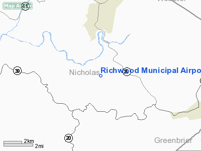
Location & QuickFacts
| FAA Information Effective: | 2008-09-25 |
| Airport Identifier: | 3I4 |
| Airport Status: | Operational |
| Longitude/Latitude: | 080-39-02.3270W/38-15-30.4050N
-80.650646/38.258446 (Estimated) |
| Elevation: | 2486 ft / 757.73 m (Surveyed) |
| Land: | 56 acres |
| From nearest city: | 6 nautical miles W of Richwood, WV |
| Location: | Nicholas County, WV |
| Magnetic Variation: | 06W (1985) |
Owner & Manager
| Ownership: | Publicly owned |
| Owner: | City Of Richwood |
| Address: | 6 White Ave
Richwood, WV 26261 |
| Phone number: | 304-846-2596
CITY HALL. |
| Manager: | John Caudle |
| Address: | 1652 Airport Road
Fenwick, WV 26202 |
| Phone number: | 304-846-6650
AFTER HOURS CALL (304) 846-2105. |
Airport Operations and Facilities
| Airport Use: | Open to public |
| Wind indicator: | Yes |
| Segmented Circle: | No |
| Control Tower: | No |
| Landing fee charge: | No |
| Sectional chart: | Cincinnati |
| Region: | AEA - Eastern |
| Boundary ARTCC: | ZDC - Washington |
| Tie-in FSS: | EKN - Elkins |
| FSS on Airport: | No |
| FSS Toll Free: | 1-800-WX-BRIEF |
| NOTAMs Facility: | EKN (NOTAM-d service avaliable) |
Airport Communications
Airport Services
| Bottled Oxygen: | NONE |
| Bulk Oxygen: | NONE |
Runway Information
Runway 10/28
| Dimension: | 3360 x 60 ft / 1024.1 x 18.3 m |
| Surface: | ASPH, Good Condition
SOFT SHOULDERS. |
| |
Runway 10 |
Runway 28 |
| Traffic Pattern: | Left | Left |
| Markings: | Nonstandard, Fair Condition
10/28 SOLID YELLOW CENTERLINE. | Nonstandard, Fair Condition |
| Obstruction: | 180 ft ridge, 5000.0 ft from runway, 120 ft right of centerline, 26:1 slope to clear
RY 10 15 FT TREE 20 FT FM THL;D 90 FT R. 10 FT BRUSH 20 FT FM THLD 125 FT L/R. | 50 ft trees, 200.0 ft from runway, 65 ft left of centerline
RY 28 +4 FT GND 40 FT FM THLD, 0 FT L & R. |
|
Radio Navigation Aids
| ID |
Type |
Name |
Ch |
Freq |
Var |
Dist |
| IJZ | NDB | Nicholas | | 272.00 | 05W | 13.7 nm |
| JTM | NDB | Braxton | | 234.00 | 06W | 25.7 nm |
| LW | NDB | Bushi | | 346.00 | 06W | 29.9 nm |
| RNL | VOR | Rainelle | | 116.60 | 04W | 18.5 nm |
| LWB | VOR/DME | Greenbrier | 107Y | 116.05 | 08W | 26.7 nm |
| BKW | VORTAC | Beckley | 124X | 117.70 | 06W | 36.4 nm |
| EKN | VORTAC | Elkins | 089X | 114.20 | 07W | 47.2 nm |
| CRW | VOT | Charleston Kanawha | | 108.80 | | 45.0 nm |
Remarks
- RUNWAY FREQUENTLY SNOW COVERED WINTER MONTHS.
-
- DEER ON & INVOF ARPT.
- ARPT CLSD NIGHTS.
- PARALLEL TWY CLSD OCT-APR.
Images and information placed above are from
http://www.airport-data.com/airport/3I4/
We thank them for the data!
| General Info
|
| Country |
United States
|
| State |
WEST VIRGINIA
|
| FAA ID |
3I4
|
| Latitude |
38-15-30.405N
|
| Longitude |
080-39-02.327W
|
| Elevation |
2486 feet
|
| Near City |
RICHWOOD
|
We don't guarantee the information is fresh and accurate. The data may
be wrong or outdated.
For more up-to-date information please refer to other sources.
|
|


