 |
|
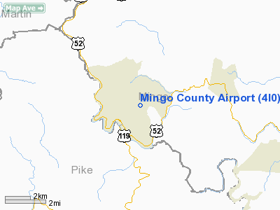
Location & QuickFacts
| FAA Information Effective: | 2008-09-25 |
| Airport Identifier: | 4I0 |
| Airport Status: | Operational |
| Longitude/Latitude: | 082-15-39.5030W/37-41-15.3650N
-82.260973/37.687601 (Estimated) |
| Elevation: | 1575 ft / 480.06 m (Surveyed) |
| Land: | 150 acres |
| From nearest city: | 1 nautical miles NE of Williamson, WV |
| Location: | Mingo County, WV |
| Magnetic Variation: | 05W (1985) |
Owner & Manager
| Ownership: | Publicly owned |
| Owner: | Mingo Co Arpt Authority |
| Address: | Mingo Co Courthouse
Williamson, WV 25661 |
| Phone number: | 304-235-2217
PAY PHONE AT ARPT ADMIN BLDG. |
| Manager: | Larry Simpkins
CHAIRMAN, MINGO COUNTY AIRPORT AUTHORITY. |
| Address: | Po Box 1408
Williamson, WV 25661 |
| Phone number: | 304-235-5020 |
Airport Operations and Facilities
| Airport Use: | Open to public |
| Wind indicator: | Yes |
| Segmented Circle: | Yes |
| Control Tower: | No |
| Landing fee charge: | No |
| Sectional chart: | Cincinnati |
| Region: | AEA - Eastern |
| Boundary ARTCC: | ZID - Indianapolis |
| Tie-in FSS: | EKN - Elkins |
| FSS on Airport: | No |
| FSS Toll Free: | 1-800-WX-BRIEF |
| NOTAMs Facility: | EKN (NOTAM-d service avaliable) |
| Federal Agreements: | NGY |
Airport Communications
| CTAF: | 122.800 |
| Unicom: | 122.800
UNICOM OTS INDEFLY. |
Airport Services
| Fuel available: | 100LL |
| Airframe Repair: | NONE |
| Power Plant Repair: | NONE |
| Bottled Oxygen: | NONE |
| Bulk Oxygen: | NONE |
Runway Information
Runway 06/24
| Dimension: | 3515 x 60 ft / 1071.4 x 18.3 m |
| Surface: | ASPH, Good Condition |
| Weight Limit: | Single wheel: 9000 lbs. |
| |
Runway 06 |
Runway 24 |
| Traffic Pattern: | Left | Left |
| Markings: | Basic, Good Condition | Basic, Good Condition |
| Displaced threshold: | 0.00 ft | 515.00 ft |
| Obstruction: | 133 ft tree, 981.0 ft from runway, 124 ft right of centerline, 5:1 slope to clear
+6 FT BRUSH 160 FT FROM THLD 50 FT L; BRUSH +6 FT167 FT DIST 0 FT OFFSET; +6 FT BRUSH 0 FT FROM THLD 114 FT L. | 61 ft tree, 370.0 ft from runway, 142 ft left of centerline, 2:1 slope to clear
APCH RATIO FROM SPLCD THLD 21:1 TO 110 FT RIDGE AT 2315 FT.
15' TREE 190' FM THR 60' R. |
|
Radio Navigation Aids
| ID |
Type |
Name |
Ch |
Freq |
Var |
Dist |
| GTC | NDB | Guyandot | | 293.00 | 03W | 17.7 nm |
| ECB | VORTAC | Newcombe | 041X | 110.40 | 02W | 41.8 nm |
| HVQ | VORTAC | Charleston | 121X | 117.40 | 03W | 46.1 nm |
Remarks
Images and information placed above are from
http://www.airport-data.com/airport/4I0/
We thank them for the data!
| General Info
|
| Country |
United States
|
| State |
WEST VIRGINIA
|
| FAA ID |
4I0
|
| Latitude |
37-41-15.365N
|
| Longitude |
082-15-39.503W
|
| Elevation |
1575 feet
|
| Near City |
WILLIAMSON
|
We don't guarantee the information is fresh and accurate. The data may
be wrong or outdated.
For more up-to-date information please refer to other sources.
|
|


